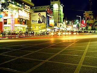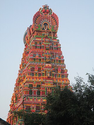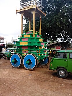
Bangalore Urban district is one of the 31 districts of Karnataka and most densely populated district in the Indian state of Karnataka. It is surrounded by the Bangalore Rural district on the east and north, the Ramanagara district on the west and the Krishnagiri district of Tamil Nadu on the south. Bangalore Urban district came into being in 1986, with the partition of the erstwhile Bangalore district into Bangalore Urban and Bangalore Rural districts. Bangalore Urban has three Taluks : Bangalore City, Yelahanka and Anekal. It has 17 hoblies, 872 villages, 11 rural habitations, 5 towns, 1 tier-three city and 1 tier-one city, administered by 96 Village Panchayats 97 Taluk Panchayats , 5 Town Municipal Councils (Purasabes), 1 City Municipal Council (Nagarasabe) and 1 City Corporation .
Ankola is a Town Municipal Council and a taluka in Uttara Kannada district of the Indian state of Karnataka. The name of the place is derived from a forest shrub Ankola grown on the coastal hill side and worshiped by the Halakki Vokkaligas as a totem. The town is around 33 km (21 mi) from Karwar and 86 km (53 mi) from Sirsi.
Bangarapet is a town in Kolar district in the state of Karnataka, India. Bangarapet is the headquarters of the taluk of Bangarapet. Bangarapet was originally called Bowringpet, named after an officer working in the Kolar Gold Fields. This town came into existence as the connecting point of traffic between the gold fields and Bangalore.
Daryapur is a city located in the Amravati District of Maharashtra State, India. It belongs to the Vidarbha region of the Amravati Division. It is located 52 km (32.31m) west of the District headquarters of Amravati.

Gajendragad is a Town Municipal Council city in Gadag District, Karnataka, India with Population of 32,359 as of 2011 Census data and is located at 15.73°N 75.98°E. It has an average elevation of 643 metres (2109 feet). This place is known for its hill station,hill strip, film shooting spots, Fort, kalakaleshwara temple, Market for Javali / Dress Materials for marriage & festivals, windmills, Handloom. It is about 55 kilometers from the district head quarter Gadag, 110 kilometers from Hubballi, 200 kilometers from Belagavi and 450 kilometers from state capital Bengaluru

Karamadai is town located near Mettupalayam, in the Indian state of Tamil Nadu. It is located on Coimbatore - Ooty NH 67. Nearby places are Teachers colony, Press Colony, Jodhipuram and Periyanaickenpalayam. The Ranganathaswamy temple and Nanjundeswarar temple are the most prominent landmarks in the town. The place of Karamadai came into limelight due to the presence of ex-steel giant Sri Ramakrishna Steel Industries.
Mundaragi is a municipal town in Gadag district in the Indian state of Karnataka. Mundargi is close to two district headquarters, being 36 kilometres (22 mi) from Gadag and 50 kilometres (31 mi) from Koppal. It is 99 kilometers from Gajendragad. Mundargi is also the taluka headquarter of the same name. Pin code of Mundaragi is 582118.
Yalaburga also called Yelburga is a panchayat town in Koppal district in the Indian state of Karnataka.
Fatehabad(listen) is a town and a municipal council in Fatehabad district in the state of Haryana, India. It is administrative headquarter of Fatehabad district.
Examba is a City and Municipal Council in the Belgaum district of the Indian state of karnataka.
Hirekudi is a village in the southern state of Karnataka, India. It is located in the Chikodi taluk of Belgaum district in Karnataka.
Kabbur is a town in the southern state of Karnataka, India. It is located in the Chikodi taluk of Belgaum district in Karnataka.
Beejadi is a village in the southern state of Karnataka, India. It is located in the Kundapura taluk of Udupi district in Karnataka.

Yachenahalli is a panchayat town in Mysore district in the state of Karnataka, India. It is located 35 km from Mysore and 17 km from Mandya. The nearest city is Bannur with 10 km distance.
Kerur is a town in Bagalkot district in Karnataka, which located on NH 218. It has an average elevation of 617 meters (2024 feet). It's the birthplace of Jagadish Shettar, a former Chief Minister of Karnataka. Kerur is a Town Panchayat city in the district of Bagalkot, Karnataka. The Kerur city is divided into 16 wards for which elections are held every five years. The Kerur Town Panchayat has a population of 19,731 of which 9,929 are males while 9,802 are females as per report released by Census India 2011.

Hanamasagar (Halasagar) is a village in the southern state of Karnataka, India. It is located in Vijayapur taluk, of Vijayapur district, Karnataka and is nearly 40km from the district headquarter Vijayapur. It is a small village which is a pilgrim, having the post office at Kambagi and Babaleshwar hobli.
Belagere is a village in Challakere, Chitradurga district, Karnataka, India. It is located on the left bank of Vedavati River. According to the 2011 census of India, there was a population of 2769 people . n Belagere village population of children with age 0-6 is 251 which makes up 9.06% of total population of village. Average Sex Ratio of Belagere village is 898 which is lower than Karnataka state average of 973. Child Sex Ratio for the Belagere as per census is 806, lower than Karnataka average of 948.
Korhalli is a large village located in Almel Taluk in Bijapur District of Karnataka State, India.
Shishila is a village located at the base of Western Ghats in Belthangady taluk of the Karnataka State, India. The main attraction of the village is a temple dedicated to Lord Shishileshwara.


