Sealdah Railway Station is one of India's major railway terminals serving the city of Kolkata. The other main railway stations in the Kolkata metropolitan area are Howrah, Shalimar, Kolkata and Santragachi. Over 1.5 million passengers use the station daily. It is an important suburban rail terminal. Kolkata Metro Line 2 passes through Sealdah with the new underground Sealdah metro station.

The Kolkata Metro is a rapid transit system serving the city of Kolkata and the wider Kolkata Metropolitan Region in West Bengal, India. Opening in 1984, it was the first operational rapid transit system in India, beside being the second busiest and fourth-longest metro network in India. As of March 2024, it has four operational lines: the 32.13 km (19.96 mi) Line 1 from Dakshineswar to Kavi Subhash, 14.1 km (8.8 mi) Line 2 from Salt Lake Sector V to Howrah Maidan, 7.75 km (4.82 mi) Line 3 from Joka to Majerhat and 5.4 km (3.4 mi) Line 6 from Kavi Subhash to Hemanta Mukherjee for a total of 59.38 km (36.90 mi). Two other lines are in various phases of construction and planning. The system has a mix of underground, at-grade and elevated stations using both broad-gauge and standard-gauge tracks. Trains operate between 06:55 and 22:30 IST and the fares range from ₹5 to ₹50.

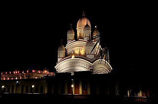
Dakshineswar is a locality in Kolkata Metropolitan Area of North 24 Parganas district under the jurisdiction of Kolkata Metropolitan Development Authority (KMDA). This place is historically famous for Dakshineswar Kali Temple, locally known as Maa Bhabatarini Mandir.

Sodepur or Sodpur is a locality in Panihati Municipality of North 24 Parganas district in the Indian state of West Bengal. It is located in north suburban Kolkata and the area is covered by Kolkata Metropolitan Development Authority (KMDA). Barrackpore, Kamarhati, Dumdum, Agarpara, and Belghoria are all close by. It is a centre for rising residential construction. GM Meena Icon, Peerless Nagar, Merlin Maximus, Godrej Prakriti, and NPR Gitanjali Apartments are a few notable residential developments in the neighbourhood.

North 24 Parganas (abv. 24 PGS (N)) or sometimes North Twenty Four Parganas is a district in southern West Bengal, of eastern India. North 24 Parganas extends in the tropical zone from latitude 22° 11′ 6″ north to 23° 15′ 2″ north and from longitude 88º20' east to 89º5' east. Barasat is the district headquarters of North 24 Parganas. North 24 Parganas is West Bengal's most populous district and also (since 2014) the most populated district in the whole of India. It is the tenth-largest district in the State by area.

Baranagar is a city and a municipality in North Kolkata of the Indian state of West Bengal. It is a part of the area covered by Kolkata Metropolitan Development Authority (KMDA). Baranagar is the fifth most densely populated city proper in the world.

Durganagar is a locality in North Dumdum of North 24 Parganas District in the Indian state of West Bengal. It was named after the goddess Durga. It is a part of area under jurisdiction of Kolkata Metropolitan Development Authority (KMDA). Kolkata Airport is located nearby.

Muragachha is a census town in Barrackpore II CD Block in Barrackpore subdivision in North 24 Parganas district in the Indian state of West Bengal. It is close to Kolkata and also a part of Kolkata Urban Agglomeration.

South Dum Dum is a city and a municipality of North 24 Parganas district in the Indian state of West Bengal. It is a part of the area covered by Kolkata Metropolitan Development Authority (KMDA) and a vital locality in Kolkata Metropolitan Area.

Belgharia is a locality in Kamarhati Municipality of North 24 Parganas district in the Indian state of West Bengal. It is a part of the area covered by Kolkata Metropolitan Development Authority (KMDA) and a vital locality in Kolkata metropolitan area. Belgharia is also known for wholesale market for all types of bags, luggage, and purses. Dakshineswar Kali Temple of Kolkata is in approximately three kilometers distance from Belgharia Railway Station. The Vivekananda Setu on the river of Hooghly which is one of the oldest bridges in Calcutta established for the connection between the city of Howrah and Kolkata is also at the adjacent area of Belgharia.
Ghola is a locality in Panihati Municipality of North 24 Parganas district in the Indian state of West Bengal. It is close to Kolkata and also a part of the area covered by Kolkata Metropolitan Development Authority (KMDA).

Netaji is an elevated metro station on the North-South corridor of the Blue Line of Kolkata Metro in Kolkata, West Bengal, India. This station is situated opposite to the Kudghat bus stand at Kudghat, in Tollygunge.

The Line 1, Blue Line, also known as North–South Metro of the Kolkata Metro, is a rapid transit system serving Kolkata in Indian state of West Bengal. It consists of 26 operational stations from Dakshineswar to Kavi Subhash. Nine of the stations are elevated, 2 at-grade and the remaining 15 are underground, with a total distance of 32.13 km (19.96 mi). The line connects Dakshineswar and New Garia and uses 5 ft 6 in broad gauge rolling stock. Dakshineswar was opened on 22 February 2021 is an elevated station located 4.1 km (2.5 mi) north of Noapara. It was the first underground railway to be built in India, with the first operations commencing in October 1984 and the full stretch that was initially planned being operational by February 1995. On 28 December 2010, it became the 17th zone of the Indian Railways. Being the country's first, and a completely indigenous process, the construction of the Kolkata Metro was more of a trial-and-error affair, in contrast to the Delhi Metro, which has seen the involvement of numerous international consultants. As a result, it took nearly 23 years to completely construct around 15 km (9.3 mi) underground railway from Birpara up to Tollygunge Metro Station.

Noapara is a locality in Baranagar of North 24 Parganas district in the Indian state of West Bengal. It is a part of the area covered by Kolkata Metropolitan Development Authority (KMDA).

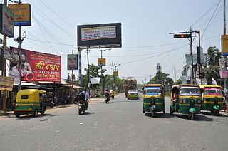
Barrackpore Trunk Road, commonly known as BT Road, is six-laned trunk road in Kolkata metropolitan area, West Bengal, India. It connects Kolkata with its suburb Barrackpore. Built in 1775, it is the oldest metalled road and one of the busiest roads in the country. The 18.1 km (11.2 mi) long road is a part of both State Highway 1 and State Highway 2.

Noapara is the largest elevated metro station on the North-South corridor of the Blue Line of Kolkata Metro in Noapara, Baranagar, Kolkata, West Bengal, India. It opened on 10 July 2013.

Dakshineswar is the elevated northern terminal metro station on the North-South corridor of the Blue Line of Kolkata Metro in Kolkata, West Bengal, India. The metro station adjoins the platforms of the Dakshineswar railway station where connections can be made with Indian Railways services. The station is located at the Dakshineswar area which is famous for Dakshineswar Kali Temple.
Nimta is a neighborhood in North KolkataNorth Dumdum Municipality of North 24 Parganas district in the Indian state of West Bengal. It is a part of the area covered by Kolkata Metropolitan Development Authority (KMDA).

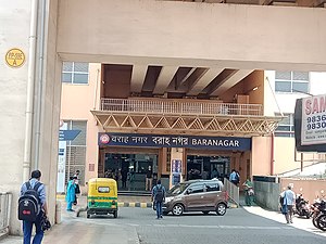
Baranagar Road Railway Station is a Kolkata Suburban Railway station situated on Sealdah-Dankuni line in the city of Baranagar. It serves the local areas of Baranagar in North 24 Parganas district, West Bengal, India.

Dunlop is a neighbourhood in Baranagar of North Kolkata in the Indian state of West Bengal. It is under the jurisdiction of Kolkata Metropolitan Development Authority (KMDA) and Barrackpore Police Commissionerate.


