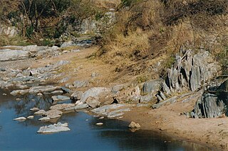
Barberton Greenstone Belt

Last updated
Location of the Barberton Greenstone Belt. South African Greenstone Belt.png
Location of the Barberton Greenstone Belt.

The Barberton Greenstone Belt is situated on the eastern edge of the Kaapvaal Craton in South Africa. It is known for its gold mineralisation and for its komatiites, an unusual type of ultramafic volcanic rock named after the Komati River that flows through the belt. Some of the oldest exposed rocks on Earth (greater than 3.6 Ga) are located in the Barberton Greenstone Belt of the Eswatini–Barberton areas and these contain some of the oldest traces of life on Earth, second only to the Isua Greenstone Belt of Western Greenland. The Makhonjwa Mountains make up 40% of the Baberton belt. [1] It is named after the town Barberton, Mpumalanga.

Contents

History and description

Simplified map of the greenstone belt. Simplified geologic map of the Barberton greenstone belt.pdf
Simplified map of the greenstone belt.
Aerial view from Landsat 7 with the Enhanced Thematic Mapper Plus (ETM+) Barberton etm 2001121 lrg.jpg
Aerial view from Landsat 7 with the Enhanced Thematic Mapper Plus (ETM+)

The Barberton Greenstone Belt consists of a sequence of mafic to ultramafic lavas and metasedimentary rocks emplaced and deposited between 3.5 and 3.2 Ga. The granitoid rocks were emplaced over a 500-million-year time span and can be divided into two suites: The tonalite-trondhjemite-granodiorite (TTG) suite (emplaced approximately 3.5–3.2 Ga), and the granite–monzogranitesyenite granite (GMS) suite (emplaced approximately 3.2–3.1 Ga). The GMS suite are found over large parts of the Kaapvaal Craton and their emplacement coincides with the first stabilisation of the central parts of the craton. "The GMS suite in the Barberton granite-greenstone terrane shows very different internal and external characteristics from the earlier TTG suite. Individual plutons may cover several thousand square kilometres and these composite granitoid bodies have traditionally been referred to as batholiths, alluding to their compositionally and texturally heterogeneous nature and enormous areal extent. For the most part, the plutons appear undeformed." [2]

The Barberton area underwent two tectonic episodes of terrane accretion at about 3.5 and 3.2 Ga. Early stages of shield development are exposed in the Barberton Mountains where the continent formation first took place by magmatic accretion and tectonic amalgamation of small protocontinental blocks. Several small diachronous blocks (3.6–3.2 Ga) have been found in the area. Apparently each block represents a cycle of arc-related magmatism and sedimentation. The Hooggenoeg Formation of the Barberton Greenstone Belt is dated at 3.45 Ga. and evolved through magmatism. This crustal development phase was followed by a period of Mesoarchaean cratonic magmatism (3.1–3.0 Ga) and is marked by the formation of a large crescent-shaped, juvenile arc that was accreted onto the northern and western margins of the evolving Kaapvaal shield. Archaean greenstone belts are hypothesized to have been formed from passive margin oceanic crust that became part of an extensive subduction-undercut margin. The TTG intrusions are thought to have been formed by post-subduction magmatism when subduction was halted, perhaps by arrival of a micro-craton.

The 3.1 Ga Mpuluzi batholith in the Barberton granite–gneiss terrane is made up of granite sheets. The structurally higher parts are underlain by an anastomosing network of steeply dipping, variably deformed dikes and sheets. According to a study done by Westraat et al. (2005): "Multiple intrusive relationships and geochronological evidence suggests that granite sheeting and the assembly of the pluton occurred over a period of 3–13 million years. The spatial and temporal relationship between deformation and magma emplacement reflects episodes of incremental dilation related to deformation along the bounding shear zones and granite sheeting. The transition to the mainly subhorizontal granite sheets at higher structural levels of the tabular Mpuluzi batholith indicates the intrusion of the granites during subhorizontal regional shortening, where the reorientation of the minimum normal stress to vertical attitudes at the shallow levels of emplacement allowed for vertical dilation and subhorizontal emplacement of the granite sheets." [2]

Possible impact event

In April 2014, scientists reported finding evidence of the largest terrestrial meteor impact event to date near the Barberton Greenstone Belt. They estimated the impact occurred about 3.26 billion years ago (during the Paleoarchean era of the Archean eon of the Precambrian supereon) and that the impactor was approximately 37 to 58 kilometres (23 to 36 mi) wide, roughly five times larger than the impactor responsible for the Chicxulub crater in the Yucatán Peninsula, which was around the size of Mount Everest. [3] The gigantic impactor was estimated to have collided with the Earth at a speed of 20 kilometres per second (12 mi/s), releasing enormous energy which drove magnitude 10.8 earthquakes across the planet, as well as megatsunamis thousands of meters high. The crater from this event, if it still exists, has not yet been found. [3]

Barberton Greenstone Belt TTG and GMS suites

The Barberton Mountain is a well preserved pre-3.0 Ga granite-greenstone terrane. The greenstone belt consists of a sequence of mafic to ultramafic lavas and metasedimentary rocks emplaced and deposited between 3.5 and 3.2 Ga. The granitoid rocks were emplaced over a 500 million year time span and can be divided into two suites. The TTG suite (emplaced approximately 3.5–3.2 Ga) contains tonalites, trondhjemites and granodiorites; and the GMS suite (emplaced approximately 3.2–3.1 Ga) includes granites, monzogranites and a small syenite–granite complex.

According to a study by Yearron et al. (2003):

"The TTGs are typically low- to medium-K, metaluminous I-type granites, Their chondrite-normalised REE patterns show two trends. The majority of plutons are LREE [lower-alpha 1] -enriched, HREE [lower-alpha 2] -depleted and with small or no Eu anomalies, whilst the Steynsdorp and Doornhoek plutons are relatively HREE-undepleted with significant Eu anomalies. Nd isotope analyses show that the 3.4 Ga TTGs have positive εNd values (0 to +3.7), indicative of depleted-mantle sources, similar to the oldest greenstone belt formations (the Onverwacht). In contrast, the 3.2 Ga TTGs have negative εNd, suggesting crustal or enriched-mantle input into the magmas.
Extensive granite plutons of a subsequent magmatic episode are associated with the intrusion of vast amounts of granodiorite-monzogranite-syenite GMS suites. The GMS rocks are medium- and high-K metaluminous I-typerocks. They display two dominant REE patterns. Medium-K GMS rocks (the Dalmeinand portions of Heerenveen) are LREE-enriched, HREE-depleted and have no Eu-anomalies, whereas, the high-K GMSs (Heerenveen, Mpuluzi and Boesmanskop) are relatively HREE-enriched with negative Eu anomalies. Positive and negative εNd values (−4.4 to +4.8) for the Boesmanskop Syenite suggests depleted-mantle and crystal signatures. The εNd and REE patterns, in particular, provide insights into the compositions of potential source rocks and restites for the TTG and GMS suites.
Since HREEs and Eu are readily accommodated in garnet and plagioclase, respectively, their depletion suggests the presence of these minerals in the restite. For the TTG suite, we therefore suggest a garnet-rich amphibolitic or eclogitic depleted-mantle source at a depth >40 km. This has been confirmed by experimental work constraining the stability of garnet in the trondhjemite compositions, and at magmatic temperatures, [lower-alpha 3] to a pressure of 15.24 ± 0.5 kbar corresponding to a depth of 54.9 ± 1.8 km. In contrast, the GMS suite most probably had a plagioclase-rich, garnet-poor source that may be a mixture of depleted-mantle and crustal materials.
The two episodes of terrane accretion at ~3.5 and 3.2 Ga correspond to ages of TTG magmatism. This compressional tectonic regime, and the partial melting of greenstone-type material, suggest that basaltic amphibolites of the greenstone sequences are the source materials for the TTG suites. The likely source rocks for the GMS suite are not easily deduced, but chemistry and εNd values of the Boesmanskop syenite suggest a hybrid mantle-crustal source. This type of hybrid source might also explain the features of the monzogranitic batholiths. Close associations between syenite and monzogranites are common, particularly in post-orogenic extensional/transtensional settings. Although extensional activity has not been documented in Barberton, ~3.1 Ga strike-slip activity has. A post-orogenic thinning of the crust might explain the production of large voluminous monzogranite batholiths and the passive nature of their intrusion dynamics." [4]
2013-02-25 13-30-08 South Africa - Barberton Barberton 7h.JPG
A panoramic photograph of the Makhonjwa Mountains area.

Hooggenoeg Formation of the Barberton Greenstone Belt

Some controversy exists pertaining to the origin and emplacement of Archaean felsic suites. According to a dissertation by Louzada (2003): "The upper part of the Hooggenoeg Formation [5] is characterized by ultramafic massive and pillow lavas, a trondhjemitic suite of silicified felsic intrusive and flow banded rocks, and sedimentary chert beds. Veins of felsic, chert and ultramafic material intrude the belt. The depositional environment is thought to be a shoaling shallow sea in which the Hooggenoeg Formation has been deposited in a west-block down, listric faulted, synsedimentary setting." [6] [ better source needed ]

The Hooggenoeg Formation felsic rocks can be divided into two groups: an intrusive group of interlocking and shallow intrusive rocks, and a porphyritic group of rocks from the veins. Lavas from the upper part of the felsic unit are too altered to be assigned to one of these groups. The intrusive group is related to the tonalite-trondhjemite-granodiorite TTG-suite Stolzburg Pluton, which intruded along the southern margin of the Barberton Greenstone Belt. Melting of an amphibolite quartz eclogite has been suggested as a probable origin for these high-Al2O3 felsic magmas. Ultramafic rocks of the Hooggenoeg Formation were most likely not parental for the felsic rocks. Subduction processes may have played a role in the generation of the felsic rocks, but a tectonic setting for the ultramafic rocks remains uncertain. The felsic units of the Hooggenoeg Formation are very similar to those of the Panorama Formation [7] of the Early Archaean Coppin Gap greenstone belt of Western Australia (See Yilgarn Craton). Similarities in geological setting, petrography, and geochemical (trace elements in particular) characteristics suggest a possible genetic relation between the two formations and support the theory that a combined continent Vaalbara existed ~3.45 Ga.

IUGS geological heritage site

In respect of the research carried out on this 'unique remnant of ancient Earth's crust', the 'Archaean Barberton Greenstone Belt' was included by the International Union of Geological Sciences (IUGS) in its assemblage of 100 'geological heritage sites' around the world in a listing published in October 2022. The organisation defines an 'IUGS Geological Heritage Site' as 'a key place with geological elements and/or processes of international scientific relevance, used as a reference, and/or with a substantial contribution to the development of geological sciences through history.' The outcrops of the Barberton Greenstone Belt had previously been inscribed on UNESCO's list of World Heritage Sites in 2008 as 'Barbeton Makhonjwa Mountains. [8]

See also

Notes

  1. Low atomic numbered rare earth elements Sc, Y, La, Ce, Pr, Nd, Pm, Sm (Eu)
  2. High atomic numbered rare earth elements (Eu) Gd, Tb, Dy, Ho, Er, Tm, Yb, Lu
  3. typical range 700 °C to 1300 °C

Related Research Articles

<span class="mw-page-title-main">Greenstone belt</span> Zone of variably metamorphosed rocks occurring in Archaean and Proterozoic cratons

Greenstone belts are zones of variably metamorphosed mafic to ultramafic volcanic sequences with associated sedimentary rocks that occur within Archaean and Proterozoic cratons between granite and gneiss bodies.

<span class="mw-page-title-main">Acasta Gneiss</span> Metamorphic rock unit in Canada

The Acasta Gneiss Complex, also called the Acasta Gneiss, is a body of felsic to ultramafic Archean basement rocks, gneisses, that form the northwestern edge of the Slave Craton in the Northwest Territories, Canada, about 300 km (190 mi) north of Yellowknife, Canada. This geologic complex consists largely of tonalitic and granodioritic gneisses and lesser amounts of mafic and ultramafic gneisses. It underlies and is largely concealed by thin, patchy cover of Quaternary glacial sediments over an area of about 13,000 km2 (5,000 sq mi). The Acasta Gneiss Complex contains fragments of the oldest known crust and record of more than a billion years of magmatism and metamorphism. The Acasta Gneiss Complex is exposed in a set of anticlinoriums within the foreland fold and thrust belt of the Paleoproterozoic Wopmay Orogen.

<span class="mw-page-title-main">Yilgarn Craton</span> Large craton in Western Australia

The Yilgarn Craton is a large craton that constitutes a major part of the Western Australian land mass. It is bounded by a mixture of sedimentary basins and Proterozoic fold and thrust belts. Zircon grains in the Jack Hills, Narryer Terrane have been dated at ~4.27 Ga, with one detrital zircon dated as old as 4.4 Ga.
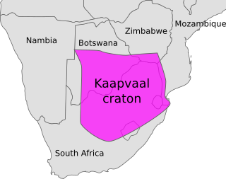
<span class="mw-page-title-main">Kaapvaal Craton</span> Archaean craton, possibly part of the Vaalbara supercontinent

The Kaapvaal Craton, along with the Pilbara Craton of Western Australia, are the only remaining areas of pristine 3.6–2.5 Ga crust on Earth. Similarities of rock records from both these cratons, especially of the overlying late Archean sequences, suggest that they were once part of the Vaalbara supercontinent.

<span class="mw-page-title-main">Monzogranite</span> Biotite granite rocks that are considered to be the final fractionation product of magma

Monzogranites are biotite granite rocks that are considered to be the final fractionation product of magma. Monzogranites are characteristically felsic (SiO2 > 73%, and FeO + MgO + TiO2 < 2.4), weakly peraluminous (Al2O3/ (CaO + Na2O + K2O) = 0.98–1.11), and contain ilmenite, sphene, apatite and zircon as accessory minerals. Although the compositional range of the monzogranites is small, it defines a differentiation trend that is essentially controlled by biotite and plagioclase fractionation. (Fagiono, 2002). Monzogranites can be divided into two groups (magnesio-potassic monzogranite and ferro-potassic monzogranite) and are further categorized into rock types based on their macroscopic characteristics, melt characteristics, specific features, available isotopic data, and the locality in which they are found.

<span class="mw-page-title-main">Algoman orogeny</span> Late Archaean episode of mountain building in what is now North America

The Algoman orogeny, known as the Kenoran orogeny in Canada, was an episode of mountain-building (orogeny) during the Late Archean Eon that involved repeated episodes of continental collisions, compressions and subductions. The Superior province and the Minnesota River Valley terrane collided about 2,700 to 2,500 million years ago. The collision folded the Earth's crust and produced enough heat and pressure to metamorphose the rock. Blocks were added to the Superior province along a 1,200 km (750 mi) boundary that stretches from present-day eastern South Dakota into the Lake Huron area. The Algoman orogeny brought the Archean Eon to a close, about 2,500 million years ago; it lasted less than 100 million years and marks a major change in the development of the Earth's crust.

<span class="mw-page-title-main">Geology of Zimbabwe</span>

The geology of Zimbabwe in southern Africa is centered on the Zimbabwe Craton, a core of Archean basement composed in the main of granitoids, schist and gneisses. It also incorporates greenstone belts comprising mafic, ultramafic and felsic volcanics which are associated with epiclastic sediments and iron formations. The craton is overlain in the north, northwest and east by Proterozoic and Phanerozoic sedimentary basins whilst to the northwest are the rocks of the Magondi Supergroup. Northwards is the Zambezi Belt and to the east the Mozambique Belt. South of the Zimbabwe Craton is the Kaapvaal Craton separated from it by the Limpopo Mobile Belt, a zone of deformation and metamorphism reflecting geological events from Archean to Mesoproterozoic times. The Zimbabwe Craton is intruded by an elongate ultramafic/mafic igneous complex known as the Great Dyke which runs for more than 500 km along a SSW/NNE oriented graben. It consists of peridotites, pyroxenites, norites and bands of chromitite.

<span class="mw-page-title-main">Tectonic evolution of the Barberton greenstone belt</span> Evolutionary history of ancient continental crust remnant located in southeastern Africa

The Barberton greenstone belt (BGB) is located in the Kapvaal craton of southeastern Africa. It characterizes one of the most well-preserved and oldest pieces of continental crust today by containing rocks in the Barberton Granite Greenstone Terrain (3.55–3.22 Ga). The BGB is a small, cusp-shaped succession of volcanic and sedimentary rocks, surrounded on all sides by granitoid plutons which range in age from >3547 to <3225 Ma. It is commonly known as the type locality of the ultramafic, extrusive volcanic rock, the komatiite. Greenstone belts are geologic regions generally composed of mafic to ultramafic volcanic sequences that have undergone metamorphism. These belts are associated with sedimentary rocks that occur within Archean and Proterozoic cratons between granitic bodies. Their name is derived from the green hue that comes from the metamorphic minerals associated with the mafic rocks. These regions are theorized to have formed at ancient oceanic spreading centers and island arcs. In simple terms, greenstone belts are described as metamorphosed volcanic belts. Being one of the few most well-preserved Archean portions of the crust, with Archean felsic volcanic rocks, the BGB is well studied. It provides present geologic evidence of Earth during the Archean (pre-3.0 Ga). Despite the BGB being a well studied area, its tectonic evolution has been the cause of much debate.
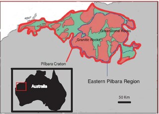
<span class="mw-page-title-main">Eastern Pilbara Craton</span> Carton in Western Australia

The Eastern Pilbara Craton is the eastern portion of the Pilbara Craton located in Western Australia. This region contains variably metamorphosed mafic and ultramafic greenstone belt rocks, intrusive granitic dome structures, and volcanic sedimentary rocks. These greenstone belts worldwide are thought to be the remnants of ancient volcanic belts, and are subject to much debate in today's scientific community. Areas such as Isua and Barberton which have similar lithologies and ages as Pilbara have been argued to be subduction accretion arcs, while others suggest that they are the result of vertical tectonics. This debate is crucial to investigating when/how plate tectonics began on Earth. The Pilbara Craton along with the Kaapvaal Craton are the only remaining areas of the Earth with pristine 3.6–2.5 Ga crust. The extremely old and rare nature of this crustal region makes it a valuable resource in the understanding of the evolution of the Archean Earth.

<span class="mw-page-title-main">Huangling Anticline</span>

The Huangling Anticline or Complex represents a group of rock units that appear in the middle of the Yangtze Block in South China, distributed across Yixingshan, Zigui, Huangling, and Yichang counties. The group of rock involves nonconformity that sedimentary rocks overlie the metamorphic basement. It is a 73-km long, asymmetrical dome-shaped anticline with axial plane orientating in the north-south direction. It has a steeper west flank and a gentler east flank. Basically, there are three tectonic units from the anticline core to the rim, including Archean to Paleoproterozoic metamorphic basement, Neoproterozoic to Jurassic sedimentary rocks, and Cretaceous fluvial deposit sedimentary cover. The northern part of the core is mainly tonalite-trondhjemite-gneiss (TTG) and Cretaceous sedimentary rock called the Archean Kongling Complex. The middle of the core is mainly the Neoproterozoic granitoid. The southern part of the core is the Neoproterozoic potassium granite. Two basins are situated on the western and eastern flanks of the core, respectively, including the Zigui basin and Dangyang basin. Both basins are synforms while Zigui basin has a larger extent of folding. Yuanan Graben and Jingmen Graben are found within the Dangyang Basin area. The Huangling Anticline is an important area that helps unravel the tectonic history of the South China Craton because it has well-exposed layers of rock units from Archean basement rock to Cretaceous sedimentary rock cover due to the erosion of the anticline.

<span class="mw-page-title-main">Eoarchean geology</span> Study of the oldest crustal fragments on Earth

Eoarchean geology is the study of the oldest preserved crustal fragments of Earth during the Eoarchean era from 4.031 to 3.6 billion years ago. Major well-preserved rock units dated Eoarchean are known from three localities, the Isua Greenstone Belt in Southwest Greenland, the Acasta Gneiss in the Slave Craton in Canada, and the Nuvvuagittuq Greenstone Belt in the eastern coast of Hudson Bay in Quebec. From the dating of rocks in these three regions scientists suggest that plate tectonics could go back as early as Eoarchean.
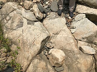
<span class="mw-page-title-main">Tonalite–trondhjemite–granodiorite</span> Intrusive rocks with typical granitic composition

Tonalite–trondhjemite–granodiorite (TTG) rocks are intrusive rocks with typical granitic composition but containing only a small portion of potassium feldspar. Tonalite, trondhjemite, and granodiorite often occur together in geological records, indicating similar petrogenetic processes. Post Archean TTG rocks are present in arc-related batholiths, as well as in ophiolites, while Archean TTG rocks are major components of Archean cratons.

<span class="mw-page-title-main">Archean felsic volcanic rocks</span> Felsic volcanic rocks formed in the Archean Eon

Archean felsic volcanic rocks are felsic volcanic rocks that were formed in the Archean Eon. The term "felsic" means that the rocks have silica content of 62–78%. Given that the Earth formed at ~4.5 billion year ago, Archean felsic volcanic rocks provide clues on the Earth's first volcanic activities on the Earth's surface started 500 million years after the Earth's formation.

The Grenville Province is a tectonically complex region, in Eastern Canada, that contains many different aged accreted terranes from various origins. It exists southeast of the Grenville Front and extends from Labrador southwestern to Lake Huron. It is bounded by the St. Lawrence River/Seaway to the southeast.

The geology of Yukon includes sections of ancient Precambrian Proterozoic rock from the western edge of the proto-North American continent Laurentia, with several different island arc terranes added through the Paleozoic, Mesozoic and Cenozoic, driving volcanism, pluton formation and sedimentation.

<span class="mw-page-title-main">Eastern Block of the North China Craton</span>

The Eastern Block of the North China Craton is one of the Earth's oldest pieces of continent. It is separated from the Western Block by the Trans-North China Orogen. It is situated in northeastern China and North Korea. The Block contains rock exposures older than 2.5 billion years. It serves as an ideal place to study how the crust was formed in the past and the related tectonic settings.

<span class="mw-page-title-main">Western Block of the North China Craton</span>

The Western Block of the North China Craton is an ancient micro-continental block mainly composed of Neoarchean and Paleoproterozoic rock basement, with some parts overlain by Cambrian to Cenozoic volcanic and sedimentary rocks. It is one of two sub-blocks within the North China Craton, located in east-central China. The boundaries of the Western Block are slightly different among distinct models, but the shapes and areas are similar. There is a broad consensus that the Western Block covers a large part of the east-central China.

The Superior Craton is a stable crustal block covering Quebec, Ontario, and southeast Manitoba in Canada, and northern Minnesota in the United States. It is the biggest craton among those formed during the Archean period. A craton is a large part of the Earth's crust that has been stable and subjected to very little geological changes over a long time. The size of Superior Craton is about 1,572,000 km2. The craton underwent a series of events from 4.3 to 2.57 Ga. These events included the growth, drifting and deformation of both oceanic and continental crusts.

<span class="mw-page-title-main">Dharwar Craton</span> Part of the Indian Shield in south India

The Dharwar Craton is an Archean continental crust craton formed between 3.6-2.5 billion years ago (Ga), which is located in southern India and considered as the oldest part of the Indian peninsula.

Appinite is an amphibole-rich plutonic rock of high geochemical variability. Appinites are therefore regarded as a rock series comprising hornblendites, meladiorites, diorites, but also granodiorites and granites. Appinites have formed from magmas very rich in water. They occur in very different geological environments. The ultimate source region of these peculiar rocks is the upper mantle, which was altered metasomatically and geochemically before melting.

References

  1. "Barberton Makhonjwa Mountains". UNESCO.
  2. 1 2 Westraat, J. D; Kisters, A. F. M.; Poujo, M.; Stevens, G. (2005). "Transcurrent shearing, granite sheeting and the incremental construction of the tabular 3.1 Ga Mpuluzi batholith, Barberton granite–greenstone terrane, South Africa". Journal of the Geological Society. 162 (2): 373–388. Bibcode:2005JGSoc.162..373W. doi:10.1144/0016-764904-026. S2CID   129905362.
  3. 1 2 Norman H. Sleep; Donald R. Lowe (April 9, 2014). "Scientists reconstruct ancient impact that dwarfs dinosaur-extinction blast". American Geophysical Union. Retrieved April 22, 2019.
  4. Yearron, L .M.; Clemens, J. D.; Stevens, G.; Anhaeusser, C. R. (2003). "Geochemistry and Petrogenesis of the Granitoids of the Barberton Mountain Land, South Africa" (PDF). Geophysical Research Abstracts. 5 (2639): 2639. Bibcode:2003EAEJA.....2639Y.
  5. Sandsta, N.R.; Robins, B.; Furnes, H.; de Wit, M. (2011). "The origin of large varioles in flow-banded pillow lava from the Hooggenoeg Complex, Barberton Greenstone Belt, South Africa". Contributions to Mineralogy and Petrology. 162 (2): 365–377. Bibcode:2011CoMP..162..365S. doi: 10.1007/s00410-010-0601-4 . hdl: 1956/4518 .
  6. Louzada, K. L. (2003) "The magmatic evolution of the upper ~3450 Ma Hooggenoeg Formation, Barberton greenstone belt, Kaapvaal Craton, South Africa", Utrecht University : unpublished MSc project abstr.
  7. Retallack, G.J. (2018). "The oldest known paleosol profiles on Earth: 3.46 Ga Panorama Formation, Western Australia". Palaeogeography, Palaeoclimatology, Palaeoecology. 489: 230–248. Bibcode:2018PPP...489..230R. doi:10.1016/j.palaeo.2017.10.013.
  8. "The First 100 IUGS Geological Heritage Sites" (PDF). IUGS International Commission on Geoheritage. IUGS. Retrieved 10 November 2022.