Related Research Articles

Snowdonia is a mountainous region in northwestern Wales and a national park of 823 square miles (2,130 km2) in area. It was the first to be designated of the three national parks in Wales, in 1951. It contains the highest peaks in the United Kingdom outside Scotland.

Golf Halt is a small railway halt on the Fairbourne Railway in Gwynedd, North Wales.

Merionethshire or Merioneth is one of thirteen historic counties of Wales, a vice county and a former administrative county.

Barmouth is a seaside town and community in the county of Gwynedd, northwestern Wales, lying on the estuary of the Afon Mawddach and Cardigan Bay. Located in the historic county of Merionethshire, the Welsh form of the name is derived from aber (estuary) and the river's name, "Mawddach". The English form of the name is a corruption of the earlier Welsh form Abermawdd. The community includes the tiny villages of Llanaber, Cutiau, and Caerdeon.

Fairbourne is a Welsh seaside village. It lies on the coast of Barmouth Bay in Arthog community, to the south of the estuary of the River Mawddach in Gwynedd, surrounded by the Snowdonia National Park. It is in an area listed by Gwynedd council for managed retreat due to rising sea levels.

Cardigan Bay is a large inlet of the Irish Sea, indenting the west coast of Wales between Bardsey Island, Gwynedd in the north, and Strumble Head, Pembrokeshire at its southern end. It is the largest bay in Wales.
Mid Wales is the central region of Wales. The Mid Wales Regional Committee of the Senedd covered the unitary authority areas of Ceredigion and Powys and the area of Gwynedd that had previously been the district of Meirionnydd. A similar definition is used by the BBC. The Wales Spatial Plan defines a region known as "Central Wales" which covers Ceredigion and Powys. If Mid Wales is classed as Ceredigion and Powys, the area would be 6,962 square kilometres (2,688 sq mi).

The Afon Mawddach is a river in Gwynedd, Wales, which has its source in a wide area SH820300 north of Dduallt in Snowdonia. It is 28 miles (45 km) in length, and is much branched; many of the significant tributaries are of a similar size to the main river. The catchment area is bounded to the east by the Aran Fawddwy massif and to the west and north by the Harlech dome which forms a watershed just south of Llyn Trawsfynydd.

The Fairbourne Railway is a 12+1⁄4 in gauge railway running for 2 miles (3.2 km) from the village of Fairbourne on the Mid-Wales coast, alongside the beach to the end of a peninsula at Barmouth Ferry railway station, where there is a connection with the Barmouth Ferry across the Mawddach estuary to the seaside resort of Barmouth.

Morfa Mawddach railway station is an unstaffed station located on the outskirts of the village of Arthog in Gwynedd, Wales, on the Cambrian Coast line between Machynlleth and Pwllheli. Built by the Aberystwith and Welsh Coast Railway in 1865, it was formerly the junction station for the Ruabon to Barmouth Line. Since the closure of the Ruabon to Barmouth line in 1965, it remains open, as a minor station on the Cambrian Line.

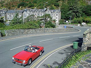
Arthog is a village, post town and community in the Meirionnydd area in Gwynedd, north Wales including the villages of Fairbourne and Friog. It is located on the A493, approximately 8 miles (13 km) west of Dolgellau, and had a population of 1,010 in 2001, increasing slightly to 1,031 at the 2011 census.
The Aberystwith and Welsh Coast Railway was a standard gauge railway company, running a line along the west coast of Wales.
The Mawddach Trail is a cycle path route, part of Lôn Las Cymru, which runs for some 8 miles (13 km) from Dolgellau (52.7446°N 3.8866°W) to Morfa Mawddach railway station (52.7076°N 4.0315°W), by Barmouth bridge on the Cambrian coast. It is maintained by the Snowdonia National Park and is popular with walkers and cyclists alike. It passes some estuarine areas that are important for water birds, and the RSPB Information Centre at Penmaenpool makes use of the old signal box as an observation centre overlooking the estuary.
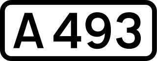
The A493 is a road located on the west coast of mid Wales and connects Dolgellau to Machynlleth via the coast, avoiding Corris and Cross Foxes.

The Barmouth Ferry provides a passenger service across the River Mawddach in Gwynedd county, north Wales. There are currently two ferry operators on the harbour. The service usually operates from April to October.
The A496 is a major coastal and mountainous road in southern Snowdonia.

Llwyngwril is a coastal village, in Llangelynnin community, two miles north of the village of Llangelynnin and eleven miles south-west of Dolgellau. It is in the county of Merionethshire, Wales, although currently administered as part of the unitary authority of Gwynedd. The railway and road run along the coast and the village is sandwiched between the hills and the sea. The population according to the 2011 census was 526, with 56.7% of the population born in England, making it very Anglicised.
The Barmouth Junction and Arthog Tramway operated a 3 ft narrow gauge tramway service in Arthog between 1899 and 1903.

Fairbourne Spit is a long spit of sand and shingle at the mouth of the River Mawddach where it reaches Cardigan Bay, on the west coast of Wales. The gravel probably originates from Llwyngwril to the south, while the sand and dunes at the north end of the spit are partly deposited from the river, which is a long-term sink for sandy sediment.
References
- ↑ OL 23 Cadair Idris & Llyn Tegid (Map) (A1 ed.). 1:25,000. Explorer. Ordnance Survey. 2005. ISBN 0319236226.
Coordinates: 52°41′50″N4°04′45″W / 52.69722°N 4.07917°W
| | This Gwynedd location article is a stub. You can help Wikipedia by expanding it. |