Cedarhill Estates is a neighbourhood located in Barrhaven Ward in the west end of Ottawa. Prior to amalgamation in 2001, it was located in Nepean. Together with Orchard Estates and the Onassa Springs development, it is located within the western part of the Ottawa Greenbelt. It is bordered by Fallowfield Road to the south, Cedarview Road to the east, and by Highway 416 to the north and west. It is located northwest of the Barrhaven suburb of the city. The neighbourhood surrounds the Cedarhill Golf Course. The neighbourhood by two nearby interchanges via Highway 416.

The Ottawa City Council is the governing body of the City of Ottawa, Ontario, Canada. It is composed of 24 city councillors and the mayor. The mayor is elected at large, while each councillor represents wards throughout the city. Council members are elected to four-year terms, with the last election being on October 24, 2022. The council meets at Ottawa City Hall in downtown Ottawa. Much of the council's work is done in the standing committees made up of sub-groups of councillors. The decisions made in these committees are presented to the full council and voted upon.

Nepean is a former municipality and now geographic area of Ottawa, Ontario, Canada. Located west of Ottawa's inner core, it was an independent city until amalgamated with the Regional Municipality of Ottawa–Carleton in 2001 to become the new city of Ottawa. However, the name Nepean continues in common usage in reference to the area. The population of Nepean is about 186,593 people.

The Regional Municipality of Ottawa–Carleton was a Regional Municipality and Census Division in Ontario, Canada, that existed between January 1, 1969, and January 1, 2001, and was primarily centred on the City of Ottawa. It was created in 1969 by restructuring Carleton County and annexing Cumberland Township from the United Counties of Prescott and Russell into the newly created Region of Ottawa–Carleton.

Barrhaven is a suburb of Ottawa, Ontario, Canada. It is located about 17 km (11 mi) southwest of the city's downtown core. Prior to amalgamation with Ottawa in 2001, Barrhaven was part of the City of Nepean. Its population as of the Canada 2021 Census was 103,234.

The 2003 Ottawa municipal election was a municipal election that was held in Ottawa to elect the city's mayor, City Council, and school trustees for the city of Ottawa, Ontario, Canada. The vote was held on November 10, 2003. The elections were held simultaneously with most other municipalities in Ontario.

Nepean—Carleton was a federal electoral district in Ontario, Canada that was represented in the House of Commons from 1979 to 1988, and again from 1997 to 2015.

The 2006 Ottawa municipal election was held on November 13, 2006, in Ottawa, Canada, to elect the mayor of Ottawa, Ottawa City Council and the Ottawa-Carleton Public and Catholic School Boards. The election was one of many races across the province of Ontario. See 2006 Ontario municipal elections.

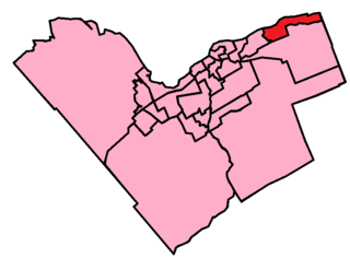
Orléans East-Cumberland Ward is a city ward in the city of Ottawa, Ontario, Canada, represented on Ottawa City Council. It was created before the 2000 Election when the area was amalgamated into the city of Ottawa. The ward covers much of the suburban community of Orleans in the east of the city. Previous to that, the ward existed in the Regional Municipality of Ottawa-Carleton Council. It contains the neighbourhoods of Queenswood Heights, Queenswood Village, Fallingbrook, Cardinal Creek, Cardinal Creek Village, Bella Vista and Cumberland Village.

Bells Corners is a suburban neighbourhood in Ottawa, Ontario, Canada. It is located along Robertson Road west of downtown, within Ottawa's western Greenbelt, in College Ward. As of the Canada 2016 Census, the community had a population of 9,272.

Merivale Road is an arterial road in the west end of Ottawa, Ontario, Canada. It starts at Island Park Drive just north of Highway 417 and continues south until it ends at Prince of Wales Drive in Rideau Glen. South of Clyde Avenue, Merivale is known as Ottawa Road #17, while north of Clyde it is Ottawa Road #63.
Riverside South is a suburban community in Gloucester-South Nepean Ward in the south end of the city of Ottawa, Ontario, Canada, just southwest of Ottawa Macdonald–Cartier International Airport. Prior to amalgamation in 2001, the area was located in the city of Gloucester. Its population, according to the Canada 2021 Census, was 19,802.

Orléans West-Innes Ward is a city ward in the city of Ottawa, Ontario, Canada. It is located in the eastern end of the city, containing the western half of Orleans subdivision plus the community of Blackburn Hamlet. The ward is represented on Ottawa City Council by Laura Dudas.

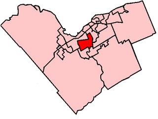
Knoxdale-Merivale is a city ward in Ottawa, Ontario. Located in the city's west end, the ward is bordered to the east by the Rideau River and Fisher Avenue, the northern boundaries of the community of Barrhaven to the south, Ontario Highway 416 and Cedarview Road to the west and to the north by the Canadian National railway west of Merivale Road and Baseline Road to its east. It includes the communities of portions or all of Arlington Woods, Craig Henry, Tanglewood, Manordale, Crestview, Skyview, Parkwood Hills, Merivale Gardens, Grenfell Glen, Pineglen and Country Place.

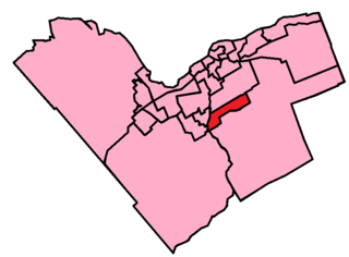
Riverside South-Findlay Creek Ward or Ward 22 is a city ward located in Ottawa, Ontario. Situated in the south end of the city, the ward includes the communities of Riverside South and Findlay Creek in the former city of Gloucester.

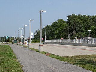
Nepean Woods station is located in the Ottawa, Ontario, Canada suburb of Barrhaven, and is on the Southwest Transitway which is served by OC Transpo buses. Located near the intersection of Woodroffe Avenue and Strandherd Drive in southern Nepean, it was the westerly terminus of most trips of rapid-transit route 74, formerly numbered route 94. It is also the site of a park and ride lot for residents of Barrhaven, which opened on 24 February 2014.
Country Place is a residential neighbourhood near the geographical centre of Ottawa, Canada, in Knoxdale-Merivale Ward. Prior to 2001, it was part of the former city of Nepean. It is a mature residential subdivision with about 400 houses located just inside the Ottawa greenbelt near the Rideau River, and about 11 km from downtown Ottawa. It is bordered by the Black Rapids Creek and the greenbelt to the south, Prince of Wales Drive to the east, Merivale Road to the west, and the Pineglen community to the north. Amberwood Crescent meanders through the community, exiting onto Prince of Wales and Merivale. Tennyson Drive links Country Place to Pineglen.

The 2018 Ottawa municipal election was a municipal election that was held on October 22, 2018, to elect the mayor of Ottawa, Ottawa City Council and the Ottawa-Carleton Public and Catholic School Boards. The election was held on the same day as elections in every other municipality in Ontario.
The following outline is provided as an overview of and topical guide to Ottawa:


