
The Barrington Tops National Park is a protected national park located in the Hunter Valley in New South Wales, Australia. Gazetted in 1969, the 76,512-hectare (189,070-acre) park is situated between Scone, Singleton, Dungog, Gloucester and East Gresford.

Tapin Tops National Park is an 110 km2 (42 sq mi) national park that is located in the Mid North Coast region of New South Wales, Australia.

The Hunter Region, also commonly known as the Hunter Valley, is a region of New South Wales, Australia, extending from approximately 120 km (75 mi) to 310 km (193 mi) north of Sydney. It contains the Hunter River and its tributaries with highland areas to the north and south. Situated at the northern end of the Sydney Basin bioregion, the Hunter Valley is one of the largest river valleys on the NSW coast, and is most commonly known for its wineries and coal industry.
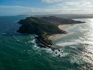
Cape Byron is the easternmost point of the mainland of Australia, located in New South Wales. It is about 3 km (1.9 mi) east of the town of Byron Bay, New South Wales and projects into the Pacific Ocean at 28.6335° S, 153.6383° E. A lighthouse is situated there. It is a popular area for hiking and for whale watching. Two national parks, one a conservation area and a marine park, are on the bay.

The Gondwana Rainforests of Australia, formerly known as the Central Eastern Rainforest Reserves, are the most extensive area of subtropical rainforest in the world. Collectively, the rainforests are a World Heritage Site with fifty separate reserves totalling 366,500 hectares from Newcastle to Brisbane.
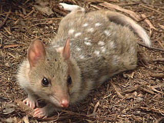
The eastern quoll is a medium-sized carnivorous marsupial (dasyurid), and one of six extant species of quolls. Endemic to Australia, they occur on the island state of Tasmania, but were considered extinct on the mainland after 1963. Recently, the species has been successfully reintroduced to Victoria in 2003 and to the Australian Capital Territory in 2016.

Barrington Tops is part of the Great Dividing Range in New South Wales, Australia, between Gloucester and Scone.

The Mount Royal Range is a mountain range in the Hunter region of New South Wales, Australia.
Guy Fawkes River, a perennial stream that is part of the Clarence River catchment, is in the New England and Northern Tablelands districts of New South Wales, Australia.

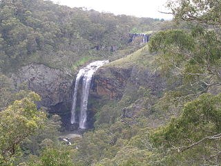
Gloucester River, a perennial river and major tributary of the Manning River catchment, is located in the Mid North Coast hinterland New South Wales, Australia.

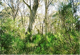
The Eastern Australian temperate forests is a broad ecoregion of open forest on uplands starting from the east coast of New South Wales in the South Coast to southern Queensland, Australia. Although dry sclerophyll and wet sclerophyll eucalyptus forests predominate within this ecoregion, a number of distinguishable rainforest communities are present as well.

The Coocumbac Island Nature Reserve is a protected nature reserve located in the mid–north coast region of New South Wales, Australia. The 6-hectare (15-acre) reserve, situated on the Manning River near Taree, is a rare example of a subtropical lowland rainforest.

The Wingham Brush Nature Reserve is a protected nature reserve that is located in the Mid North Coast region of New South Wales, in eastern Australia. The 8-hectare (20-acre) reserve is a rare example of sub tropical lowland rainforest and is situated on the Manning River.

The Black Bulga State Conservation Area is a protected conservation area located near the Barrington Tops, in the Hunter Region of New South Wales, Australia. The 1,554-hectare (3,840-acre) conservation area is situated 16 kilometres (9.9 mi) from Dungog, and used to be part of Trevor State Forest and Chichester State Forest.

Careys Peak is a peak in the Williams Range, part of the Mount Royal Range, located in the Upper Hunter region of New South Wales, Australia. At 1,544 metres (5,066 ft) above sea level, it is one of the higher points in Barrington Tops National Park, some 200 kilometres (120 mi) north of Sydney. The peak is at the edge of the Barrington Tops plateau, within the declared wilderness of the World Heritage Gondwana Rainforests of Australia.
Brumlow Top is a mountain on the Barrington Tops plateau, in the Mid-Coast Council in New South Wales, Australia.

Mount Barrington, a mountain that is part of the Mount Royal Range, is located on the Barrington Tops plateau in the Mid-Coast Council within New South Wales, Australia and has an elevation of 1,555 metres (5,102 ft) above sea level.

Polblue is a mountain on the Barrington Tops plateau, located in the Mid-Coast Council within New South Wales, Australia.

The Copeland Tops State Conservation Area is a protected conservation area located near the Barrington Tops in the Hunter Region of New South Wales, Australia. The 2,201-hectare (5,440-acre) is situated 12 km (7 mi) west of Gloucester.
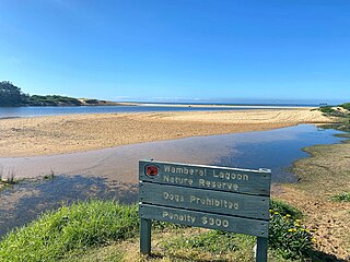
Wamberal Lagoon, an intermittently closed intermediate saline coastal lagoon, is located on the Central Coast region of New South Wales, Australia. Wamberal Lagoon is located between the beachside settlements of Forresters Beach and Wamberal, and adjacent to the east coast, about 87 kilometres (54 mi) north of Sydney.
