Mangotsfield is an urban area and former village in the unitary authority of South Gloucestershire, to the north-east of Bristol.

Bedfordshire is an English ceremonial county which lies between approximately 25 miles and 55 miles north of central London.

The region now known as Gloucestershire was originally inhabited by Brythonic peoples in the Iron Age and Roman periods. After the Romans left Britain in the early 5th century, the Brythons re-established control but the territorial divisions for the post-Roman period are uncertain. The city of Caerloyw was one centre and Cirencester may have continued as a tribal centre as well. The only reliably attested kingdom is the minor south-east Wales kingdom of Ergyng, which may have included a portion of the area. In the final quarter of the 6th century, the Saxons of Wessex began to establish control over the area.

The Rodings are a group of eight villages in the upper part of the River Roding and the west of Essex, England, the largest group in the country to bear a common name. The Rodings do not lie within a single district in the county; they are arranged around the tripoint of the administrative areas of Chelmsford, Uttlesford and Epping Forest. An alternative arcane name, linked to the Middle English Essex dialect, was The Roothings.

Pucklechurch is a large village and civil parish in South Gloucestershire, England, 7.4 miles (11.9 km) ENE of the city of Bristol and 8.9 miles (14.3 km) NW of the city of Bath.

Barley is a village and civil parish in the district of North Hertfordshire, England. According to the 2001 census, it has a population of 659, increasing to 662 at the 2011 Census. The place-name refers to a lea or meadow and not to the grain-producing plant. Coincidentally to the southwest lies the village of Reed. The Prime Meridian passes to the west of Barley, which is located on the Royston to Saffron Walden road, as well as the medieval London to Cambridge road.
Barton Hill is an area of Bristol, just to the east of the city centre and Bristol Temple Meads railway station.
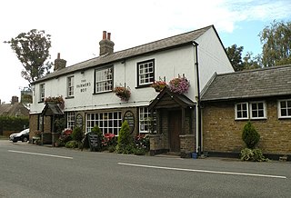
Thornbury Rural District was a rural district council centred on Thornbury in the south of Gloucestershire. It was originally formed as a Poor Law Union on 5 April 1836 with 26 Guardians representing the 21 parishes in the Union and the Guardians of the Poor became the Rural Sanitary Authority for the District in 1872. The Rural District Council became a separate body in 1894 although the District Councillors had a dual mandate as members of both the council and the Board of Guardians.The District was enlarged in 1904 when Henbury was transferred from the abolished Barton Regis Rural District. In 1930 the Guardians were abolished when their functions were transferred to It was abolished in 1974 and the majority of it transferred into the new county of Avon, as part of the new district of Northavon.

Astley is a village, and a civil parish in Worcestershire, England, about two miles outside Stourport-on-Severn and seven miles south-west of Kidderminster.

Grimley is a village and civil parish in the Malvern Hills District in the county of Worcestershire, England about 3 miles (4.8 km) north of Worcester.
Brickendon is a village in the civil parish of Brickendon Liberty in the district of East Hertfordshire about 3 miles (4.8 km) south of the county town Hertford, and is served by Bayford railway station.

Reed is a small village and civil parish in North Hertfordshire. It is situated on a chalk ridge, approximately 3 miles (4.8 km) south of the market town of Royston. The Prime Meridian passes just to the east of the village, between Reed and Barkway. The modern A10 road passes just to the west of the village. The population of the parish was 310 at the time of the 2011 census.

Clifton upon Teme is a village and civil parish in the Malvern Hills District in the county of Worcestershire, England.
Barton Regis was, from 1894 to 1904, a rural district in the English administrative county of Gloucestershire, adjacent to the City of Bristol.

Harlaston is a village and civil parish in Staffordshire, England. It lies on the River Mease, about 5 miles (8 km) north of Tamworth. There is an Early English church, dedicated to St Matthew, and a public house, the White Lion.
South Stoneham was a manor in South Stoneham parish. It was also a hundred, Poor law union, sanitary district then rural district covering a larger area of south Hampshire, England close to Southampton.
The Hundred of Catsash is one of the 40 historical Hundreds in the ceremonial county of Somerset, England, dating from before the Norman conquest during the Anglo-Saxon era although exact dates are unknown. Each hundred had a 'fyrd', which acted as the local defence force and a court which was responsible for the maintenance of the frankpledge system. They also formed a unit for the collection of taxes. The role of the hundred court was described in the Dooms (laws) of King Edgar. The name of the hundred was normally that of its meeting-place.
The Hundred of Williton and Freemanners is one of the 40 historical Hundreds in the ceremonial county of Somerset, England, dating from before the Norman conquest during the Anglo-Saxon era although exact dates are unknown. Each hundred had a 'fyrd', which acted as the local defence force and a court which was responsible for the maintenance of the frankpledge system. They also formed a unit for the collection of taxes. The role of the hundred court was described in the Dooms (laws) of King Edgar. The name of the hundred was normally that of its meeting-place.
Langley and Swinehead was an ancient hundred of Gloucestershire, England. Hundreds originated in the late Saxon period as a subdivision of a county and lasted as administrative divisions until the 19th century.
