Battery Weed | |
 | |
 | |
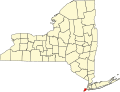
| Location | Fort Wadsworth Reservation, New York, New York |
|---|---|
| Coordinates | 40°36′19″N74°3′17″W / 40.60528°N 74.05472°W |
| Area | less than 1-acre (4,000 m2) |
| Built | 1845–1861 |
| Architect | Robert E. Lee, Joseph G. Totten |
| Architectural style | Third System of US fortifications |
| NRHP reference No. | 72000908 [1] |
| NYCL No. | 0379 |
| Significant dates | |
| Added to NRHP | January 20, 1972 |
| Designated NYCL | October 12, 1967 |
Battery Weed is a four-tiered 19th century fortification guarding the Narrows, the main approach from the Atlantic Ocean to New York City. Located on the Staten Island waterfront on the west shore of the Narrows, directly across from Fort Hamilton and the now-destroyed Fort Lafayette in Brooklyn, the fort was intended to protect New York from attack by sea. When built, it was named Fort Richmond, as was a previous fort on the site. [2]