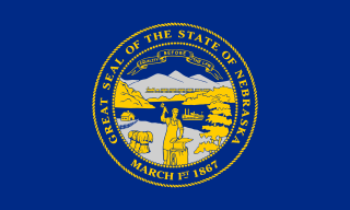
Nebraska is a state in the Midwestern region of the United States. It is bordered by South Dakota to the north; Iowa to the east and Missouri to the southeast, both across the Missouri River; Kansas to the south; Colorado to the southwest; and Wyoming to the west. It is the only triply landlocked U.S. state.

West Point is a city in and the county seat of Cuming County, Nebraska, United States. The population was 3,364 at the 2010 census.

Battle Creek is a city in Madison County, Nebraska, United States. It is part of the Norfolk, Nebraska Micropolitan Statistical Area. The population was 1,207 at the 2010 census.

The Platte River is a major river in the State of Nebraska. It is about 310 mi (500 km) long; measured to its farthest source via its tributary, the North Platte River, it flows for over 1,050 miles (1,690 km). The Platte River is a tributary of the Missouri River, which itself is a tributary of the Mississippi River which flows to the Gulf of Mexico. The Platte over most of its length is a broad, shallow, meandering stream with a sandy bottom and many islands—a braided stream.
The neighborhoods of Omaha are a diverse collection of community areas and specific enclaves. They are spread throughout the Omaha metro area, and are all on the Nebraska side of the Missouri River.
The timeline of Kansas details past events that happened in what is present day Kansas. Located on the eastern edge of the Great Plains, the U.S. state of Kansas was the home of sedentary agrarian and hunter-gatherer Native American societies, many of whom hunted American bison. The region first appears in western history in the 16th century at the time of the Spanish conquest of Mexico, when Spanish conquistadores explored the unknown land now known as Kansas. It was later explored by French fur trappers who traded with the Native Americans. It became part of the United States in the Louisiana Purchase of 1803. In the 19th century, the first American explorers designated the area as the "Great American Desert."

Logan Fontenelle, also known as Shon-ga-ska, was a trader of Omaha and French ancestry, who served for years as an interpreter to the US Indian agent at the Bellevue Agency in Nebraska. He was especially important during the United States negotiations with Omaha leaders in 1853–1854 about ceding land to the United States prior to settlement on a reservation. His mother was a daughter of Big Elk, the principal chief, and his father was a respected French-American fur trader.
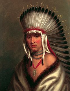
Petalesharo was a Skidi Pawnee chief or brave who rescued an "Ietan" girl, that is Comanche girl, from a ritual human sacrifice around 1817 and earned publicity for his act in national newspapers. In 1821, he was one of numerous Great Plains tribal chiefs to go to Washington, D.C. as part of the O'Fallon Delegation where they met President James Monroe.

Fontanelle is an unincorporated community and census-designated place (CDP) in Washington County, Nebraska, United States. The site of repeated incursions by the neighboring Pawnee tribe, Fontanelle was an early boom town in the Nebraska Territory, but waned in importance after failing to secure a railroad connection in the late 19th century. The 1860 Federal Census showed the town having dozens of residents, including farmers, carpenters, blacksmiths, clergymen, lawyers, and other professions. The town dwindled from a population of 500 to a few dozen after an early university left in the 1870s, it failed to get a railroad connection, and the nation suffered a financial depression.

The Pike-Pawnee Village Site, or Hill Farm Site, designated 25WT1 by archaeologists, is a site near the village of Guide Rock in Webster County, in the south central portion of the state of Nebraska, in the Great Plains region of the United States. It was the location of a village of the Kitkehahki band of the Pawnee people, in a region of the Republican River valley that they occupied intermittently from the 1770s to the 1820s.

Native American tribes in the U.S. state of Nebraska have been Plains Indians, descendants of succeeding cultures of indigenous peoples who have occupied the area for thousands of years. More than 15 historic tribes have been identified as having lived in, hunted in, or otherwise occupied territory within the current state boundaries.

Pahuk, also written Pahaku, or Pahuk Hill, is a bluff on the Platte River in eastern Nebraska in the United States. In the traditional Pawnee religion, it was one of five dwellings of spirit animals with miraculous powers. The Pawnee occupied three villages near Pahuk in the decade prior to their removal to the Pawnee Reservation on the Loup River in 1859.
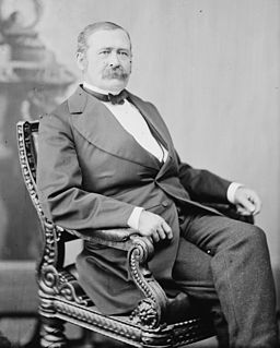
John Milton Thayer was a general in the Union Army during the American Civil War and a postbellum United States Senator from Nebraska. Thayer served as Governor of Wyoming Territory and Governor of Nebraska.
Significant events in the history of Omaha, Nebraska, include social, political, cultural, and economic activities.

Salt Creek is a tributary of the Platte River, located in Saunders, Cass, and Lancaster counties in southeast Nebraska. It is approximately 44.38 miles (71.42 km) in length. Salt Creek begins in southern Lancaster county and flows north to connect to the Platte River at Mahoney State Park in Ashland.
This timeline of South Dakota is a list of events in the history of South Dakota by year.

