
Christopher Houston Carson was an American frontiersman. He was a fur trapper, wilderness guide, Indian agent and U.S. Army officer. He became a frontier legend in his own lifetime through biographies and news articles; exaggerated versions of his exploits were the subject of dime novels. His understated nature belied confirmed reports of his fearlessness, combat skills, tenacity, as well as profound effect on the westward expansion of the United States. Although he was famous for much of his life, historians in later years have written that Kit Carson did not like, want, or even fully understand the fame that he experienced during his life.
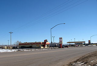
Chinle is a census-designated place (CDP) in Apache County, Arizona, United States. The name in Navajo means 'flowing out' and is a reference to the location where the water flows out of the Canyon de Chelly. The population was 4,518 at the 2010 census.
Fort Defiance is a census-designated place (CDP) in Apache County, Arizona, United States. It is also located within the Navajo Nation. The population was 3,624 at the 2010 census.

Ganado is a chapter of the Navajo Nation and census-designated place (CDP) in Apache County, Arizona, United States. The population was 883 at the 2020 census, reduced from 1,210 at the 2010 census.

Four Corners is a region of the Southwestern United States consisting of the southwestern corner of Colorado, southeastern corner of Utah, northeastern corner of Arizona, and northwestern corner of New Mexico. Most of the Four Corners region belongs to semi-autonomous Native American nations, the largest of which is the Navajo Nation, followed by Hopi, Ute, and Zuni tribal reserves and nations. The Four Corners region is part of a larger region known as the Colorado Plateau and is mostly rural, rugged, and arid.

The Long Walk of the Navajo, also called the Long Walk to Bosque Redondo, was the deportation and ethnic cleansing of the Navajo people by the United States federal government and the United States army. Navajos were forced to walk from their land in western New Mexico Territory to Bosque Redondo in eastern New Mexico. Some 53 different forced marches occurred between August 1864 and the end of 1866. In total, 10,000 Navajos and 500 Mescalero Apache were forced to the internment camp in Bosque Redondo. During the forced march and internment, up to 3,500 people died from starvation and disease over a four-year period. In 1868, the Navajo were allowed to return to their ancestral homeland following the Treaty of Bosque Redondo. Some anthropologists state that the "collective trauma of the Long Walk ... is critical to contemporary Navajos' sense of identity as a people".
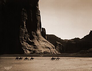
Canyon de Chelly National Monument was established on April 1, 1931, as a unit of the National Park Service. Located in northeastern Arizona, it is within the boundaries of the Navajo Nation and lies in the Four Corners region. Reflecting one of the longest continuously inhabited landscapes of North America, it preserves ruins of the indigenous tribes that lived in the area, from the Ancestral Puebloans to the Navajo. The monument covers 83,840 acres and encompasses the floors and rims of the three major canyons: de Chelly, del Muerto, and Monument. These canyons were cut by streams with headwaters in the Chuska Mountains just to the east of the monument. None of the land is federally owned. Canyon de Chelly is one of the most visited national monuments in the United States.

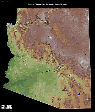
Northern Arizona is an unofficial, colloquially defined region of the U.S. state of Arizona. Generally consisting of Apache, Coconino, Mohave, Navajo, and Yavapai counties, the region is geographically dominated by the Colorado Plateau, the southern border of which in Arizona is called the Mogollon Rim.
The term Navajo Wars covers at least three distinct periods of conflict in the American West: the Navajo against the Spanish ; the Navajo against the Mexican government ; and the Navajo against the United States. These conflicts ranged from small-scale raiding to large expeditions mounted by governments into territory controlled by the Navajo. The Navajo Wars also encompass the widespread raiding that took place throughout the period; the Navajo raided other tribes and nearby settlements, who in return raided into Navajo territory, creating a cycle of raiding that perpetuated the conflict.
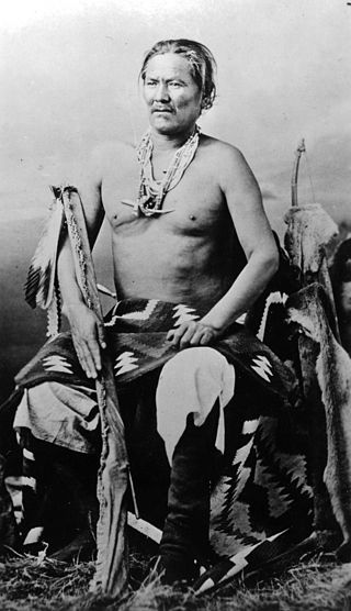
Chief Manuelito or Hastiin Chʼil Haajiní was one of the principal headmen of the Diné people before, during and after the Long Walk Period. Manuelito is the diminutive form of the name Manuel, the Iberian variant of the name Immanuel; Manuelito translates to Little Immanuel. He was born to the Bit'ahnii or ″Folded Arms People Clan″, near the Bears Ears in southeastern Utah about 1818. As many Navajo, he was known by different names depending upon context. He was Ashkii Diyinii, Dahaana Baadaané, Hastiin Ch'ilhaajinii and as Nabááh Jiłtʼaa to other Diné, and non-Navajo nicknamed him "Bullet Hole".
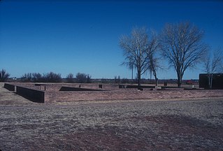
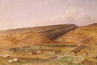
Fort Sumner was a military fort in New Mexico Territory charged with the internment of Navajo and Mescalero Apache populations from 1863 to 1868 at nearby Bosque Redondo.

The Apache Scouts were part of the United States Army Indian Scouts. Most of their service was during the Apache Wars, between 1849 and 1886, though the last scout retired in 1947. The Apache scouts were the eyes and ears of the United States military and sometimes the cultural translators for the various Apache bands and the Americans. Apache scouts also served in the Navajo War, the Yavapai War, the Mexican Border War and they saw stateside duty during World War II. There has been a great deal written about Apache scouts, both as part of United States Army reports from the field and more colorful accounts written after the events by non-Apaches in newspapers and books. Men such as Al Sieber and Tom Horn were sometimes the commanding officers of small groups of Apache Scouts. As was the custom in the United States military, scouts were generally enlisted with Anglo nicknames or single names. Many Apache Scouts received citations for bravery.

Barboncito or Hastiin Dághaaʼ was a Navajo political and spiritual leader.

The Shape Shifter is a crime novel by American writer Tony Hillerman, the eighteenth in the Joe Leaphorn/Jim Chee Navajo Tribal Police series, first published in 2006. It was a New York Times best-seller and the last Chee/Leaphorn novel by Hillerman published before Hillerman's death on October 26, 2008.

The Battle of Pecos River was fought in 1864 during the Navajo Wars. United States Army troops and Apache Scouts defeated a force of Navajo warriors next to the Pecos River in New Mexico. It is notable for being one of the many Indian war battles involving the California Column.
The Skirmish in Doubtful Canyon took place on May 3, 1864, between a company of infantry from the California Column and a band of about 100 Apaches. The fighting occurred near Steins Peak in Doubtful Canyon, Arizona Territory. Doubtful Canyon, along with Apache Pass and Cookes Canyon, was a favored location for an ambush by the Apache along the Butterfield Overland Mail route.
The Defiance Plateau, part of the geologic Defiance Uplift, is an approximately 75-mile (121 km) long, mostly north-trending plateau of Apache County, Arizona, with its east and southeast perimeter, as parts of San Juan and McKinley Counties, New Mexico.

Chinle Creek is a tributary stream of the San Juan River in Apache County, Arizona and San Juan County, Utah. Its source is at 36°53′40″N109°44′37″W, the confluence of Laguña Creek and the Chinle Wash arroyo. Its name is derived from the Navajo word ch'inili meaning 'where the waters came out. Its sources is in Canyon de Chelly National Monument where Canyon de Chelly and Canyon del Muerto have their confluence at an elevation of 5,616 feet at 36°08′35″N109°29′17″W. It then trends northwest to its confluence with Laguña Creek where it forms Chinle Creek, 7 miles northeast of Dennehotso, Arizona at an elevation of 4,774 feet.

The Navajo Nation Museum is a museum and library on Navajo ground in Window Rock, Arizona. Its collections, exhibits, and other activities focus on the cultural history of the Navajo people. Its activities include traditional museum exhibits, a research library, and programs that help to revive and preserve the Navajo language.
How the West was Lost is a 1993 television documentary miniseries about the westward expansion across the North American continent during the latter half of the 19th Century from the point of view of the Native American peoples. The episodes used "more than 1,200 rare archival photographs, creating images that enhance the first-hand and personal tales of family and tribal history." It was directed by Chris Wheeler and Sonny Hutchison and narrated by Peter Thomas. It was produced by KUSA-TV for the Discovery Channel. The series won the Cable ACE award for "Educational Special or Series" in 1994.

