Bradley County is located in southeastern Arkansas, and is bordered by Union County to the southwest, Calhoun County to the west, Drew County to the east, Ashley County to the southeast, and Cleveland County to the north. The county is home to the Bradley County Pink Tomato Festival, which is an annual event held in June that celebrates the county's tomato industry and features a variety of activities such as a parade, live music, food vendors, and arts and crafts exhibits. The county is next to Drew County which is home to the University of Arkansas at Monticello, a public university located in Monticello, Arkansas. As of the 2020 census, the population was 10,545. The county seat is Warren. It is Arkansas's 43rd county, formed on December 18, 1840, and is named for Captain Hugh Bradley, who fought in the War of 1812.

Ouachita Parish is located in the northern part of the U.S. state of Louisiana. As of the 2020 census, the population was 160,368. The parish seat is Monroe. The parish was formed in 1807.

Concordia Parish borders the Mississippi River in eastern central Louisiana. As of the 2020 census, the population was 18,687. The parish seat is Vidalia. The parish was formed in 1807.

Natchez is the only city in and the county seat of Adams County, Mississippi, United States. It has a total population of 14,520. Located on the Mississippi River across from Vidalia in Concordia Parish, Louisiana, Natchez was a prominent city in the antebellum years, a center of cotton planters and Mississippi River trade.

The Natchez Trace, also known as the Old Natchez Trace, is a historic forest trail within the United States which extends roughly 440 miles (710 km) from Nashville, Tennessee, to Natchez, Mississippi, linking the Cumberland, Tennessee, and Mississippi rivers.

The Pearl River is a river in the U.S. states of Mississippi and Louisiana. It forms in Neshoba County, Mississippi from the confluence of Nanih Waiya and Tallahaga creeks, and has a meander length of 444 miles (715 km). The lower part of the river forms part of the boundary between Mississippi and Louisiana.

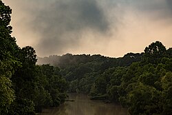
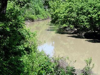
The Ouachita River is a 605-mile-long (974 km) river that runs south and east through the U.S. states of Arkansas and Louisiana, joining the Tensas River to form the Black River near Jonesville, Louisiana. It is the 25th-longest river in the United States.

The Natchez Trace Parkway is a national parkway in the southeastern United States that commemorates the historic Natchez Trace and preserves sections of that original trail. Its central feature is a two-lane road that extends 444 miles (715 km) from Natchez, Mississippi, to Nashville, Tennessee. Access to the parkway is limited, with more than fifty access points in the states of Mississippi, Alabama, and Tennessee. The southern end of the route is in Natchez at its intersection with Liberty Road, and the northern end is northeast of Fairview, Tennessee, in the suburban community of Pasquo, at an intersection with Tennessee State Route 100. In addition to Natchez and Nashville, larger cities along the route include Jackson and Tupelo, Mississippi, and Florence, Alabama.
The Natchez District was one of two areas established in the Kingdom of Great Britain's West Florida colony during the 1770s – the other being the Tombigbee District. The first Anglo settlers in the district came primarily from other parts of British America. The district was recognized to be the area east of the Mississippi River from Bayou Sara in the south and Bayou Pierre in the north.

The Natchez are a Native American people who originally lived in the Natchez Bluffs area in the Lower Mississippi Valley, near the present-day city of Natchez, Mississippi in the United States. They spoke a language with no known close relatives, although it may be very distantly related to the Muskogean languages of the Creek Confederacy. An early American geographer noted in his 1797 gazetteer that they were also known as the "Sun Set Indians".

The Tensas River is a river in Louisiana in the United States. The river, known as Tensas Bayou in its upper reaches, begins in East Carroll Parish in the northeast corner of the state and runs roughly southwest for 177 miles (285 km) more or less in parallel with the Mississippi River. The Tensas River merges with the Ouachita River in Jonesville in Catahoula Parish to become the Black River, not to be confused with Black Lake in Natchitoches Parish in north central Louisiana.

The Atchafalaya Basin, or Atchafalaya Swamp, is the largest wetland and swamp in the United States. Located in south central Louisiana, it is a combination of wetlands and river delta area where the Atchafalaya River and the Gulf of Mexico converge. The river stretches from near Simmesport in the north through parts of eight parishes to the Morgan City southern area.
Bayou Macon is a bayou in Arkansas and Louisiana. It begins in Desha County, Arkansas, and flows south, between the Boeuf River to its west and the Mississippi River to its east, before joining Joe's Bayou south of Delhi in Richland Parish, Louisiana. Bayou Macon is about 218 miles (351 km) long.
Black Bayou is a 66.6-mile-long (107.2 km) river in Texas and Louisiana. It is a tributary of Twelvemile Bayou, which feeds Cross Bayou and consequently the Red River and the Mississippi River. It rises in Cass County, Texas, 7 miles (11 km) north of Atlanta, and flows south past Atlanta, then southeast into Caddo Parish, Louisiana. It continues southeast until reaching the Red River floodplain, then curves south and southwest to its confluence with the outlet of Caddo Lake, where Twelvemile Bayou is formed.

Cross Bayou is a 38.0-mile-long (61.2 km) river in Texas and Louisiana. It is a tributary of the Red River, part of the Mississippi River watershed.
Loggy Bayou is a 17.3-mile-long (27.8 km) stream in northwestern Louisiana which connects Lake Bistineau with the Red River. Bistineau is the reservoir of Dorcheat Bayou, which flows 115 miles (185 km) southward from Nevada County, Arkansas, into Webster Parish. Loggy Bayou flows through south Bossier Parish, west of Ringgold, in a southerly direction through Bienville Parish, and into Red River Parish, where north of Coushatta it joins the Red River, a tributary of the Mississippi. At East Point, LA, the river has a mean annual discharge of 1,960 cubic feet per second.

U.S. Highway 65 (US 65) is a part of the United States Numbered Highway System that spans 966 miles (1,555 km) from Clayton, Louisiana to Albert Lea, Minnesota. Within the state of Louisiana, the highway travels 100.77 miles (162.17 km) from the national southern terminus at US 425/LA 15 in Clayton to the Arkansas state line north of Lake Providence.

Louisiana Highway 66 (LA 66) is a state highway located in southeastern Louisiana. It runs 19.62 miles (31.58 km) in a general east–west direction from the main entrance of the Louisiana State Penitentiary at Angola to a junction with U.S. Highway 61 (US 61) north of St. Francisville.
Atchafalaya is a ghost town that was located in St. Martin Parish, approximately 6 miles north of Butte La Rose, Louisiana, United States and just north of I-10 on the Atchafalaya River. The site of the town itself is located at coordinates 30°20'40.9"N 91°43'26.8"W, and is abandoned. United States Geological Survey maps from 1935 show the town to be located on the east bank of the Atchafalaya River at the Southern Pacific Railroad crossing, which was built in 1908. After the bridge was damaged due to the Great Mississippi Flood of 1927, the railroad from Lafayette to Baton Rouge was abandoned a few years later. With no transportation in and out, the town population began to dwindle, with the last resident leaving in 1959. There is no visible trace of the town left today.