
Newton County is a county located near the northwestern corner of the U.S. state of Indiana. As of 2020, the population was 13,830. This county is part of Northwest Indiana as well as the Chicago metropolitan area. The county seat is Kentland. The county is divided into 10 townships which provide local services.

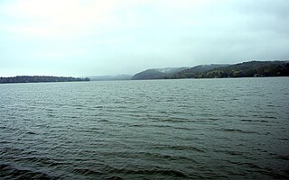
Lake County is a county located in the U.S. state of Indiana. In 2020, its population was 498,700, making it Indiana's second-most populous county. The county seat is Crown Point. The county is part of Northwest Indiana and the Chicago metropolitan area, and contains a mix of urban, suburban and rural areas. It is bordered on the north by Lake Michigan and contains a portion of the Indiana Dunes. It includes Marktown, Clayton Mark's planned worker community in East Chicago.

The Great Black Swamp was a glacially fed wetland in northwest Ohio and northeast Indiana, United States, that existed from the end of the Wisconsin glaciation until the late 19th century. Comprising extensive swamps and marshes, with some higher, drier ground interspersed, it occupied what was formerly the southwestern part of proglacial Lake Maumee, a Holocene precursor to Lake Erie. The area was about 25 miles (40 km) wide and 100 miles (160 km) long, covering an estimated 1,500 square miles (4,000 km2). Gradually drained and settled in the second half of the 19th century, it is now highly productive farmland. However, this development has been detrimental to the ecosystem as a result of agricultural runoff. This runoff, in turn, has contributed to frequent toxic algal blooms in Lake Erie.

The Kankakee River is a tributary of the Illinois River, approximately 133 miles (214 km) long, in the Central Corn Belt Plains of northwestern Indiana and northeastern Illinois in the United States. At one time, the river drained one of the largest wetlands in North America and furnished a significant portage between the Great Lakes and the Mississippi River. Significantly altered from its original channel, it flows through a primarily rural farming region of reclaimed cropland, south of Lake Michigan.
Lake Lemon is a reservoir located in southern Indiana approximately 10 miles (16 km) northeast of Bloomington, Indiana. It is bounded by private and public property in Monroe County and Brown County, with the eastern end of the lake in Brown County. The surface area of the lake is 1,650 acres (670 ha), making it the 11th largest lake in Indiana. There are 24 miles (39 km) of shoreline. The lake has an average depth of 9.7 feet (3.0 m) at full pool level. The greatest depth is somewhat in excess of 20 feet (6.1 m), matching with the original Bean Blossom Creek bed.

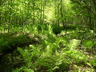
Cowles Bog is a 4,000-year-old wetland complex in Indiana Dunes National Park, near Chesterton, Indiana. It is named for Henry Chandler Cowles who did his pioneering work in ecology and ecological succession here. His work brought international attention to the area which led to efforts to preserve the Indiana Dunes. It was designated a National Natural Landmark in 1965. It contains bog, fen, marsh, wet meadow, swamp, and pond habitats.

The geography of Indiana comprises the physical features of the land and relative location of U.S. State of Indiana. Indiana is in the north-central United States and borders on Lake Michigan. Surrounding states are Michigan to the north and northeast, Illinois to the west, Kentucky to the south, and Ohio to the east. The entire southern boundary is the Ohio River.
The Iroquois County State Wildlife Area is an Illinois state park that occupies 2,480 acres (1,004 ha) in northeastern Iroquois County, near the border with Indiana. The nearest municipality is Beaverville, Illinois, and the nearest exit on a limited-access highway is Exit 302 on Interstate 57.
The Emiquon National Wildlife Refuge is a 11,122-acre (45.01 km2) wetland wildlife refuge located in Waterford Township in Fulton County, Illinois across the Illinois River from the town of Havana. Only 3,000 acres (12 km2) are currently managed by the U.S. Fish and Wildlife Service as part of the Illinois River National Wildlife and Fish Refuges Complex. It is in the Central forest-grasslands transition ecoregion.
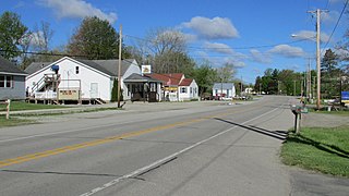
Fish Lake is an unincorporated community and census-designated place in Lincoln Township, LaPorte County, Indiana, United States. It is located where Indiana State Road 4 passes between Upper Fish Lake and Lower Fish Lake. These lakes feed the Kankakee River. As of the 2010 census, the population of the community was 1,016.

The Kankakee Outwash Plain is a flat plain interspersed with sand dunes in the Kankakee River valley in northwestern Indiana and northeastern Illinois of the United States. It is just south of the Valparaiso Moraine and was formed during the Wisconsin Glaciation. As the glacier stopped at the Valparaiso Moraine, its meltwater was carried away to the outwash plain. On the south side of the moraine, where the elevation drops, the meltwaters eroded away valleys, carrying sand and mud with them. As the muddy meltwater reached the valley where the slope lessened, the water slowed, depositing the sand on the outwash plain. This created a smooth, flat, and sandy plain. Before its draining, the Kankakee Marsh, located on the outwash plain, was one of the largest freshwater marshes in the United States.
A U.S. federal law, the Swamp Land Act of 1850, fully titled "An act to enable the State of Arkansas and other States to reclaim the swamp lands within their limits", essentially provided a mechanism for reverting title of federally-owned swampland to states which would agree to drain the land and turn it to productive, agricultural use. Primarily aimed at the development of Florida's Everglades, and transferring some 20 million acres of land in the Everglades to the State of Florida for this purpose, the law also had application outside Florida, and spurred drainage and development in many areas of the United States, including areas around Indiana's Kankakee River, Michigan's Lake St. Clair's shores, and elsewhere, and encouraged settlement by immigrants arriving in the United States after that time. Later considered to have been ecologically problematic, many of its provisions were in time reversed by the Clean Water Act of 1972 and later legislation, but its historical effects on U.S. development and settlement patterns remained.

Wapato Lake is a restored historic lake located in what became parts of Washington County and Yamhill County in the U.S. state of Oregon. The area was sometimes known as Wapato Lake Bed and Wapato Flat. The lake is located about a half mile east of Gaston at 55 metres (180 ft) elevation. The lake bed soils contain a layer of organic peat that once supported a wetland community dominated by the wapato plant, Sagittaria latifolia, particularly in the upper marsh areas. Wapato plants were reintroduced to the restored lake by tribal people from the Grand Ronde Reservation in preparation for the opening of the Wapato Lake National Wildlife Refuge in March 2023.
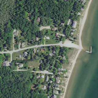
Whitefish Bay is an unincorporated community on the Lake Michigan shoreline in the town of Sevastopol, Door County, Wisconsin. Native Americans, likely the Menominee, called Whitefish Bay Ah-Quas-He-Ma-Ganing.
Chiwaukee Prairie is a 485-acre (1.96 km2) prairie in Pleasant Prairie, Wisconsin managed by the Wisconsin Department of Natural Resources. It is located on Lake Michigan at the Illinois state line and includes grassy wetlands, wooded areas, and the Kenosha Sand Dunes at its northern tip. It is home to an abundance of wildlife. It was designated a Wisconsin State Natural Area in 1967 and a National Natural Landmark in 1973.

The Lemuel Milk Carriage House or Stone Barn is a historic building in Kankakee, Illinois, United States. It is the last remnant of the estate of Lemuel Milk, who once owned over 25,000 acres (10,000 ha) of land.

Lemuel Milk (1820–1893) was an early settler to Eastern Illinois and, at one point, the largest landholder in the state. Born in New York, Milk came to Illinois after purchasing a large tract of land in Iroquois County. Milk came to own over 25,000 acres (10,000 ha) of land in Illinois, Indiana, and North Dakota. He also found success with a general store in Chebanse, Illinois and an ice harvesting company in Kankakee, Illinois. Milk is the namesake of Milks Grove Township, Iroquois County, Illinois.

Lake Kankakee formed 14,000 years before present (YBP) in the valley of the Kankakee River. It developed from the outwash of the Michigan Lobe, Saginaw Lobe, and the Huron-Erie Lobe of the Wisconsin glaciation. These three ice sheets formed a basin across Northwestern Indiana. It was a time when the glaciers were receding, but had stopped for a thousand years in these locations. The lake drained about 13,000 YBP, until reaching the level of the Momence Ledge. The outcropping of limestone created an artificial base level, holding water throughout the upper basin, creating the Grand Kankakee Marsh.
Scotch Corners Wetland is a provincially significant wetland complex located in Lanark County, Ontario, Canada. The 202 hectares area has a wide array of wetland types including swamps, marshes, vernal pools, beaver ponds and seepage areas. It forms the headwaters of several creeks that drain into Mississippi Lake.

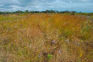
Kankakee Sands is a 10,000-acre (4,000 ha) restored tallgrass prairie in Kankakee County, Illinois and Newton County, Indiana. It is managed by The Nature Conservancy staff and volunteers. The Efroymson Restoration at Kankakee Sands is 8,400 acres (3,400 ha) of prairies and wetlands connecting Willow Slough Fish and Wildlife Area, Beaver Lake Nature Preserve, Conrad Savanna Nature Preserve and Conrad Station Savanna. This creates over 20,000 acres (8,100 ha) of dry, mesic and wet sand prairies, sand blows, sedge meadows, wetlands, and black oak savannas.
