Bedhampton

Last updated

Bedhampton
Old Bedhampton P1010023.JPG
An older style house in Old Bedhampton
Hampshire UK location map.svg
Red pog.svg
Bedhampton
Location within Hampshire
Population8,835 (2011.Ward) [1]
OS grid reference SU703067
District
Shire county
Region
Country England
Sovereign state United Kingdom
Post town Havant
Postcode district PO9
Police Hampshire and Isle of Wight
Fire Hampshire and Isle of Wight
Ambulance South Central
UK Parliament
List of places
UK
England
Hampshire
50°51′20″N1°00′08″W / 50.85545°N 1.00234°W / 50.85545; -1.00234

Bedhampton is a former village, and now suburb, located in the borough of Havant, Hampshire, England. [2] It is located at the northern end of Langstone Harbour and at the foot of the eastern end of Portsdown Hill.

Contents

Early mentions of Bedhampton are recorded in the ninth century, and the village was mentioned in the Domesday Book of 1086. [3]

Modern Bedhampton has a railway station, [4] with regular services to Portsmouth, Brighton, and London, and less frequent services to Southampton, Bristol, and South Wales. The A27 and the A3(M) pass through the south-west part of Bedhampton. There is a community centre in Bedhampton village which has two coffee mornings per week to address potential community isolation.

Housing

Municipal Housing, some now privately owned Municipal HousinG P1010006.JPG
Municipal Housing, some now privately owned

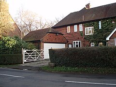
Bedhampton has a mixture of older houses, many (but not all) in what is known as Old Bedhampton; [5] post-war municipal housing at Stockheath; [6] built in the late 50s and 60s at the southern end of the Leigh Park estate, a significant proportion of which is now privately owned; [7] and a range of private housing, largely semi-detached. [8]

Schools

The Old School 1868-1985 Old Bedhampton SchoolP1010001.JPG
The Old School 1868–1985

The first school in Bedhampton was built on the corner of Bedhampton Road and King's Croft Lane. Miss Dust was the original mistress, serving at the school until 1876. The first page in her log book notes that she had to "reprove a boy for fighting". [9] Scrutiny of the logbook suggests that Miss Dust was frequently visited by the squire, Mr Stone, and the rector, Rev Daubiney.

The next occupant of the school house, Mrs Dugdale, was to forge an association with the school which would last 46 years (Smith 1968). Mrs Dugdale (until 1902) and her daughter, Miss Dugdale [10] (until 1922) were the first two in a long line of long serving head teachers, continued by Mrs Smith (1948 until 1975), Mrs Carrick (1975–94), Mrs Rowley (1994–2007) Mrs Jones (2007–2019) and now Miss Townshend. [11]

After World War Two, school places were at a premium and extra places were created by turning the former HMS Daedalus III Naval Camp into Stockheath Primary School. [12] Stockheath Naval Camp was two miles north where Great Copse Drive is now.

In 1974 Hampshire County Council decided to split the primary intake, and a new school for the older children was built on land immediately south of Hooks Lane Recreation Ground, and named Bidbury Middle School. A long campaign began to move the newly created Bedhampton First School to the new site too. This eventually happened in February 1985 when Bedhampton and Stockheath First schools amalgamated to become Bidbury First School, renamed Bidbury Infant School in 1994.

Just across the recreation ground is a Roman Catholic Primary School, St Thomas More's. [13]

Parks

Hooks Lane Hooks Lane P1010010.JPG
Hooks Lane

The Hermitage Stream Walk runs to the north of the parish, from New Road in the east to Purbrook Way in the west. Havant Borough Council have prioritised the environmental well-being of the habitat, and erected signs and information panels to highlight its importance. In the centre of Bedhampton is a large open space bounded by Hooks Lane, part of which is home to Havant RFC.

Bidbury Mead BIDBURY MEAD P1010014.JPG
Bidbury Mead

To the south of Bedhampton Road is Bidbury Mead, a large tree-ringed recreation ground – home to Bedhampton Mariners Cricket Club and Bedhampton Bowling Club. The locality borders onto Old Bedhampton, the area around St Thomas the Apostle parish church. The fourth, and least known, [14] space in Bedhampton is Scratchface Recreation Ground, situated to the west of the village within the parish boundary.

Churches

Parish Church of St Thomas The Apostle St Thomas P1010008.JPG
Parish Church of St Thomas The Apostle

Some include St Joseph’s R.C. Church here (because of its proximity to Bedhampton railway station) but most do not. [15]

There has been a church in Bedhampton since 1086. [16] The present parish church, St Thomas The Apostle, [17] situated in Old Bedhampton, dates from the 12th century. [18] In 1953 a church centre was built, and dedicated to St Nicholas. There are also a Methodist church, a modern building in Hulbert Road replacing an earlier primitive chapel by the station, and a Gospel Hall, built between 1901 and 1922 with funds provided by local benefactor Miss Meiklam. [19]

History

Botanist Lady Anne Brewis has commented on the different kinds of trees and flowers in the area. [20] The author of Jane's Fighting Ships, Fred T. Jane, lived in Bedhampton and founded the first Bedhampton Scout troop. [21]

In 1931 the civil parish had a population of 1411. [22] On 1 April 1932 the parish was abolished and merged with Havant and Rowlands Castle. [23] It is now in the unparished area of Havant and Waterloo.

Related Research Articles

<span class="mw-page-title-main">Emsworth</span> Human settlement in England

Emsworth is a town in the Borough of Havant in the county of Hampshire, on the south coast of England near the border with West Sussex. It lies at the north end of an arm of Chichester Harbour, a large and shallow inlet from the English Channel, and is equidistant between Portsmouth and Chichester.

<span class="mw-page-title-main">Waterlooville</span> Human settlement in England

Waterlooville is a town in the Borough of Havant in Hampshire, England, approximately 6 miles (9.7 km) north northeast of Portsmouth. It is the largest town in the borough. The town had a population of 64,350 in the 2011 Census. It is surrounded by Purbrook, Blendworth, Cowplain, Lovedean, Clanfield, Catherington, Crookhorn, Denmead, Hambledon, Horndean and Widley. It forms part of the South Hampshire conurbation. The town formed around the old A3 London to Portsmouth road.

<span class="mw-page-title-main">Chessington</span> Human settlement in England

Chessington is an area in the Royal Borough of Kingston upon Thames within Greater London. Historically part of Surrey, today it is the largest salient of Greater London into that county. At the 2011 census it had a population of 18,973. The Bonesgate Stream, a tributary of the Hogsmill River, runs through it. The popular theme park resort Chessington World of Adventures, which incorporates Chessington Zoo, is located in the south-west of the area.

<span class="mw-page-title-main">Havant</span> Human settlement in England

Havant is a town in the south-east corner of Hampshire, England between Portsmouth and Chichester. Its borough comprises the town (45,826) and its suburbs including the resort of Hayling Island as well as Rowland's Castle, the larger town of Waterlooville and Langstone Harbour. Housing and population more than doubled in the 20 years following World War II, a period of major conversion of land from agriculture and woodland to housing across the region following the incendiary bombing of Portsmouth and the Blitz.

<span class="mw-page-title-main">Portchester</span> Village in England

Portchester is a village in the borough of Fareham in Hampshire, England. It is 4 miles (6.4 km) northwest of Portsmouth and around 18 miles east of Southampton on the A27 road. Its population according to the 2011 United Kingdom census was 17,789.

<span class="mw-page-title-main">Totton and Eling</span> Human settlement in England

Totton and Eling is a civil parish in Hampshire, England, with a population of about 28,100 people. It contains the town of Totton and is situated between the eastern edge of the New Forest and the River Test, close to the city of Southampton but outside the city boundary; the town is within the New Forest non-metropolitan district. Surrounding towns and villages include Ashurst, Marchwood, Cadnam and Ower.

<span class="mw-page-title-main">Leigh Park</span> Post World War II housing estate in the suburbs of Havant, Hampshire, England

Leigh Park is a large suburb of Havant, in Hampshire, England. It currently forms the bulk or whole of four electoral wards: Battins, Bondfields, Barncroft and Warren Park.

<span class="mw-page-title-main">North Waltham</span> Human settlement in England

North Waltham is a village and civil parish in the borough of Basingstoke and Deane in Hampshire, England. It is located around 6 miles (9.7 km) southwest of Basingstoke and just north of the M3 motorway. In the 2011 Census it had a population of 870. The village is home to a pond, shop, Victorian primary school, a recreation ground and two pubs: The Fox, and The Wheatsheaf. The Church of England Parish Church is dedicated to St Michael.

<span class="mw-page-title-main">Chandler's Ford</span> Human settlement in England

Chandler's Ford is a largely residential area and civil parish in the Borough of Eastleigh in Hampshire, England. It has a population of 21,436 in the 2011 Census.

<span class="mw-page-title-main">Worcester Park</span> Suburb of Greater London, England

Worcester Park is a suburban town in South West London, England. It lies in the London boroughs of Sutton and Kingston, and partly in the Surrey borough of Epsom and Ewell. The area is 10 miles (16 km) southwest of Charing Cross. The suburb's population was 16,031 at the time of the 2001 census. The suburb comprises the Worcester Park ward, an electoral area of the London Borough of Sutton with a population in 2011 of 11,655, as well as the Cuddington ward, an electoral area of Epsom and Ewell, which had a population of 5,791 at the time of the 2001 census.

<span class="mw-page-title-main">Goldsworth Park</span> Human settlement in England

Goldsworth Park is a large housing estate to the north-west of Woking in Surrey, England. It was named after the nearby Goldsworth area which was a large 'tithing' of Woking Parish. The tithing included most of the north west of Woking, such as Brookwood, Knaphill and St. John's. It is bordered by villages such as St. John's, Knaphill and Horsell.

<span class="mw-page-title-main">Hockley Heath</span> Human settlement in England

Hockley Heath is a large village and civil parish in the Arden area mostly within the Metropolitan Borough of Solihull, West Midlands, England. It incorporates the hamlet of Nuthurst, and has a history dating back to the year 705 AD as a wood owned by Worcester Cathedral. The parish, known as Nuthurst cum Hockley Heath, is to the south of the West Midlands conurbation, 12 miles (19 km) southeast of Birmingham 5.5 miles (8.9 km) from Solihull town centre and 13 miles (21 km) north of Stratford-upon-Avon. The village forms part of the border with Warwickshire and the District of Stratford-on-Avon to the south, with some parts of the village on either side of the border. According to the 2001 census, the parish had a population of 6,771, being measured at the 2011 Census as 2,038.

<span class="mw-page-title-main">West End, Hampshire</span> Human settlement in England

West End is a parish in Hampshire in the borough of Eastleigh, five miles (8.0 km) east of the city of Southampton. The village of West End is small and generally classed as an area in the outer suburbs or rural urban fringe of the borough of Eastleigh because of the surrounding woodland and countryside, including Telegraph Woods and Itchen Valley Country Park.

<span class="mw-page-title-main">Millbrook, Southampton</span> Human settlement in England

Millbrook is a suburb and former civil parish of Southampton, in the ceremonial county of Hampshire, England. As the area developed, several settlements grew within the parish, some of them becoming parishes in their own right, thus reducing the extent of the Millbrook parish. As well as the Millbrook of today, the original Millbrook parish included Freemantle, Regents Park, and Redbridge. Some of these areas are still referred to as being part of Millbrook. The brook that Millbrook was named after is now known as Tanner's Brook.

<span class="mw-page-title-main">Farlington, Hampshire</span> Suburb of Portsmouth, England

Farlington is a primarily residential district of the city of Portsmouth in the ceremonial county of Hampshire, England. It is located in the extreme north east of the city on the mainland and is not on Portsea Island unlike most of the other areas of Portsmouth. Farlington was incorporated into the city in 1932 and now forms a continuous development with Cosham and Drayton. To the north of Farlington is the suburb of Widley and to the east is the town of Havant. To the west is the suburb of Drayton, and to the south is Langstone Harbour.

<span class="mw-page-title-main">Warblington</span> Human settlement in England

Warblington is a suburb of Havant, in the county of Hampshire, England. Warblington used to be a civil parish, and before that was part of the Hundred of Bosmere.

<span class="mw-page-title-main">Borough of Havant</span> Borough and non-metropolitan district in England

The Borough of Havant is a local government district with borough status in Hampshire, England. Its council is based in Havant. Other towns and villages within the borough include Bedhampton, Cowplain, Emsworth, Hayling Island, Purbrook, Waterlooville and Widley. The borough covers much of the semi-urban area in the south east of Hampshire, between the city of Portsmouth and the West Sussex border.

Sheet is a village and civil parish in the East Hampshire district of Hampshire, England. It is 1.1 miles (1.8 km) northeast of Petersfield, just off the A3 road.

<span class="mw-page-title-main">Westfield, Woking, Surrey</span> Human settlement in England

Westfield is an area in Woking borough, Surrey. Westfield marks the southern boundary of Woking altering from English archetypal suburban homes in the north to semi-rural homes, smallholdings, small woodlands and fields in the south, where it abuts areas of London's Metropolitan Green Belt.

References

  1. "Havant Ward population 2001.accessdate=17 October 2015".
  2. Havant Borough Council > Leisure and Culture > Tourism and Travel > Tour the Borough > Havant Archived 13 June 2007 at the Wayback Machine
  3. A History of the Parish of Bedhampton: Burrows,D (1998)
  4. Ordnance Survey SU705 065
  5. The area from Kingscroft Lane to Mill Lane, around the parish church and up to Manor Farm
  6. The area from Hooks Lane Field northwards to The Hermitage Stream, bounded to the west by Tarrant gardens and to the east by New Road
  7. In the early 80s, the (Conservative) government of the day passed legislation enabling sitting tenants to buy their own home; after three years they were free to sell on the open market
  8. Such as the roads, built by Hilson Homes in 1961, clustered around the Bowood Sewer
  9. Original still held at Bidbury Infant School.
  10. November 2006 Parish Magazine
  11. SChool web-site
  12. For photographs of these buildings, see Hind R.W. (2003)
  13. "Home". bidbury-inf.hants.sch.uk.
  14. Borough Council Open Spaces Overview
  15. Houseley,C A History of the Catholic Church in Havant ( 2000, Havant, St Josephs Church) ISBN   0-9539352-0-5
  16. Historical Research
  17. Parish Web-Site
  18. Burrows,D A History of The Church of St Thomas The Apostle with St Nicholas Church Centre (1998, Bedhampton, St Thomas Parish)
  19. Palmer, A Hidden Bedhampton (2000, Bedhampton, Bedhampton Society) "Archived copy" (PDF). Archived from the original on 24 October 2007. Retrieved 23 January 2009.{{cite web}}: CS1 maint: archived copy as title (link) CS1 maint: bot: original URL status unknown (link)
  20. The Flora of Hampshire Anne Brewis et al. 1996. Harley Books. ISBN   0-946589-34-8.
  21. "The Centenary of Bedhampton Scouting" Neal,O Bedhampton, 1st Bedhampton Scout Troop, 2008
  22. "Population statistics Bedhampton AP/CP through time". A Vision of Britain through Time . Retrieved 23 April 2024.
  23. "Relationships and changes Bedhampton AP/CP through time". A Vision of Britain through Time. Retrieved 23 April 2024.

Bibliography

Commons-logo.svg Media related to Bedhampton at Wikimedia Commons