Behamberg

Last updated
Behamberg
Rom.kath. Pfarrkirche Behamberg.jpg
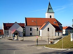
Catholic parish church
Behambergwappenweb.jpg
Coat of arms
Austria adm location map.svg
Red pog.svg
Behamberg
Location within Austria
Coordinates: 48°1′N14°28′E / 48.017°N 14.467°E / 48.017; 14.467 Coordinates: 48°1′N14°28′E / 48.017°N 14.467°E / 48.017; 14.467
Country Austria
State Lower Austria
District Amstetten
Government
   Mayor Karl Josef Stegh (ÖVP)
Area
[1]
  Total20.26 km2 (7.82 sq mi)
Elevation
524 m (1,719 ft)
Population
 (2018-01-01) [2]
  Total3,387
  Density170/km2 (430/sq mi)
Time zone UTC+1 (CET)
  Summer (DST) UTC+2 (CEST)
Postal code
4441
Area code +43 7252
Website www.behamberg.gv.at

Behamberg is a town in the district of Amstetten in Lower Austria in Austria.

Geography

Behamberg lies in the Mostviertel in Lower Austria.

Related Research Articles

Horn, Austria Place in Lower Austria, Austria

Horn is a small town in the Waldviertel in Lower Austria, Austria and the capital of the district of the same name.

Ardagger Place in Lower Austria, Austria

Ardagger is a town in the district of Amstetten in Lower Austria in Austria.

Haag, Austria Place in Lower Austria, Austria

Haag is a town in the district of Amstetten in Lower Austria in Austria. It is at the geographical centre of Europe.

Neustadtl an der Donau Place in Lower Austria, Austria

Neustadtl an der Donau is a town in the district of Amstetten in Lower Austria in Austria.

St. Valentin Place in Lower Austria, Austria

St. Valentin is the most westerly town in the district of Amstetten in Lower Austria in Austria.

Sankt Peter in der Au Place in Lower Austria, Austria

Sankt Peter in der Au is a town in the district of Amstetten in Lower Austria in Austria.

Winklarn, Austria Place in Lower Austria, Austria

Winklarn is a town in the district of Amstetten in Lower Austria in Austria.

Zeillern Place in Lower Austria, Austria

Zeillern is a town in the district of Amstetten in Lower Austria in Austria.

Enzesfeld-Lindabrunn Place in Lower Austria, Austria

Enzesfeld-Lindabrunn is a town in the district of Baden in Lower Austria in Austria.

Scharndorf Place in Lower Austria, Austria

Scharndorf is a town in the district of Bruck an der Leitha in Lower Austria in Austria.

Hohenruppersdorf Place in Lower Austria, Austria

Hohenruppersdorf is a town in the district of Gänserndorf in the Austrian state of Lower Austria.

Schönkirchen-Reyersdorf Place in Lower Austria, Austria

Schönkirchen-Reyersdorf is a town in the district of Gänserndorf in the Austrian state of Lower Austria.

Spannberg Place in Lower Austria, Austria

Spannberg is a town in the district of Gänserndorf in the Austrian state of Lower Austria.

Krummnußbaum Place in Lower Austria, Austria

Krummnußbaum is a town in the district of Melk in the Austrian state of Lower Austria.

Münichreith-Laimbach Place in Lower Austria, Austria

Münichreith-Laimbach is a town in the district of Melk in the Austrian state of Lower Austria.

Sankt Leonhard am Forst Place in Lower Austria, Austria

Sankt Leonhard am Forst is a town in the district of Melk in the Austrian state of Lower Austria.

Payerbach Place in Lower Austria, Austria

Payerbach is a town in the district of Neunkirchen in the Austrian state of Lower Austria.

Schwarzau im Gebirge village in Lower Austria, Austria

Schwarzau im Gebirge is a village in the district of Neunkirchen in the Austrian state of Lower Austria.

Eichgraben Place in Lower Austria, Austria

Eichgraben is a town in the district of Sankt Pölten-Land in the Austrian state of Lower Austria.

Ober-Grafendorf Place in Lower Austria, Austria

Ober-Grafendorf is a municipality in the district of Sankt Pölten-Land in the Austrian state of Lower Austria.

References

  1. "Dauersiedlungsraum der Gemeinden Politischen Bezirke und Bundesländer - Gebietsstand 1.1.2018". Statistics Austria. Retrieved 10 March 2019.
  2. "Einwohnerzahl 1.1.2018 nach Gemeinden mit Status, Gebietsstand 1.1.2018". Statistics Austria. Retrieved 9 March 2019.