
The Blackmore Vale is a vale, or wide valley, in north Dorset, and to a lesser extent south Somerset and southwest Wiltshire in southern England.
The Vale of White Horse is a local government district of Oxfordshire in England. It was historically part of Berkshire. The area is commonly referred to as the 'Vale of the White Horse'. It is crossed by the Ridgeway National Trail in its far south, across the North Wessex Downs AONB at the junction of four counties. The northern boundary is defined by the River Thames. The name refers to Uffington White Horse, a prehistoric hill figure.

The North Wessex Downs National Landscape is located in the English counties of Berkshire, Hampshire, Oxfordshire and Wiltshire. The name North Wessex Downs is not a traditional one, the area covered being better known by various overlapping local names, including the Berkshire Downs, the North Hampshire Downs, the White Horse Hills, the Lambourn Downs, the Marlborough Downs, the Vale of Pewsey and Savernake Forest.

Fontmell Magna is a village and civil parish in Dorset, England. It is situated in the Blackmore Vale, close to the chalk hills of Cranborne Chase, on the A350 road five miles south of Shaftesbury and eight miles north of Blandford Forum. In the 2011 census the parish had a population of 734.

Okeford Fitzpaine is a village and civil parish in the English county of Dorset, situated in the Blackmore Vale three miles south of the town of Sturminster Newton. It is sited on a thin strip of greensand under the scarp face of the Dorset Downs. In the 2011 census the civil parish—which includes the village of Belchalwell to the west and most of the hamlet of Fiddleford to the north—had 404 dwellings, 380 households and a population of 913.

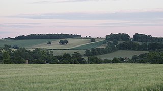
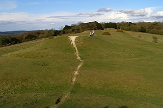
The Ringmoor settlement is an Iron Age/Romano-British farming settlement in Dorset, England. It is between the villages of Okeford Fitzpaine and Turnworth, and lies on east-facing slopes of Bell Hill, on the Dorset Downs.
Belchalwell is a small village and former civil parish, now in the parish of Okeford Fitzpaine in the Blackmore Vale, in the Dorset district, in the ceremonial county of Dorset, England. It lies 2+1⁄2 miles south of Sturminster Newton and 6 miles northwest of Blandford Forum. Belchalwell Street is sited on Upper Greensand, with Lower Belchalwell on the boundary of Gault and Kimmeridge Clay, both beneath the north slopes of Bell Hill, part of the Dorset Downs. In 1881 the parish had a population of 169. On 25 March 1885 the parish was abolished and merged with Okeford Fitzpaine and Fifehead Neville.
Lewesdon Hill is a hill in west Dorset, England. With a maximum elevation of 279 m (915 ft), it is the highest point in Dorset.

Chanctonbury Ring is a prehistoric hill fort atop Chanctonbury Hill on the South Downs, on the border of the civil parishes of Washington and Wiston in the English county of West Sussex. A ridgeway, now part of the South Downs Way, runs along the hill. It forms part of an ensemble of associated historical features created over a span of more than 2,000 years, including round barrows dating from the Bronze Age to the Saxon periods and dykes dating from the Iron Age and Roman periods.

The Hatterrall Ridge is a ridge in the Black Mountains forming the border between Powys and Monmouthshire in Wales and Herefordshire in England. The ridge is about 10 miles (16 km) long, and is followed by the Offa's Dyke Path. On the west side of the ridge is the Vale of Ewyas, and on the east side is the Olchon Valley and Black Hill. The western side of the ridge falls within the Brecon Beacons National Park. Much of the northern part of the ridge is a broad whaleback, but it narrows down considerably further south, and especially near to Llanthony Priory in the Vale of Ewyas to the west of the mountain. There is a large and prominent landslip on the eastern side of the mountain here, known as Black Darren, where a large slice of the rocks has fallen away from the main mass of the hill.

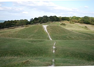
Bratton Castle is a bivallate Iron Age built hill fort on Bratton Down, at the western edge of the Salisbury Plain escarpment. The hill fort comprises two circuits of ditch and bank which together enclose a pentagonal area of 9.3 hectares.
The Devil's Humps are four Bronze Age barrows situated on Bow Hill on the South Downs near Stoughton, West Sussex. They are situated on a downland ridgeway crossed by an ancient trackway, above Kingley Vale. The Devil's Humps are counted among the most impressive round barrows surviving on the South Downs. The Devil's Humps are within the Kingley Vale National Nature Reserve. The two bell barrows together with two pond barrows and a cross dyke are listed as Scheduled Ancient Monument 1008371, while the two bowl barrows are listed as Scheduled Ancient Monument 1008372.

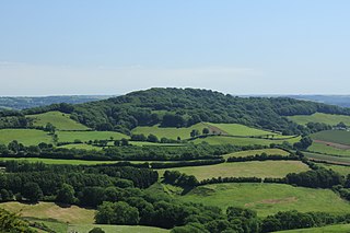
Breeze Hill is a prominent, largely treeless, rounded summit, 262 metres high, on the edge of Cranborne Chase about a mile east of the village of Melbury Abbas, Dorset.

At 251 metres, Ball Hill is one of the highest hills in the county of Dorset, England, and is on the Wessex Ridgeway.

The Dorsetshire Gap, also called the Dorset Gap, is an important, historic track junction - once the hub of central Dorset in southern England - and a well known beauty spot and magnet for ramblers. It is located on the northern slopes of Lyscombe Hill and not far from the village of Melcombe Bingham in the vicinity of grid reference ST743031. It is 13 km west-northwest of Bere Regis.

Payne's Down is a prominent hill, 211 metres (692 ft) high, some 10 kilometres east-northeast of Axminster and 1 kilometre northwest of Birdsmoorgate, in the county of Dorset in southern England. Its prominence of 62 metres (203 ft) means it is listed as one of the Tumps. It is located within the Dorset Downs.

The Stonehill Down Nature Reserve is a downland nature reserve on the Purbeck Hills in the county of Dorset, England. It is managed by the Dorset Wildlife Trust.

Mendip is a local government district of Somerset in England. The Mendip district covers a largely rural area of 285 square miles (738 km2) ranging from the Mendip Hills through on to the Somerset Levels. It has a population of approximately 110,000. The administrative centre of the district is Shepton Mallet but the largest town is Frome.
Bow Hill is an elongated hill ridge, 206 metres (676 ft) high, and running roughly from north to south in the South Downs, in the county of West Sussex, England. It has a prominence of 74 metres.


