Bellamy, Tennessee

Last updated

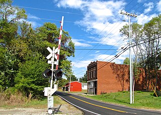
Bellamy is a ghost town in Montgomery County, in the U.S. state of Tennessee. [1]

Ghost town City depopulated of inhabitants and that stays practically intact

A ghost town is an abandoned village, town, or city, usually one that contains substantial visible remains. A town often becomes a ghost town because the economic activity that supported it has failed, or due to natural or human-caused disasters such as floods, prolonged droughts, government actions, uncontrolled lawlessness, war, pollution, or nuclear disasters. The term can sometimes refer to cities, towns, and neighbourhoods that are still populated, but significantly less so than in past years; for example, those affected by high levels of unemployment and dereliction.

Montgomery County, Tennessee U.S. county in Tennessee

Montgomery County is a county located in the U.S. state of Tennessee. As of the 2010 census, the population was 172,331. The county seat is Clarksville. The county was created in 1836.

U.S. state constituent political entity of the United States

In the United States, a state is a constituent political entity, of which there are currently 50. Bound together in a political union, each state holds governmental jurisdiction over a separate and defined geographic territory and shares its sovereignty with the federal government. Due to this shared sovereignty, Americans are citizens both of the federal republic and of the state in which they reside. State citizenship and residency are flexible, and no government approval is required to move between states, except for persons restricted by certain types of court orders.

History

A post office was established at Bellamy in 1891, and remained in operation until it was discontinued in 1908. [2] The name Bellamy was likely a family name of pioneer settlers. [3]

Related Research Articles

Lauderdale County, Alabama U.S. county in Alabama

Lauderdale County is a county located in the northwestern corner of the U.S. state of Alabama. As of the 2010 census the population was 92,709. Its county seat is Florence. Its name is in honor of Colonel James Lauderdale, of Tennessee.

Stewart County, Tennessee U.S. county in Tennessee

Stewart County is a county located in the U.S. state of Tennessee. As of the 2010 census, the population was 13,324. Its county seat is Dover.

Ashland City, Tennessee Town in Tennessee, United States

Ashland City is a town in and the county seat of Cheatham County, Tennessee, United States. The population was 4,541 as of the 2010 census.

New Johnsonville, Tennessee City in Tennessee, United States

New Johnsonville is a city in Humphreys County, Tennessee, United States. The population was 1,951 at the 2010 census.

Waverly, Tennessee City in Tennessee, United States

Waverly is a city in and the county seat of Humphreys County, Tennessee, United States. The population was 4,105 at the 2010 census.

Dandridge, Tennessee Town in Tennessee, United States

Dandridge is a town in Jefferson County, Tennessee, United States. It had a population of 2,812 at the 2010 census. It is the county seat of Jefferson County. The town is part of the Morristown, Tennessee Metropolitan Statistical Area.
Cedar Hill, Tennessee City in Tennessee, United States

Cedar Hill is a city in Robertson County, Tennessee, United States. The population was 314 at the 2010 census.

Martin, Tennessee City in Tennessee, United States

Martin is a city in Weakley County, Tennessee, United States. The population was 11,473 at the 2010 census. The city is the home of the University of Tennessee at Martin.

Fort Donelson National Battlefield National Battlefield in USA

Fort Donelson National Battlefield preserves Fort Donelson and Fort Heiman, two sites of the American Civil War Forts Henry and Donelson Campaign, in which Union Army Brigadier General Ulysses S. Grant and Flag Officer Andrew Hull Foote captured three Confederate forts and opened two rivers, the Tennessee River and the Cumberland River, to control by the Union Navy. The commanders received national recognition for their victories in February 1862, as they were the first major Union successes of the war. The capture of Fort Donelson and its garrison by the Union led to the capture of Tennessee's capital and industrial center, Nashville, which remained in Union hands from February 25, 1862 until the end of the war, and gave the Union effective control over much of Tennessee. This struck a major blow to the Confederacy early in the war.

Cumberland Furnace is an unincorporated community in Dickson County, Tennessee, United States. Cumberland Furnace is served by a U.S. Post Office, ZIP Code 37051.

Bellsburg is an unincorporated community in Dickson County, in the U.S. state of Tennessee. It lies along State Route 49.

White Oak Creek (Tennessee) river in United States of America

White Oak Creek is a 30.5-mile-long (49.1 km) tributary of the Tennessee River in Middle Tennessee in the United States. The area of the creek around the span of the Magnolia Bridge is a popular public park.

Southaven, Tennessee Neighborhood in Montgomery, Tennessee, United States

Southaven is an unincorporated community and neighborhood in Clarksville, Montgomery County, Tennessee, United States

Bear Spring is an unincorporated community in Stewart County, Tennessee, in the United States.

Shacklett is an unincorporated community in Cheatham County, in the U.S. state of Tennessee.

Whitfield is an unincorporated community in Hickman County, in the U.S. state of Tennessee.

Ardee is a ghost town in Stewart County, in the U.S. state of Tennessee.

Edgoten is an unincorporated community in Christian County, in the U.S. state of Kentucky.

Cheap Hill is an unincorporated community in Cheatham County, in the U.S. state of Tennessee.

References

  1. U.S. Geological Survey Geographic Names Information System: Bellamy, Tennessee
  2. "County". Jim Forte Postal History. Archived from the original on 24 February 2005. Retrieved 7 February 2015.
  3. Miller, Larry L. (2001). Tennessee Place-names. Indiana University Press. p. 16. ISBN   0-253-21478-5.

Coordinates: 36°29′16″N87°34′41″W / 36.48783°N 87.57807°W / 36.48783; -87.57807

Geographic coordinate system Coordinate system

A geographic coordinate system is a coordinate system that enables every location on Earth to be specified by a set of numbers, letters or symbols. The coordinates are often chosen such that one of the numbers represents a vertical position and two or three of the numbers represent a horizontal position; alternatively, a geographic position may be expressed in a combined three-dimensional Cartesian vector. A common choice of coordinates is latitude, longitude and elevation. To specify a location on a plane requires a map projection.