Related Research Articles
Bostwick is a town in Morgan County, Georgia, United States. As of the 2020 census, the city had a population of 378.
Clyde is an extinct town in Bryan County, in the U.S. state of Georgia.
Belvedere is an unincorporated community in Wayne Township, Jefferson County, Ohio, United States. It is located between Bloomingdale and Wintersville along U.S. Route 22 at its intersection with "Old U.S. Route 22", at 40°21′28″N80°45′54″W.

Okee is an unincorporated community located in the town of Lodi, in Columbia County, Wisconsin, United States.
Hoosier is an unincorporated hamlet in Antelope Park Rural Municipality No. 322, Saskatchewan, Canada. The hamlet is approximately 40 km north west of the Town of Kindersley at the intersection of Highway 317 and Highway 772. The Canadian Pacific Railway played a big role in the town's economy when it was completed in 1913, in the early years of Hoosier's history. Due to the closure of a branch line in 1981, the tracks from Dodsland to Hoosier were pulled and the last of the community's grain elevators was demolished, causing Hoosier's population to decline.
Easton is an unincorporated community in Wayne County, in the U.S. state of Ohio.
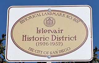
Islenair is a neighborhood and city-designated historic district in San Diego, California, often considered part of the larger City Heights neighborhood. The historic district is located along Euclid Ave., Belle Isle Dr., Isla Vista Dr., and Thorn St.
Hart is an unincorporated community in northwest McDonald County, in the U.S. state of Missouri. The community is located along Missouri Route 43, north of Tiff City and less than one-half mile east of the Missouri - Oklahoma border.
Worry is an unincorporated community in Burke County, in the U.S. state of North Carolina.
Eagleport is an unincorporated community in Morgan County, in the U.S. state of Ohio.
Leonardsburg is an unincorporated community in Delaware County, in the U.S. state of Ohio.
Tyler is an unincorporated community in Pemiscot County, located in the U.S. state of Missouri. The community is situated on County Road 570, approximately four miles east-southeast of Cooter. The Mississippi River is 1.5 miles to the east, while Cottonwood Point, situated on the bank of the Mississippi, is three miles to the northeast.
Rayborn is an unincorporated community in eastern Wright County, in the U.S. state of Missouri. Rayborn is located on Missouri Route 38, between Hartville and Graff. The intersection of Route 38 and Missouri Route 95 is approximately 2.5 miles to the east of the town.

Doctortown is a ghost town in Wayne County, Georgia. The GNIS classifies it as a populated place.
Birdford is an extinct town in Tattnall County, in the U.S. state of Georgia.
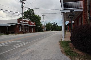
Bladen is an extinct town in Glynn, in the U.S. state of Georgia.
Aaron is an unincorporated community in Bulloch County, in the U.S. state of Georgia. It is located at an elevation of 266 feet.
Old Damascus is an unincorporated community in Early County, in the U.S. state of Georgia.
Mica is an unincorporated community in Cherokee County, in the U.S. state of Georgia.
Scarboro is an unincorporated community in Jenkins County, in the U.S. state of Georgia.
References
- ↑ "Post Offices". Jim Forte Postal History. Retrieved April 1, 2018.
- ↑ Krakow, Kenneth K. (1975). Georgia Place-Names: Their History and Origins (PDF). Macon, GA: Winship Press. p. 16. ISBN 0-915430-00-2.
Municipalities and communities of Glynn County, Georgia, United States | ||
|---|---|---|
| City | 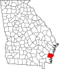 | |
| CDPs | ||
| Other unincorporated communities | ||
| Ghost towns | ||
31°21′28″N81°44′14″W / 31.35778°N 81.73722°W
| | This ghost town–related article is a stub. You can help Wikipedia by expanding it. |
| | This Glynn County, Georgia state location article is a stub. You can help Wikipedia by expanding it. |