
Balmoral Castle is a large estate house in Royal Deeside, Aberdeenshire, Scotland, owned by Queen Elizabeth II. It is near the village of Crathie, 9 miles west of Ballater and 50 miles west of Aberdeen.

The River Dee is a river in Aberdeenshire, Scotland. It rises in the Cairngorms and flows through southern Aberdeenshire to reach the North Sea at Aberdeen. The area it passes through is known as Deeside, or Royal Deeside in the region between Braemar and Banchory because Queen Victoria came for a visit there in 1848 and greatly enjoyed herself. She and her husband, Prince Albert, built Balmoral Castle there, replacing an older castle.
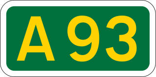
The A93 is a major road in Scotland and the highest public road in the United Kingdom. It runs north from Perth through Blairgowrie and Rattray, then through the Grampian Mountains by way of Glenshee, the Cairnwell Pass and Glen Clunie to Braemar in Aberdeenshire. At Braemar, the road then switches east down the strath of the River Dee before crossing the A90 and terminating in Aberdeen.

The Royal Deeside Railway was formed in 1996 by a group of volunteers with the intention of reclaiming part of the former branch line from Aberdeen to Ballater.

Aberdeenshire or the County of Aberdeen is a historic county and registration county of Scotland. The area of the county, excluding the city of Aberdeen itself, is also a lieutenancy area. The county borders Kincardineshire, Angus and Perthshire to the south, Inverness-shire and Banffshire to the west, and the North Sea to the north and east. It has a coast-line of 65 miles (105 km).

Kincardine and Mearns is one of six area committees of the Aberdeenshire council area in Scotland. It has a population of 38,506. There are significant natural features in this district including rivers, forests, mountains and bogs.
Maryculter or Kirkton of Maryculter is a village in the Lower Deeside area of Aberdeenshire, Scotland. The River Dee separates it from the town of Peterculter, and the B979 road runs through Maryculter. Maryculter House Hotel lies slightly north of the village along the south bank of the River Dee and to the west of Templars Park. The Old Mill Inn, a former coaching inn dating back to the 18th century lay at the mouth of the Crynoch Burn from 1797 until its demolition in February 2021 after being damaged by an extensive fire. At the edge of the village of Maryculter is a public forest land, known as the Oldman Wood, through which flows the Crynoch Burn. Also the children's theme park, StoryBook Glen, which also consists of a shop and restaurant is located near the old church which is still in use today as a Church of Scotland. Other notable vicinity buildings include the former Lairhillock Inn which closed in March 2020 and Muchalls Castle. Maryculter also has an animal sanctuary, Blaikiewell Animal Sanctuary.
Torphins is a village in Royal Deeside, Aberdeenshire, Scotland which lies about 22 miles (35 km) west of Aberdeen. It is situated on the A980, about 7 miles (11 km) north-west of Banchory, and was once served by the Great North of Scotland Railway.

The Deeside Way is a 41-mile (66 km) rail trail that follows, in part, the bed of the former Deeside Railway in Aberdeenshire. Forming part of the National Cycle Network the trail leads from Aberdeen to Ballater.

The Deeside Railway was a passenger and goods railway between Aberdeen and Ballater in Aberdeenshire, Scotland. Opening in 1853 to Banchory, an extension reached Aboyne in 1859. A separate company, the Aboyne & Braemar Railway, built an extension to Ballater and this opened in 1866. By 1855 there were five services a day over the 43+1⁄4-mile (69.6 km) long line, taking between 1 hour 50 minutes and 2+1⁄2 hours. The line was used by the Royal Train for travel to and from Balmoral Castle from 1853 and a special 'Messenger Train' ran daily when the Royal Family was in residence.

Lumphanan is a village in Aberdeenshire, Scotland located 25 miles (40 km) from Aberdeen and 10 miles (16 km) from Banchory.
Lower Deeside is a region along the River Dee in Aberdeenshire and Aberdeen in Scotland. The boundaries of this area are subject to interpretation, since the usage has altered through historic times; however, the area is generally associated with the communities of Durris, Maryculter and Banchory-Devenick in the historic district of Kincardineshire and the communities of Peterculter, Milltimber, Bieldside and Cults in Aberdeen.
Burn O'Vat is a pothole located close to Loch Kinord near the village of Dinnet in Aberdeenshire, Scotland.
Aboyne Academy is a secondary school in Aboyne, Aberdeenshire, Scotland. The school is located on the Western side of the village and serves many other villages in the surrounding area, including: Braemar, Ballater, Kincardine O'Neil and Tarland. The catchment primary schools for Aboyne Academy are Aboyne, Ballater, Braemar, Crathie, Finzean, Kincardine O’Neil, Logie Coldstone, Lumphanan, Tarland and Torphins. As of September 2015, the school had 665 pupils, making it one of the smallest secondary schools in Aberdeenshire. Aboyne Academy offer their students multiple extra curricular activities ranging widely from sports to music to other opportunities for them to develop their skills.

Corse Castle near Lumphanan in Aberdeenshire, now ruined, was a fortress and centre of a landed estate in the north-east of Scotland. The present castle dates from the 16th century and stands by the Corse Burn, around 3 miles north-west of Lumphanan.
Torphins railway station served the village of Torphins from 1859 to 1966 on the Deeside Railway that ran from Aberdeen (Joint) to Ballater.

Glassel railway station is a disused railway station in Britain. It served Glassel House, the Mill of Beltie and the local farms and the inhabitants of this rural area from 1859 to 1966 on the Deeside Railway that ran from Aberdeen (Joint) to Ballater.

The Denburn Valley Line was a connecting line constructed to connect the northern end of the Aberdeen Railway and Deeside Railway to the southern end of the Great North of Scotland Railway mainline.

The Hill of Fare is a small hill in Aberdeenshire, Scotland. It is located about 5 km northeast of the village of Torphins. The hill is long and ridge-shaped, and 470 metres tall. At the top of the hill are several small lochs, and the hill is the source of many small burns. As with many hills in this region, there is a cairn at the summit. The hill is likely the source of Torphins's name; it probably came from Torr Fionn, 'fair hill', referring to the Hill of Fare.
