Related Research Articles
The Lamoka Site, or simply Lamoka, is an archaeological site near Tyrone, in Schuyler County, New York that was named a National Historic Landmark in 1961. According to the National Park Service, "This site provided the first clear evidence of an Archaic hunting and gathering culture in the Northeastern United States ".
Walker Prehistoric Village Archeological Site is an archeological site located near Poolesville, Montgomery County, Maryland. The site is a large Late Woodland village located on Selden Island in the Potomac River. Excavations carried out in the 1930s and 1940s revealed a 40-foot section of a palisade, circular house patterns, shallow oval pits and cylindrical pits, and flexed burials interred in the floors of the houses.
Arundel Cove Archaeological Site is an archaeological site near Baltimore in Anne Arundel County, Maryland. It is situated on the south shore of Arundel Cove, a tributary of Curtis Creek which drains into the Patapsco River. The site was discovered during routine shovel test pitting of the U.S. Coast Guard Yard at Curtis Bay in 1981. The test pits revealed that the site is small in size, extending only 20 feet north-south by 15 feet east-west. It represents the remains of a prehistoric summer camp which apparently was not repeatedly occupied. It contains a prehistoric period storage pits, with evidence of the use of galium and wild black cherry.

Towosahgy State Historic Site (23MI2), also known as Beckwith's Fort Archeological Site, is a large Mississippian archaeological site with a Woodland period Baytown culture component located in Mississippi County, Missouri. It is believed to have been inhabited from c. 400-1350. The site is maintained by the Missouri Department of Natural Resources as a state historic site. The name Towosahgy is an Osage word which means "old town." It is not known if members of the historic Osage, who dominated a large area of present-day Missouri at the beginning of encounter with European colonizers, occupied the site. The site was acquired by the Missouri state park system in 1967 and added to the National Register of Historic Places in 1969 as NRIS number 69000113,

Cranberry Creek Archeological District, also known as Cranberry Creek Mound Group, is an ancient American Indian burial mound site from circa AD 100–800 near New Miner, Wisconsin, United States. It is three miles east of Necedah National Wildlife Refuge in Juneau County. It is part of the "effigy mound culture" of native peoples in Wisconsin, who practiced the "respectful burial of their dead".
The Schilling Archeological District is a prehistoric Native American archaeological site on private property on Lower Grey Cloud Island in Cottage Grove, Minnesota, United States. It consists of a habitation site and mound group with artifacts that date from the Early Woodland Period to the Late Prehistoric Period. It was listed on the National Register of Historic Places in 1978 for having state-level significance in the theme of archaeology. It was nominated for its rare Early Woodland component, Middle Mississippian cultural influences, and potential to show climatic adaptations over time.
The St. Croix River Access Site is a prehistoric Native American archaeological site on the St. Croix River in Stillwater Township, Minnesota, United States. It consists of a habitation site with a large quantity of stone tool artifacts, occupied from roughly 800 to 1700 CE. It was listed on the National Register of Historic Places in 1984 for having local significance in the theme of archaeology. It was nominated for its scientific potential to illuminate Late Woodland period cultural relationships, lithic technology, and resource use.
Indian Fish Trap State Preserve, also known as the Indian Fish Weir, is a historic site located near the Amana Colonies in rural Iowa County, Iowa. The fish weir is an array of rocks in a V-shaped formation in the Iowa River. It is the only structure of this kind in Iowa. It is not known when the fish weir was built, possibly in either the Late Prehistoric period or Early Historic period. Glacial boulders from a nearby bluff were probably used to construct it. Each wing of the dam is about 155 feet (47 m) in length. The fish were thought to be herded toward the vertex of the "V" where they would be easier to net or spear. They were then placed into an adjacent holding pool. Early pioneers discovered the weir, and it was included on a General Land Office map in the 1840s. Archaeologist Charles R. Keyes wrote about the weir in 1925.
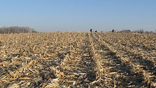
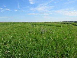
Big Sioux Prehistoric Prairie Procurement System Archaeological District is a discontiguous historic district of 30 sites located along 15 miles (24 km) of river terraces and blufftops in Lyon County, Iowa. The sites are both large and small in size and they "contain a representative sample of the best preserved elements of a hunting and gathering system" of the native peoples who inhabited the northwest Iowa plains from 10,000 to 200 years ago. They include late base camps, deeply-buried early Archaic camps, and procurement sites from all time periods in the Pre-Columbian era. The district was listed on the National Register of Historic Places in 1989.

The Glenwood Archeological District is a nationally recognized historic district and archaeological sites located in the vicinity of Glenwood, Iowa, United States. It is one of nine sites from the Nebraska Phase of the Woodland period recognized by archaeologists, and the only one located east of the Missouri River. The district is made up of earth lodge sites, mortuary sites and artifact scatters from the Glenwood culture. They date from sometime between 1250 and 1400 C.E.. The district was listed on the National Register of Historic Places in 2013.
Kimball Village is an archaeological site located in the vicinity of Westfield, Iowa, United States. It is one of six known Big Sioux phase villages from the Middle Missouri Tradition that existed between 1100-1250 C.E. The site, located on a terrace overlooking the Big Sioux River, has well-preserved features, including earth lodge and storage pits, and evidence of fortifaction. The site was listed on the National Register of Historic Places in 2010, and as a National Historic Landmark in 2016.

The Upper Hay Lake Archeological District is a prehistoric Native American archaeological site in Jenkins Township, Minnesota, United States. It consists of about 75 linear mounds—including one of the state's longest at 725 feet (221 m)—plus the sites of a village and a portage. The mound grouping has also been dubbed Fort Poualak. The site was listed on the National Register of Historic Places in 1978 for having local significance in the theme of archaeology. It was nominated for indicating an area of substantial activity during the Blackduck phase of the Late Woodland period.
The Sebre Lake Site is a prehistoric Native American archaeological site in Fort Ripley Township, Minnesota, United States. It has yielded habitation and burial features accumulated over 4,000 years of intermittent use from the mid-Archaic to the early Late Woodland period. The site was listed on the National Register of Historic Places in 1984 for having local significance in the theme of archaeology. It was nominated for being one of the richest archaeological sites in the Nokasippi River Valley.
The Spring Branch Butter Factory Site is an archaeological site located in the vicinity of Manchester, Iowa, United States. John Stewart built the first commercial creamery in the state of Iowa at this location in 1872. He won the gold medal for the best butter at the Centennial Exposition in Philadelphia in 1876. Because of this, he made technological and managerial changes to his operation that transformed commercial butter making in the state. Stewart became the founding president of the Northern Iowa Butter and Cheese Association, which was headquartered in Manchester. As markets on the East Coast expanded "creamery grade" butter was shipped regularly between northeast Iowa and New York City. By 1889, commercial creameries had taken the place of the farm-based dairy in Iowa. The site was listed on the National Register of Historic Places in 1974.
The Four Mounds Site is a historic site located in Dubuque, Iowa, United States. It is made up of a row of four conical burial mounds on a blufftop that overlooks the Mississippi River. They are prehistoric in their origin. The site was individually listed on the National Register of Historic Places in 2000. It was included as a contributing property in the Four Mounds Estate Historic District in 2002.
Fort Juelson, designated 21OT198 in the state archaeological inventory, is a historic site located east of Underwood, Minnesota, United States. An earthen fort was built at this hilltop in July 1876 after rumors of Indian attacks in Foxhome, French, and Fergus Falls following the Battle of Little Bighorn in Montana. Many settlers left the area. Charles A. Dollner, a local merchant, suggested the rest of the people band together and build the fortification under leadership of two American Civil War veterans, Hans Juelson and Berge O. Lee. The scare proved to be a hoax, and the fort was never used for defensive purposes. Remnants of the sod barricade are still on the site.
The Orwell Site, designated 21OT7 in the state archaeological inventory, is a historic site located near Fergus Falls, Minnesota, United States. It consists of twelve Middle or Late Woodland period burial mounds, four of which are enclosed by an earthwork. They were built from about A.D. 350–600. They share similarities with the mounds found at Fort Juelson, also in Otter Tail County, with their central burial chamber. The site was listed on the National Register of Historic Places in 1974.
The King Coulee Site is a prehistoric Native American archaeological site in Pepin Township, Minnesota, United States. It was listed on the National Register of Historic Places in 1994 for having state-level significance in the theme of archaeology. It was nominated for being a largely undisturbed occupation site with intact stratigraphy and numerous biofacts stretching from the late Archaic period to the Oneota period. This timeframe spans roughly from 3,500 to 500 years ago. The site yielded the oldest known evidence of domesticated plants in Minnesota: seeds dated to 2,500 years ago from the squash Cucurbita pepo.
Notbohm Mill Archaeological District, designated 13LN296 in the state archaeological inventory, is a nationally recognized historic district located west of Alburnett, Iowa, United States. It includes the remnants of the mill's foundation, the mill race, and the now-dry mill pond along the east branch of Otter Creek. This was both a grist mill and a sawmill operation. The mill began operating in the late 1860s. Frederick Notbohm began building the mill facility, which is the subject of this district, in 1875 near the now-defunct town of Lafayette. It continued to operate into the late 1930s and the mill itself continued to stand into the 1970s when it collapsed. The historic district was listed on the National Register of Historic Places in 2000.
21SL55 is a precontact Native American archaeological site in the Boundary Waters of northern Minnesota, United States. It was occupied by the Blackduck culture of the late Woodland period sometime between 700 and 1500 C.E. Located on a small island in what is now Voyageurs National Park, the site is known only by its Smithsonian trinomial. It contains well-preserved faunal remains, a possible ricing jig, and other subsurface features.
References
- ↑ Federal and state laws and practices restrict general public access to information regarding the specific location of this resource. In some cases, this is to protect archeological sites from vandalism, while in other cases it is restricted at the request of the owner. See: Knoerl, John; Miller, Diane; Shrimpton, Rebecca H. (1990), Guidelines for Restricting Information about Historic and Prehistoric Resources, National Register Bulletin, National Park Service, U.S. Department of the Interior, OCLC 20706997 .
- 1 2 "National Register Information System". National Register of Historic Places . National Park Service. March 13, 2009.
- ↑ Alex, Lynn M. (2000). Iowa's Archaeological Past. Iowa City: University of Iowa Press. pp. 94, 96, 113. ISBN 9781609380151.


| This article about a property in Woodbury County, Iowa on the National Register of Historic Places is a stub. You can help Wikipedia by expanding it. |