Shropshire is a ceremonial county in the West Midlands of England, on the Welsh border. It is bordered by Wrexham County Borough and Cheshire to the north, Staffordshire to the east, Worcestershire to the south-east, Herefordshire to the south and Powys to the west. The largest settlement is Telford, and Shrewsbury is the county town.

Church Stretton is a market town and civil parish in Shropshire, England, 13 miles (21 km) south of Shrewsbury and 15 miles (24 km) north of Ludlow. The population in 2011 was 4,671.

Dawley is a constituent town of Telford and a civil parish in the borough of Telford and Wrekin, Shropshire, England. It was originally, in 1963, going to be the main centre of the 'Dawley New Town' plan before it was decided in 1968 to name the new town as 'Telford', after the engineer and road-builder Thomas Telford. Dawley now forms part of Telford whose town centre is north of Dawley itself.

Broseley is a market town in Shropshire, England, with a population of 4,929 at the 2011 Census and an estimate of 5,022 in 2019. The River Severn flows to its north and east. The first iron bridge in the world was built in 1779 across the Severn, linking Broseley with Coalbrookdale and Madeley. This contributed to the early industrial development in the Ironbridge Gorge, which is now part of a World Heritage Site.

Wold Newton is a small Yorkshire Wolds village and civil parish in the East Riding of Yorkshire, England. It is situated approximately 9 miles (14 km) south of Scarborough and 9 miles (14 km) north-west of Bridlington. Wold Newton is located within the Great Wold Valley and the course of the Gypsey Race, a winterbourne chalk stream, passes through the south of the village. The village of Fordon is also part of the civil parish of Wold Newton. According to the 2011 UK census, Wold Newton parish had a population of 337, an increase on the 2001 UK census figure of 291.

Battlefield is a village and suburb of the town of Shrewsbury in Shropshire, England. It is 3 miles (5 km) north of the town centre. The village is today split between three civil parishes - Shrewsbury, Astley and Pimhill.

Benthall Hall is a 16th-century English country house in Benthall in the town of Broseley, Shropshire, England, and a few miles from the historic Ironbridge Gorge. It retains much of its fine oak interior, and an elaborate 17th-century staircase. It is still occupied by the Benthall family, but has been owned by the National Trust since 1958, and is open to the public every Monday, Tuesday, Wednesday, Saturday, Sunday and Bank Holiday Monday.

Barrow is a hamlet and civil parish in Shropshire, England, some 5 miles south of Telford between Ironbridge and Much Wenlock.

Jackfield is a village in the Telford and Wrekin borough of Shropshire, England, lying on the south bank of River Severn in the Ironbridge Gorge, downstream from Ironbridge. Like many of the settlements in the area, it is notable for its place in the Industrial Revolution.

Salopian Art Pottery was a range of decorative earthenwares made by the Benthall Pottery at Benthall, Shropshire, England, between c. 1880 and c. 1930. Pieces were marked with a variety of impressed and inscribed marks, the most frequent mark being 'SALOPIAN' in upper-case printers' type.

Thwing is a village and civil parish in the Yorkshire Wolds, in the East Riding of Yorkshire, England.

Leighton is a scattered settlement and civil parish in the unitary authority of Cheshire East and the ceremonial county of Cheshire, England, which lies immediately north west of Crewe. The parish also includes the village of Barrows Green, which lies on the northern outskirts of Crewe, 1½ miles from the centre. Nearby villages include Bradfield Green and Worleston. The total population of the civil parish was 4,883 at the 2011 Census.

Edgton is a small village and civil parish in Shropshire, England. It is also an ecclesiastical parish and a chapelry. It lies in a rather remote and very rural area, south of the River Onny. The nearest market towns are Bishop's Castle, Craven Arms, Clun and Church Stretton, while the larger village of Lydbury North lies a few miles to the west. It is located 4 miles west of Craven Arms and is positioned on the former stagecoach route from London to Bishop's Castle.

Willey is a small village in the civil parish of Barrow, south west of the town of Broseley, Shropshire, England. It is made up of about 4 farms and the majority of land is owned and leased by the Weld-Forester family of Willey Hall. Willey also sports a proud cricket team like many small villages around the United Kingdom.

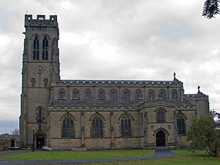
St Giles' Church is in the hamlet of Barrow, Shropshire, England. It is an active Anglican parish church in the deanery of Telford Severn Gorge, the archdeaconry of Ludlow, and the diocese of Hereford. Its benefice is united with those of All Saints, Broseley, St Mary, Jackfield, St Bartholomew, Benthall, and St Leonard, Linley. The church is recorded in the National Heritage List for England as a designated Grade I listed building. It is one of the earliest surviving churches in Shropshire, and contains the county's only Anglo-Saxon chancel.

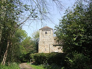
St Leonard's Church is in the hamlet of Linley, Shropshire, England. It is a redundant church under the care of the Churches Conservation Trust. When it was in active use, the church was an Anglican parish church in the deanery of Telford Severn Gorge, the archdeaconry of Ludlow, and the diocese of Hereford. Its benefice has been united with those of All Saints, Broseley, St Bartholomew, Benthall, St Giles, Barrow, and St Mary, Jackfield. The church is recorded in the National Heritage List for England as a designated Grade I listed building.

Maw & Co have made earthenware encaustic tiles for walls and floors since 1850, when the English company was established by George Maw and his brother Arthur. Their first factory was in Worcester and in 1862 the company moved to Broseley, Shropshire in the Ironbridge Gorge. In 1883 they moved to the Benthall Works in Jackfield, Shropshire. The new, purpose-built factory was the largest tile works in the world and the company was the world's largest producer of ceramic tiles, making more than 20 million pieces a year.
Barrow is a civil parish in Shropshire, England. It contains 28 listed buildings that are recorded in the National Heritage List for England. Of these, three are listed at Grade I, the highest of the three grades, three are at Grade II*, the middle grade, and the others are at Grade II, the lowest grade. The parish contains the settlements of Barrow, Willey, Benthall, and Linley, and is otherwise completely rural. Four of the listed buildings are churches, two of which are at Grade I, and two at Grade II*. The other Grade I listed building is a country house. The rest of the listed buildings include farmhouses and farm buildings, other houses and cottages, a row of almshouses, a bridge, a chest tomb in a churchyard, and a war memorial.

Stockton is a village and civil parish 17 miles (27 km) south east of Shrewsbury, in the Shropshire district, in the county of Shropshire, England. The parish includes the village of Norton and the hamlet of Higford. In 2011, the parish had a population of 331. The parish touches Astley Abbotts, Badger, Barrow, Beckbury, Broseley, Sutton Maddock and Worfield.


