Berrimah, Northern Territory

Last updated

Berrimah
Darwin,  Northern Territory
Berrimah-NT.jpg
Amy Johnson Avenue, Berrimah
Darwin-Palmerston locator map.svg
Red pog.svg
Berrimah
Coordinates 12°26′2″S130°55′22″E / 12.43389°S 130.92278°E / -12.43389; 130.92278
Population789 (2016 census) [1]
Established1941
Postcode(s) 0820 [2]
Location12.4 km (8 mi) from Darwin
LGA(s)
Territory electorate(s) Karama
Federal division(s) Solomon
Suburbs around Berrimah:
Eaton Marrara
Karama
Holmes
Eaton
Winnellie
Coonawarra
Berrimah Knuckey Lagoon
Pinelands
Hidden Valley Hidden Valley
Wishart
Pinelands
Tivendale
FootnotesAdjoining suburbs [3] [4]

Berrimah is an eastern suburb in the city of Darwin, in the Northern Territory of Australia.

Contents

History

Berrimah was created on the traditional country and waterways of the Larrakia people. [5]

Before World War II, the military authorities had decided on a number of locations in the north to identify strategic "camps" on "the road to the North" – "Berrimah", "Noonamah" and "Larrimah". The military board chose some local Aboriginal names. During that time Berrimah became a military and industrial area. [6]

Leading up to the bombing of Darwin and in late 1941, action was being taken to erect quickly the 119th Australian General Hospital [7] at the camp site to be known as "Berrimah", the Army quoting the origin of the Aboriginal word "to the south". The hospital was erected on the present day Kormilda College site and was then called "Berrimah".

The original road reserve between Sections 41 and 42, Hundred of Bagot, became known as Berrimah Road and by September 1952, this name was officially gazetted as the access road south of the main highway crossing to the quarantine station. The strafing of this hospital by Japanese war planes in 1942 led to its eventual removal to Adelaide River.

Not far away on the eastern side of Berrimah Road, a small cemetery reserve marked the graves of Japanese airmen who died in the earlier attempts to bomb Darwin into submission.

It is also the rough location of a concept known as the Berrimah Line, demarcation of inequitable resourcing towards the capital Darwin and surrounding areas, over the vast remote areas of the south. [8]

Present day

Located within Berrimah are the Summer Institute of Linguistics, Kormilda College, Berrimah Power Station, CSIRO Wildlife Research Laboratory, Berrimah Research Farm Centre, Darwin Prison, Don Dale Youth Detention Centre, the Showground and Exhibition Centre.

Berrimah is a predominantly industrial area.

Population

According to the 2016 census of population, there were 789 people in Berrimah.

Related Research Articles

<span class="mw-page-title-main">Darwin, Northern Territory</span> Capital city of the Northern Territory, Australia

Darwin is the capital city of the Northern Territory, Australia. With a population of 139,902 at the 2021 census, the city contains most of the sparsely populated Northern Territory's residents. It is the smallest, wettest, and most northerly of the Australian capital cities and serves as the Top End's regional centre.

<span class="mw-page-title-main">Nightcliff, Northern Territory</span> Suburb of Darwin, the Northern Territory, Australia

Nightcliff is a northern suburb of the city of Darwin, Northern Territory, Australia. It is the traditional country and waterways of the Larrakia people.

<span class="mw-page-title-main">Larrakeyah</span> Suburb of Darwin, Australia

Larrakeyah is an inner suburb of Darwin, the capital city of Australia's Northern Territory. It is the traditional country and waterways of the Larrakia people. It was one of the first parts of the city to be developed, and borders the Darwin Central Business District.

<span class="mw-page-title-main">City of Darwin</span> Local government area in the Northern Territory, Australia

The City of Darwin is a local government area of the Northern Territory, Australia. It includes the central business district of the capital, Darwin City, and represents two-thirds of its metropolitan population. Located on the traditional land and waterways of the Larrakia people, the city now covers an area of 111 square kilometres (43 sq mi) and, in June 2018, had a population of 84,613 people.

<span class="mw-page-title-main">Tiwi, Northern Territory</span> Suburb of Darwin, the Northern Territory, Australia

Tiwi is a northern suburb of the city of Darwin, Northern Territory, Australia. The suburb is bounded by Trower Road, Henbury Avenue and a coastal strip, separating Casuarina Beach and Lee Point Beach. It is in the Local Government Area of City of Darwin. It is home to Dripstone Middle School.

<span class="mw-page-title-main">Rapid Creek, Northern Territory</span> Suburb of Darwin, the Northern Territory, Australia

Rapid Creek refers to both a creek in the city of Darwin, Northern Territory, Australia and the name of a suburb north of the city, situated where the creek meets Darwin Harbour. It is the traditional country and waterways of the Larrakia people.

<span class="mw-page-title-main">Brinkin, Northern Territory</span> Suburb of Darwin, the Northern Territory, Australia

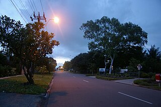
Brinkin is a northern suburb of Darwin, the capital city of the Northern Territory, Australia. It is located 12 kilometres (7 mi) north of Darwin's central business district, and is home to the Casuarina campus of Charles Darwin University. It is the traditional country and waterways of the Larrakia people.

<span class="mw-page-title-main">Alawa, Northern Territory</span> Suburb of Darwin, the Northern Territory, Australia

Alawa is a northern suburb of the city of Darwin, Northern Territory, Australia. It is bounded by Trower and Dripstone Roads, Lakeside Drive and the Rapid Creek in the local government area of City of Darwin. It is the traditional country and waterways of the Larrakia people.

<span class="mw-page-title-main">Coconut Grove, Northern Territory</span> Suburb of Darwin, the Northern Territory, Australia

Coconut Grove is a northern suburb of the city of Darwin, Northern Territory, Australia within the local government area of City of Darwin. It is the traditional country and waterways of the Larrakia people.

<span class="mw-page-title-main">East Point, Northern Territory</span> Suburb of Darwin, the Northern Territory, Australia

East Point is an inner northern suburb of the city of Darwin, Northern Territory of Australia. It is the traditional country and waterways of the Larrakia people.

<span class="mw-page-title-main">Ludmilla, Northern Territory</span> Suburb of Darwin, the Northern Territory, Australia

Ludmilla is a northern inner suburb of the city of Darwin, Northern Territory, Australia. It is the traditional country and waterways of the Larrakia people.

<span class="mw-page-title-main">Jingili, Northern Territory</span> Suburb of Darwin, the Northern Territory, Australia

Jingili is a northern suburb of the city of Darwin, Northern Territory, Australia. It is the traditional country and waterways of the Larrakia people.

<span class="mw-page-title-main">Stuart Park, Northern Territory</span> Suburb of Darwin, the Northern Territory, Australia

Stuart Park is an inner suburb of the city of Darwin, Northern Territory, Australia. It is the traditional country and waterways of the Larrakia people.

<span class="mw-page-title-main">Leanyer, Northern Territory</span> Suburb of Darwin, the Northern Territory, Australia

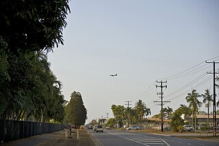
Leanyer is a northern suburb of Darwin, Northern Territory, Australia.

<span class="mw-page-title-main">Winnellie, Northern Territory</span> Suburb of Darwin, the Northern Territory, Australia

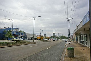
Winnellie is a northern suburb of Darwin in the Northern Territory of Australia. It is the traditional country and waterways of the Larrakia people.

<span class="mw-page-title-main">Holtze, Northern Territory</span> Suburb of Darwin, the Northern Territory, Australia

Holtze is a locality in Darwin, Northern Territory, Australia. It is 22 km southeast of the Darwin CBD. Its local government area is the Municipality of Litchfield. The locality is mostly a rural area, just north of Palmerston. It was named for Maurice William Holtze (1840–1923), the botanist who established Darwin's Botanical Gardens, and his son Nicholas, who succeeded him as curator.

<span class="mw-page-title-main">Darwin central business district</span> Suburb of Darwin, the Northern Territory, Australia

Darwin City is a suburb in metropolitan Darwin which comprises the original settlement, the central business district, parkland and other built-up areas. It is the traditional country and waterways of the Larrakia people. It is original site of occupation and includes many of the city's important institutions and landmarks, such as Parliament, Government House, the Northern Territory Supreme Court, Bicentennial Park and the George Brown Darwin Botanic Gardens. The city centre is located in the local government areas of the City of Darwin and the Darwin Waterfront Precinct.

<span class="mw-page-title-main">Berrimah Road</span> Road in Darwin, Northern Territory

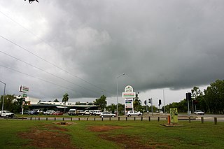
Berrimah Road is a major arterial road in the outer eastern suburbs of Darwin, Northern Territory Australia. The road provides an important transport corridor to access the port facilities at East Arm as well as the northernmost passenger and freight terminals on the Adelaide-Darwin railway. It has undergone recent upgrades as part of the Tiger Brennan Drive extension works between 2009 and 2012. Berrimah Road is used by approximately 4000 vehicles per day, including a large proportion of heavy trucks and this number is expected to increase significantly with the growth of the port activities There are major junctions controlled by traffic lights at Tiger Brennan Drive and Wishart Road, as well as a public weighbridge used by trucks entering and exiting the industrial precinct at the southern end.

<span class="mw-page-title-main">Bagot Community</span> Place in the Northern Territory, Australia

Bagot Community is an Aboriginal community in the Northern Territory of Australia located in Ludmilla, a northern suburb of the city of Darwin. It was established in 1938 as the Bagot Aboriginal Reserve, when the Aboriginal residents were moved from the Kahlin Compound, it was also sometimes referred to as the Bagot Road Aboriginal Reserve.

Haileybury Rendall School is an independent co-educational early learning, primary and secondary day school located in the Darwin suburb of Berrimah, in the Northern Territory of Australia.

References

  1. 1 2 Australian Bureau of Statistics (27 June 2017). "2016 Community Profiles: Berrimah (State Suburb)". 2016 Census of Population and Housing. Retrieved 28 June 2017. OOjs UI icon edit-ltr-progressive.svg
  2. Bonzle Digital Atlas – Berrimah. Retrieved 2007-12-16
  3. 1 2 3 "Berrimah". NT Atlas and Spatial Data Directory. Northern Territory Government. February 2005. Retrieved 7 June 2019.
  4. "Darwin City Council Suburbs" (PDF). Place Names Committee. Northern Territory Government. Archived from the original (PDF) on 18 March 2019. Retrieved 30 April 2019.
  5. "Home". Larrakia Development Corporation. 9 February 2014. Retrieved 25 March 2022.
  6. Greater Darwin Suburb Name Origins Archived 23 January 2008 at the Wayback Machine . Retrieved 2007-12-16
  7. "119 Australian General Hospital | Monument Australia".
  8. "The invisible border separating the haves and have-nots of the Territory". ABC News. 28 May 2018. Retrieved 25 March 2022.