Related Research Articles
A Ramsar site is a wetland site designated to be of international importance under the Ramsar Convention, also known as "The Convention on Wetlands", an intergovernmental environmental treaty established in 1971 by UNESCO, which came into force in 1975. It provides for national action and international cooperation regarding the conservation of wetlands, and wise sustainable use of their resources. Ramsar identifies wetlands of international importance, especially those providing waterfowl habitat.

The Pantanal is a natural region encompassing the world's largest tropical wetland area, and the world's largest flooded grasslands. It is located mostly within the Brazilian state of Mato Grosso do Sul, but it extends into Mato Grosso and portions of Bolivia and Paraguay. It sprawls over an area estimated at between 140,000 and 195,000 square kilometres. Various subregional ecosystems exist, each with distinct hydrological, geological and ecological characteristics; up to 12 of them have been defined.
Wetlands International is a global organisation that works to sustain and restore wetlands and their resources for people and biodiversity. It is an independent, not-for-profit, global organisation, supported by government and NGO membership from around the world.

Burns Bog is an ombrotrophic peat bog located in Delta, British Columbia, Canada. It is the largest raised peat bog and the largest undeveloped urban land mass on the West Coast of the Americas. Burns Bog was originally 4,000–4,900 hectares before development. Currently, only 3,500 hectares remain of the bog.
Kanjli Wetland is a man-made Wetland that subsumes the Kanjli Lake, and is located in the Kapurthala district of Punjab state in India. It was created in 1870 by constructing the headworks across the perennial Bien River, a tributary of the Beas River to provide irrigation facilities to the hinterland. The rich biodiversity of the wetland comprising aquatic, mesophytic and terrestrial flora and fauna including some important species of plants and animals was recognized internationally by the Ramsar Convention in 2002 by designating the Kanjli Lake in the List of Wetlands of International Importance. In this context, it is reported that the Punjab State which has 14 wetlands covering an area of 225.76 km2 has the unique position of three of its wetlands viz., the Kanjli Wetland covering an area of 490 ha of which the Kanjli Lake water spread is 184 ha), the Harike Wetland and the Ropar Wetland chosen by the Ministry of Environment and Forest (MoE&F), Government of India for their conservation and management are now also included in the Ramsar list covering a total area of 5650 ha; Kanjli is upstream of Harike wetland located in the Beas river basin while the Ropar wetland is in the Roopnagar district.
Classification of wetlands has been a problematical task, with the commonly accepted definition of what constitutes a wetland being among the major difficulties. A number of national wetland classifications exist. In the 1970s, the Ramsar Convention on Wetlands of International Importance introduced a first attempt to establish an internationally acceptable wetland classification scheme.
The Ginini Flats Wetlands Ramsar Site, also known as the Ginini Flats Subalpine Bog Complex, is a wetland in the Australian Capital Territory (ACT) that has been recognised as being of international importance by designation under the Ramsar Convention. It was listed on 11 March 1996 as Ramsar Site 793, and is the only such site in the ACT. It lies in the Australian Alps, close to the boundary of the ACT with New South Wales.

Mandora Marsh, also known as Mandora Salt Marsh, is a complex and diverse wetland system in Western Australia close to Eighty Mile Beach, and included in the Eighty Mile Beach Ramsar Site. It lies at the western edge of the Great Sandy Desert bioregion and within the Mandora Station pastoral lease. The marsh is part of the 3337 km2 Mandora Marsh and Anna Plains Important Bird Area, identified as such by BirdLife International because of its importance for supporting large numbers of waders and waterbirds.
Rudrasagar Lake, also known as Twijilikma, is a lake located in Melaghar, Tripura, India.

The Whangamarino Wetland in the Waikato District is the second largest wetland complex of the North Island of New Zealand. Encompassing a total area of more than 7200 hectares, the Department of Conservation Te Papa Atawhai manages 5,923 hectares of peat bog, swamp, mesotrophic lags, open water and river systems listed as a wetland of international importance under the Ramsar Convention. Fish and Game New Zealand are the second largest landowner, managing 748 hectares of the wetland primarily as gamebird hunting habitat.

Champasak is a province in southwestern Laos, near the borders with Thailand and Cambodia. It is one of the three principalities that succeeded the Lao kingdom of Lan Xang. As of the 2015 census, it had a population of 694,023. The capital is Pakse, but the province takes its name from Champasak, the former capital of the Kingdom of Champasak.
A mire, peatland, or quagmire is a wetland area dominated by living peat-forming plants. Mires arise because of incomplete decomposition of organic matter, usually litter from vegetation, due to water-logging and subsequent anoxia. All types of mires share the common characteristic of being saturated with water, at least seasonally with actively forming peat, while having their own ecosystem. Like coral reefs, mires are unusual landforms that derive mostly from biological rather than physical processes, and can take on characteristic shapes and surface patterning.

Meshchyora National Park covers extensive wetlands and pine/birch woodlands in the Meshchera Lowlands on the East European Plain in Vladimir Oblast, about 120 km east of Moscow. The wetland habitat provides for extremely rich biodiversity among the plants and animals. The area is associated with the medieval Meshchera tribe, from which the area takes its name. "Meshchyora" National Park (Мещёра) is not to be confused with "Meshchersky" (Мещёрский) National Park, which is just to the south, over the border in Ryazan Oblast. The Meshchyora NP is located entirely within the Oka River watershed. A small corner of the park touches on the border of the Moscow region. About 39% of the park territory is used and managed for agricultural purposes by local communities.

Meshchyorsky National Park covers extensive wetlands and pine/birch woodlands in the Meshchera Lowlands on the East European Plain in the northern section of Ryazan Oblast, Russia, about 120 km east of Moscow. The wetland habitat provides for extremely rich biodiversity among the plants and animals. "Meshchersky" (Мещёрский) National Park is not to be confused with "Meshchyora" (Мещёра) National Park, which is just to the north, over the border in Vladimir Oblast. The park protects a section of the Pra River, Lake Beloye, and associated wetlands and forests. About 54% of the park territory is used and managed for agricultural purposes by local communities.
Mediterranean Wetlands comprise the wetlands of the Mediterranean region.
Paludiculture is wet agriculture and forestry on peatlands. Paludiculture combines the reduction of greenhouse gas emissions from drained peatlands through rewetting with continued land use and biomass production under wet conditions. “Paludi” comes from the Latin “palus” meaning “swamp, morass” and "paludiculture" as a concept was developed at Greifswald University. Paludiculture is a sustainable alternative to drainage-based agriculture, intended to maintain carbon storage in peatlands. This differentiates paludiculture from agriculture like rice paddies, which involve draining, and therefore degrading wetlands.

Bofedales, known in some parts of Peru as oconales, are a type of wetland found in the Andes in Peru and Chile. They are a feature in the land use and ecology of high Andean ecosystems. They form in flat areas around ponds or streams and may be permanent or seasonal, and they can be man made or natural. The soil in a bofedal will be moist throughout the year. Bofedales are associated with peat in the soil and the presence of humidity in the soil means that they are green throughout the year. Bofedales are found above 3,100 metres (10,200 ft) above sea level (asl), although some classifications put them no lower than 3,800 metres (12,500 ft) asl. The Ramsar Convention describes bofedales as peatlands without forest. Bofedales absorb the limited amount of water derived from snow, glacier meltwater and rain showers storing it in ground and slowly releasing it. The water can be either fresh or saline. Their vegetation is slow-growing and tough, made up of grasses, especially rushes, and some low spreading herbs. Birds such as the Andean goose, ducks and wading birds use these wetlands for feeding and a wide variety of other birds depend on these permanent water sources and their associated insects. Other types of animals in the bofedales are poorly known.

The Tonle Sap-Mekong peat swamp forests ecoregion covers a patchwork of areas permanently inundated with fresh water along the Tonle Sap River and Mekong River floodplains in Cambodia and Vietnam. The terrain is mostly flat, with extensive agricultural fields, reed beds, and degraded shrub forest. Less than 10% of the region is in its original state, and less than 1% is protected. Habitat in the region is distinguished from the Tonle Sap freshwater swamp forests ecoregion that runs through the middle, as that ecoregion is only seasonally flooded.
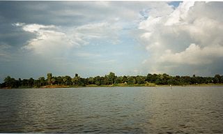
Xe Champhone Wetlands located in Savannakhet Province, in southern Laos and includes a large plain containing perennial and seasonal river channels, scattered lakes, ponds, permanent and seasonal freshwater marshes and rice paddy fields. Xe Champhone Wetlands was declared Ramsar Convention site in 2010.
Sri Lanka is a relatively small continental island, it exhibits a remarkable diversity of forest types, which are among the biologically one of richest forests in Asia. In these forests plant species show extraordinary patterns of localized distribution. Sri Lanka's forest became one of highest density of species diversity in the world. Sri Lanka natural forest cover about 12,493 km2 29.46% According to the National Red List said, Sri Lanka counts 253 land species, 245 species of butterflies, 240 birds, 211 reptiles, 748 evaluated vertebrates and 1,492 invertebrates. Forest coverage is about 70% tropical dry monsoon forests, 15% tropical moist monsoon forests and 5% tropical lower montane forests. By the dawn of the 19th century, Sri Lanka's forest cover was estimated at up to 70% of the total land area. Since then, the forest cover has decreased progressively over time. Significant loss of Sri Lanka's forest cover was first reported in the 19th century, with the introduction of plantation agricultural crops such as tea and vegetables. Commercial timber extraction policy of colonial rulers (British colonial time also led to clearing of forests in the dry zone. Irrigation development and agricultural expansions have been identified as key drivers of forest cover change.
References
- ↑ Beung Kiat Ngong Wetlands at Ramsar Sites International Service
- 1 2 3 4 Beung Kiat Ngong Wetlands brochure
- ↑ Duckworth, J. W. 2008. A Reconnaissance Wildlife Survey of the BCI Pilot Villages in Laos. Biodiversity Corridors Initiative (BCI, March 2008).
- ↑ biodiversity hospots on Conservation International
- ↑ Management plan of the Beung Kiat Ngong Ramsar site