Related Research Articles
Narsingdi District is a district in central Bangladesh. It is located 50 km north-east of Dhaka, capital city of Bangladesh. It is a part of the Dhaka Division. The district is famous for its textile craft industry. Narsingdi is bordered by Kishoreganj in the north and north-east, Brahmanbaria in the east and south-east, Comilla in the south and south-east, Narayanganj in the south and south-west and Gazipur in the west.

Belabo is an upazila of the Narsingdi District of Bangladesh, located in the Dhaka Division. Here the 2,500-year-old civilisation of Wari-Bateshwar has been discovered. It is believed that it was a port city with foreign trade with Ancient Rome, Southeast Asia and other regions. It is the oldest city so far discovered after Indus Valley Civilisation. Though part of Narsingdi, the Bengali dialect spoken by the people of Belabo is similar to that of Greater Mymensingh.
Monohardi is a reputed upazila of Narsingdi District in the Division of Dhaka, Bangladesh.
Narsingdi Sadar is an upazila of Narsingdi District in the Division of Dhaka, Bangladesh.
Shibpur is an upazila of Narsingdi District in the Division of Dhaka, Bangladesh.
Raipura is an Upazila of Narsingdi District in the Narsingdi District belonging to Dhaka Division.
Narsingdi is a city and district headquarter of Narsingdi District in the division of Dhaka, Bangladesh.
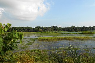
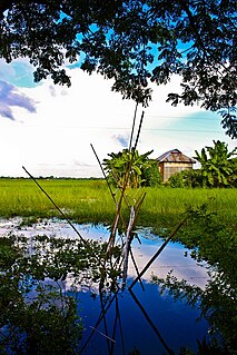
Karai Tala is a village in Chandarkandi Union of Raipura Upazila, Narsingdi District, Bangladesh. According to the 2011 Bangladesh census, it had a population of 2,470. There is a primary school. There are three mosques and one temple. There are two major Eidgah fields for two mosque-based mahallas. The second Eidgah was established in 2011 by praying Eid Ul Fitr, which is situated in the northern area of this village. Mayl Basa is a well known public place where people meet daily.
Gazipur-4 is a constituency represented in the Jatiya Sangsad of Bangladesh since 2012 by Simeen Hussain Rimi of the Awami League.
Narsingdi-5 is a constituency represented in the Jatiya Sangsad of Bangladesh since 1996 by Rajiuddin Ahmed Raju of the Awami League.
Munshiganj-2 is a constituency represented in the Jatiya Sangsad of Bangladesh since 2008 by Sagufta Yasmin of the Awami League.
Narsingdi-4 is a constituency represented in the Jatiya Sangsad of Bangladesh since 2008 by Nurul Majid Mahmud Humayun of the Awami League.
Narsingdi-2 is a constituency represented in the Jatiya Sangsad of Bangladesh since 2019 by Anwarul Ashraf Khan of the Awami League.
Manikganj-2 is a constituency represented in the Jatiya Sangsad of Bangladesh since 2014 by Momtaz Begum of the Awami League.
Manikganj-3 is a constituency represented in the Jatiya Sangsad of Bangladesh since 2008 by Zahid Maleque of the Awami League.
Gazipur-2 is a constituency represented in the Jatiya Sangsad of Bangladesh since 2004 by Zahid Ahsan Russell of the Awami League.
Gazipur-3 is a constituency represented in the Jatiya Sangsad of Bangladesh since 2019 by Iqbal Hossain Sabuj of the Awami League.
Narsingdi-1 is a constituency represented in the Jatiya Sangsad of Bangladesh since 2008 by Muhammad Nazrul Islam of the Awami League.
Narayanganj-5 is a constituency represented in the Jatiya Sangsad of Bangladesh since 2014 by Salim Osman of the Jatiya Party (Ershad).
Narsingdi-3 is a constituency represented in the Jatiya Sangsad of Bangladesh since 2019 by Zahirul Haque Bhuiyan Mohan of the Awami League.
References
- ↑ "Population Census 2011: Narsingdi Table C-01" (PDF). Bangladesh Bureau of Statistics. Archived from the original (PDF) on May 8, 2016. Retrieved July 11, 2014.
Coordinates: 24°05′17″N90°49′19″E / 24.088°N 90.822°E
Capital: Narsingdi | ||
| Upazilas | ||
| Constituencies | ||
| Sites and attractions | ||
| Inhabited areas | ||
| Education | ||
| Rivers | ||
| Transport | ||
| See also | ||
| | This Dhaka Division location article is a stub. You can help Wikipedia by expanding it. |