
Medford is a hamlet and census-designated place (CDP) in the Town of Brookhaven in Suffolk County, on Long Island, in New York, United States. The population was 24,247 at the 2020 census.

Selden is a hamlet and census-designated place (CDP) in the Town of Brookhaven in Suffolk County, New York, United States. The population was 21,262 at the time of the 2020 census.

Brookhaven is a large suburban town in Suffolk County, Long Island, New York. With a population of 488,497 as of 2022, it is the second most populous town in the United States and in New York and the third most populous community in the state.

New York State Route 25A (NY 25A) is a state highway on Long Island in New York, United States. It serves as the main east–west route for most of the North Shore of Long Island, running for 73 miles (117 km) from Interstate 495 (I-495) at the Queens–Midtown Tunnel in the New York City borough of Queens to NY 25 in Calverton, Suffolk County. The highway is a northern alternate route of NY 25, which follows a more inland routing along Jericho Turnpike.

New York State Route 27 (NY 27) is a 120.58-mile (194.05 km) long state highway that runs east–west from Interstate 278 (I-278) in the New York City borough of Brooklyn to Montauk Point State Park on Long Island, New York. Its two most prominent components are Sunrise Highway and Montauk Highway, the latter of which includes the Montauk Point State Parkway. NY 27 acts as the primary east–west highway on southern Long Island east of the interchange with the Heckscher State Parkway in Islip Terrace. The entire route in Suffolk, Nassau, and Queens counties were designated by the New York State Senate as the POW/MIA Memorial Highway. The highway gives access to every town on the South Shore. NY 27 is the easternmost state route in the state of New York, as well as the longest highway on Long Island.

New York State Route 112 (NY 112) is a state highway located entirely within the town of Brookhaven in Suffolk County, New York, in the United States. It runs from an intersection with East Main Street in the village of Patchogue to a junction with NY 25A in Port Jefferson Station. It is known locally as Medford Avenue in Patchogue and Patchogue Road in Terryville and Port Jefferson Station. The official name for the road outside these areas is "Patchogue–Port Jefferson Road", though it is often signed simply as "Route 112".

New York's 1st congressional district is a congressional district for the United States House of Representatives in eastern Long Island. It includes the eastern two-thirds of Suffolk County, including the northern portion of Brookhaven, as well as the entirety of the towns of Huntington, Smithtown, Riverhead, Southold, Southampton, East Hampton, and Shelter Island. The district encompasses extremely wealthy enclaves such as the Hamptons, middle class suburban towns such as Selden, Centereach, and Lake Grove, working-class towns such as Riverhead and rural farming communities such as Mattituck and Jamesport on the North Fork. The district currently is represented by Republican Nick LaLota.

New York State Route 347 (NY 347) is an east–west state highway located in Suffolk County, New York, in the United States. It connects the Northern State Parkway in Hauppauge to NY 25A in Mount Sinai. The route serves as a southern bypass of Smithtown and as a direct link between Nesconset and Port Jefferson, leading to the road being known as Smithtown Bypass in the Town of Smithtown, and for its entire length as the Nesconset–Port Jefferson Highway. Along the way, NY 347 intersects NY 25 in Nesconset and Nicolls Road in Lake Grove. The westernmost 2 miles (3.2 km) of NY 347 is concurrent with NY 454 while the portion northeast of NY 25 parallels NY 25A, which follows a more northerly alignment through the Town of Brookhaven than NY 347.
County Route 16 (CR 16) is a main thoroughfare through central Suffolk County, New York, in the United States. Its western terminus is at Middle Country Road in Village of the Branch, and its eastern terminus is at Montauk Highway (CR 80) in Brookhaven. The route carries five different names along its length: Terry Road, Smithtown Boulevard, Lake Shore Road, Portion Road, and Horseblock Road.

County Route 97 (CR 97) is a north–south expressway in Suffolk County, New York, in the United States. It runs from an intersection with CR 85 in Bayport just west of Blue Point on the south shore of Long Island to a junction with New York State Route 25A (NY 25A) in Stony Brook on the island's north shore. A 5-mile (8.0 km) section of the route from Holbrook to Farmingville is a freeway, while the remainder of the road is an expressway with at-grade intersections. CR 97 is known as Nicolls Road, named after 17th-century colonial Governor Richard Nicolls.

County Route 83 (CR 83) is a major north–south county road in Suffolk County, New York, in the United States. It runs from NY 27 exit 52A in North Patchogue to NY 25A in Mount Sinai. The road was to have to run further south along North Ocean Avenue and South Ocean Avenue through the village of Patchogue, but that proposal was canceled. CR 83 is known as North Ocean Avenue south of Granny Road in Medford and as Patchogue–Mount Sinai Road north of that point.
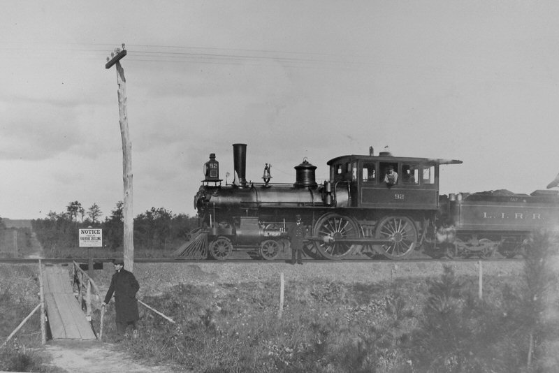
The Suffolk Traction Company is a former streetcar system in Suffolk County, New York. It operated primarily between Patchogue and Holtsville, but also included a route that served Blue Point, Bayport, and Sayville. It was opened in 1909 and ceased operations in 1919.
County Route 111 (CR 111) is a north–south county road in Suffolk County, New York, in the United States. It runs northwest and southeast from New York State Route 27 (NY 27) at exit 62 near Eastport to Interstate 495 (I-495) at exit 70 in Manorville. It serves as a connecting route between central Long Island and the Hamptons. The road is known as Captain Daniel Roe Highway, for Captain Daniel Roe (1740–1820) of Selden, who served in the French and Indian War and was a captain in the Revolutionary War. Within Manorville, the road is also known as Eastport Manor Road. It also appears on maps as Port Jefferson-Westhampton Road, for the communities in which the route was originally intended to have its north and south endpoints in.
