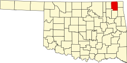
Big Cabin, Oklahoma

Last updated

Big Cabin, Oklahoma
OKMap-doton-BigCabin.PNG
Location of Big Cabin, Oklahoma
Coordinates: 36°32′32″N95°13′19″W / 36.54222°N 95.22194°W / 36.54222; -95.22194
Country United States
State Oklahoma
County Craig
Area
[1]
  Total2.34 sq mi (6.05 km2)
  Land2.34 sq mi (6.05 km2)
  Water0.00 sq mi (0.00 km2)
Elevation
[2]
715 ft (218 m)
Population
 (2020)
  Total174
  Density74.45/sq mi (28.74/km2)
Time zone UTC-6 (Central (CST))
  Summer (DST) UTC-5 (CDT)
ZIP code
74332
Area codes 539/918
FIPS code 40-05900 [3]
GNIS feature ID2411686 [2]

Big Cabin is a town in Craig County, Oklahoma, United States. The population was 265 at the 2010 census, [4] a decrease of 9.6 percent from the figure of 293 recorded in 2000. [5]

Contents

History

The town was named for a local landmark, a plank cabin, that existed near the place where the Missouri, Kansas and Texas Railway built a switch in 18712. The first post office in this part of Indian Territory opened in 1872. (though it was not named Big Cabin until 1892). Some entrepreneurs built a stockyard in the town in 1888. The first two-story frame building was constructed in 1892. In 1892 the Post Office Department assigned a postal designation to Big Cabin. A school for non-Indian children began in 1895. The railroad built a depot in 1903. [6]

Big Cabin was platted as a town in 1904. It began the process to incorporate in 1926, but did not finish the task until 1958. Meanwhile, the area around Big Cabin became noted for producing hay. A local resident claimed that the town had shipped out more hay between 1893 and 1910 than any other town in the U.S. He claimed that Big Cabin was "the Hay Capital of the World." [6]

Geography

Big Cabin is located near the southern border of Craig County. U.S. Route 69 passes through the town, leading north 10 miles (16 km) to Vinita, the county seat, and south 8 miles (13 km) to Adair. Interstate 44, the Will Rogers Turnpike, passes just north of the town, with access from Exit 283. Via I-44, it is 56 miles (90 km) southwest to Tulsa and 32 miles (51 km) northeast to Miami.

According to the United States Census Bureau, Big Cabin has a total area of 2.2 square miles (5.7 km2), all land. [4]

Demographics

Historical population
CensusPop.Note
1930 271
1940 270−0.4%
1950 210−22.2%
1960 2288.6%
1970 198−13.2%
1980 25227.3%
1990 2717.5%
2000 2938.1%
2010 265−9.6%
2020 174−34.3%
U.S. Decennial Census [7]

As of the census [3] of 2000, there were 293 people, 120 households, and 89 families residing in the town. The population density was 140.6 inhabitants per square mile (54.3/km2). There were 137 housing units at an average density of 65.8 per square mile (25.4/km2). The racial makeup of the town was 75.77% White, 14.68% Native American, 0.68% Asian, 0.34% from other races, and 8.53% from two or more races. Hispanic or Latino of any race were 1.71% of the population.

There were 120 households, out of which 35.0% had children under the age of 18 living with them, 56.7% were married couples living together, 15.8% had a female householder with no husband present, and 25.8% were non-families. 23.3% of all households were made up of individuals, and 10.0% had someone living alone who was 65 years of age or older. The average household size was 2.44 and the average family size was 2.84.

In the town, the population was spread out, with 25.9% under the age of 18, 9.2% from 18 to 24, 27.6% from 25 to 44, 24.2% from 45 to 64, and 13.0% who were 65 years of age or older. The median age was 34 years. For every 100 females, there were 98.0 males. For every 100 females age 18 and over, there were 92.0 males.

The median income for a household in the town was $30,972, and the median income for a family was $35,000. Males had a median income of $23,750 versus $21,964 for females. The per capita income for the town was $18,165. About 19.6% of families and 18.9% of the population were below the poverty line, including 25.4% of those under the age of 18 and 10.3% of those 65 or over.

Government

Traffic citations

In 2004 Big Cabin raised nearly three-fourths of its revenue from traffic citations for speeding. The state of Oklahoma enacted a law in 2004 that penalizes towns where the citation revenue exceeds 50% of the annual budget. As a result of a complaint filed by a local business, Oklahoma's Department of Public Safety designated the town a speed trap, and prohibited the town's officers from writing traffic tickets for six months. The police department maintained that enforcement lowered the annual rate of traffic deaths. [8]

Education

It is in Vinita Public Schools. [9]

Notable people

Related Research Articles

<span class="mw-page-title-main">Mayes County, Oklahoma</span> County in Oklahoma, United States

Mayes County is a county located in the U.S. state of Oklahoma. As of the 2020 census, the population was 39,046. Its county seat is Pryor Creek. Named for Samuel Houston Mayes, Principal Chief of the Cherokee Nation from 1895 to 1899, it was originally created at the Sequoyah Convention in August 1905.

<span class="mw-page-title-main">Craig County, Oklahoma</span> County in Oklahoma, United States

Craig County is a county in the U.S. state of Oklahoma. As of the 2020 census, the population was 14,107. Its county seat is Vinita. The county was organized in 1907, shortly before statehood, and named for Granville Craig, a prominent Cherokee farmer who lived in the Bluejacket area.

<span class="mw-page-title-main">Vinita Park, Missouri</span> City in Missouri, United States

Vinita Park is a city in St. Louis County, Missouri, United States, located just east of I-170 and south of St. Charles Rock Road. The population was 1,970 at the 2020 census.

<span class="mw-page-title-main">Vinita Terrace, Missouri</span> Former Village in Missouri, United States

Vinita Terrace was a village in St. Louis County, Missouri, United States. The population was 277 at the 2010 census.

<span class="mw-page-title-main">Bokchito, Oklahoma</span> Town in Oklahoma, United States

Bokchito is a town in Bryan County, Oklahoma, United States. The population was 632 at the 2010 census, an increase of 12.1 percent over the figure of 564 recorded in 2000. In the Choctaw language, "bok" means river, and "chito" means big or large, literally translating into "big creek".

<span class="mw-page-title-main">Calumet, Oklahoma</span> Town in Oklahoma, United States

Calumet is a town in Canadian County, Oklahoma, United States. It is part of the Oklahoma City Metropolitan Area. The population was 507 at the 2010 census, a 5.23 percent decrease since 2000.

<span class="mw-page-title-main">Bluejacket, Oklahoma</span> Town in Oklahoma, United States

Bluejacket is a town in eastern Craig County, Oklahoma, United States. The population was 339 at the 2010 census, an increase of 23.7 percent over the figure of 274 recorded in 2000.

<span class="mw-page-title-main">Ketchum, Oklahoma</span> Town in Oklahoma, United States

Ketchum is a town in Craig and Mayes counties, Oklahoma, United States. The population was 442 at the 2010 census, a 27 percent gain from 286 at the 2000 census.

<span class="mw-page-title-main">Vinita, Oklahoma</span> City in Oklahoma, United States

Vinita is a city and county seat of Craig County, Oklahoma, United States. As of the 2020 census, the population was 5,193.

<span class="mw-page-title-main">Welch, Oklahoma</span> Town in Oklahoma, United States

Welch is a town in northern Craig County, Oklahoma, United States. The population was 619 at the 2010 census, an increase of 3.7 percent over the figure of 597 recorded in 2000. It is 8 miles (13 km) south of the Kansas state line, at the intersection of state highways 2 and 10 with U.S. Highway 59.

<span class="mw-page-title-main">Arapaho, Oklahoma</span> Town in Oklahoma, United States

Arapaho is a town in, and the county seat of, Custer County, Oklahoma, United States. The population was 668 at the time of the 2020 census. The town lies long U.S. Route 183 and is named for the Arapaho Native American tribe.

<span class="mw-page-title-main">Cleora, Oklahoma</span> Census-designated place in Oklahoma, United States

Cleora is an unincorporated community and census-designated place (CDP) in Delaware County, Oklahoma, United States, along State Highway 85. The population was 1,463 at the 2010 census, up from the figure of 1,113 recorded in 2000. The Cleora Post Office existed from November 28, 1900, until October 15, 1954. Cleora was established in District 2 of the old Indian Territory. It was named for Cleora Ann Lunday, sister of the postmaster, Ed Lunday.

<span class="mw-page-title-main">Ninnekah, Oklahoma</span> Town in Oklahoma, United States

Ninnekah is a town in Grady County, Oklahoma, United States. The population was 775 at the 2020 census, a 22.7% decrease from 2010.

<span class="mw-page-title-main">Afton, Oklahoma</span> Town in Oklahoma, United States

Afton is a town in northeast Oklahoma in Ottawa County, Oklahoma, United States. The population was 734 at the time of the 2020 United States census.

<span class="mw-page-title-main">Fairland, Oklahoma</span> Town in Oklahoma, United States

Fairland is a town in southern Ottawa County, Oklahoma, United States. The population was 1,057 at the 2010 U. S. Census, an increase from the figure of 1,025 recorded in 2000. The town is in the historic Cherokee Nation.

<span class="mw-page-title-main">Wanette, Oklahoma</span> Town in Oklahoma, United States

Wanette is a town in Pottawatomie County, Oklahoma, United States. The population was 279 at the time of the 2020 Census. Wanette is part of the Purcell-Lexington retail trade area and is within the Greater Oklahoma City Metropolitan Area.

<span class="mw-page-title-main">Bushyhead, Oklahoma</span> CDP in Oklahoma, United States

Bushyhead is a census-designated place (CDP) in Rogers County, Oklahoma, United States. The population was 1,314 at the 2010 census, a 9.2 percent increase over the figure of 1,203 recorded in 2000. Established on the St. Louis-San Francisco Railway between Claremore and Vinita, the community was named for Dennis W. Bushyhead, Principal Chief of the Cherokee, 1879–1887. The post office existed from April 18, 1898, until November 15, 1955.

<span class="mw-page-title-main">Muldrow, Oklahoma</span> Town in Oklahoma, United States

Muldrow, officially the Town of Muldrow, is a town in Sequoyah County, Oklahoma, United States. It is part of the Fort Smith, Arkansas–Oklahoma Metropolitan Statistical Area. The population was 3,466 at the 2010 census, an increase of 11.7 percent over the figure of 3,104 recorded in 2000.

<span class="mw-page-title-main">Vera, Oklahoma</span> Town in Oklahoma, United States

Vera is a town in Washington County, Oklahoma, United States. The population was 334 as of the 2020 census.

Allen is a town in Hughes and Pontotoc counties in the U.S. state of Oklahoma. The population was 805 at the 2020 census.

References

  1. "ArcGIS REST Services Directory". United States Census Bureau. Retrieved September 20, 2022.
  2. 1 2 U.S. Geological Survey Geographic Names Information System: Big Cabin, Oklahoma
  3. 1 2 "U.S. Census website". United States Census Bureau . Retrieved January 31, 2008.
  4. 1 2 "Geographic Identifiers: 2010 Demographic Profile Data (G001): Big Cabin town, Oklahoma". U.S. Census Bureau, American Factfinder. Archived from the original on March 9, 2015. Retrieved March 4, 2015.
  5. CensusViewer: Population of the City of Big Cabin, Oklahoma
  6. 1 2 3 Craig County Genealogical Society, "Big Cabin." Encyclopedia of Oklahoma History and Culture. Retrieved September 3, 2014.
  7. "Census of Population and Housing". Census.gov. Retrieved June 4, 2015.
  8. Morgan, Rhett (July 22, 2005). "Speed trap snaps on town". Tulsa World . Retrieved March 25, 2010.
  9. "2020 CENSUS - SCHOOL DISTRICT REFERENCE MAP: Craig County, OK" (PDF). U.S. Census Bureau . Retrieved February 2, 2024.