
Cache Creek is a historic transportation junction and incorporated village 354 kilometres (220 mi) northeast of Vancouver in British Columbia, Canada. It is on the Trans-Canada Highway in the province of British Columbia at a junction with Highway 97. The same intersection and the town that grew around it was at the point on the Cariboo Wagon Road where a branch road, and previously only a trail, led east to Savona's Ferry on Kamloops Lake. This community is also the point at which a small stream, once known as Riviere de la Cache, joins the Bonaparte River.
Cheviot is a locality in Victoria, Australia in the Shire of Murrindindi local government area. The nearest town is Yea.

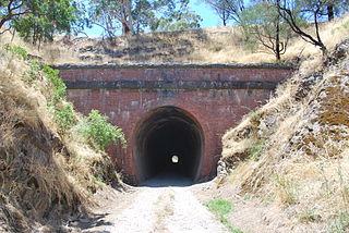
Gaffneys Creek is a former mining locality situated between Jamieson and Woods Point in Victoria, Australia. It is located at the junction of Gaffney and Raspberry Creeks in a steep valley in mountainous terrain. It is situated in the Shire of Mansfield on the unsealed Mansfield - Woods Point Rd.

Dorset Vale is a rural locality near Adelaide, South Australia. It straddles three local government areas adjacent to the Onkaparinga River, being within the Adelaide Hills, Mount Barker and the Onkaparinga council areas. The precise boundaries were set in April 1994 and extended in November 2003 for the long-established name. The first post office in the area was given the English name Dorset Vale circa 1850, but it was locally known as "Scotts Bottom" as it was downstream from Scott Creek. Scotts Bottom School opened in 1930, its name was changed to Dorset Vale in 1937 and it closed in 1944.
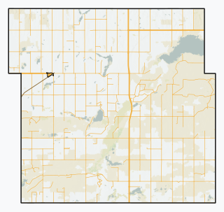
The Rural Municipality of Big Stick No. 141 is a rural municipality (RM) in the Canadian province of Saskatchewan within Census Division No. 8 and SARM Division No. 3. It is located in southwest portion of the province.

Bolivia is a locality on the Northern Tablelands in the New England region of New South Wales, Australia. The remains of the settlement comprises the former Bolivia Hotel, a disused post office, a disused railway siding and a community hall.

Bakers Creek is a rural town and coastal locality in the Mackay Region, Queensland, Australia. In the 2016 census the locality of Bakers Creek had a population of 1,161 people.

Big Pats Creek is a bounded rural locality in Victoria, Australia to the south of Woods Point Road beyond Warburton. Its local government area is the Shire of Yarra Ranges.

Sunnynook is a hamlet in southern Alberta, Canada within Special Area No. 2. It is located approximately 10 kilometres (6.2 mi) east of Highway 36 and 86 kilometres (53 mi) northeast of Brooks. The hamlet formerly housed the Berry Creek Community School Division office and area post office until amalgamation of the school division into Prairie Land Regional Division.
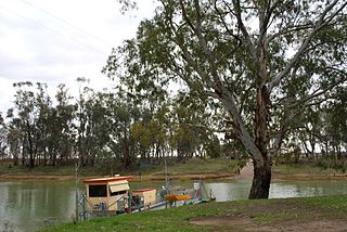
Speewa is a rural locality in the Riverina District of New South Wales, Australia near the Murray River in Murray River Council local government area.
Jesmond is a ranching community in the South Cariboo region of the Interior of British Columbia, Canada, located in the area west of the town of Clinton on the road from Kelly Lake, which is on the Pavilion-Clinton Road, to Big Bar Creek and Big Bar Ferry. Jesmond once had a post office, starting in 1913, when the postmaster adopted the name of his father's birthplace in the United Kingdom as the name of the place, until 1960 when it was closed.
Silver River was a logging camp on the east side of Harrison Lake in British Columbia, Canada, located at the mouth of Big Silver Creek, which is also unofficially called the Silver River or Big Silver River.
Mena Creek is a rural locality in the Cassowary Coast Region, Queensland, Australia. In the 2016 census Mena Creek had a population of 244 people.

Abercorn is a rural town and locality in the North Burnett Region, Queensland, Australia. In the 2016 census the locality of Abercorn had a population of 46 people.
Pine Creek is a rural locality in the Mid North region of South Australia, situated in the Regional Council of Goyder. It was established in August 2000 when boundaries were formalised for the long established local name.
Wondecla is a rural locality in the Tablelands Region, Queensland, Australia. In the 2016 census Wondecla had a population of 638 people.
Kidaman Creek is a rural locality in the Sunshine Coast Region, Queensland, Australia. In the 2016 census Kidaman Creek had a population of 130 people.

Packers Camp is a locality in the Cairns Region, Queensland, Australia. In the 2016 census, Packers Camp had a population of 106 people.
