Hawkshaw is a pair of semi-detached houses on the River Tweed, two miles southwest of Tweedsmuir in the Scottish Borders. Historically part of Peeblesshire, the original village of Hawkshaw was destroyed when the Fruid Reservoir was constructed in 1963, and is remembered as the ancestral family home of the Porteous family, dating from at least 1439.

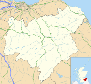
Tweeddale is a committee area and lieutenancy area in the Scottish Borders Council district, southeastern Scotland. Its boundaries correspond to the historic county of Peeblesshire.
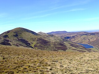
The Pentland Hills are a range of hills to the south-west of Edinburgh, Scotland. The range is around 20 miles (32 km) in length, and runs south west from Edinburgh towards Biggar and the upper Clydesdale.

Coulter or Culter is a small village and civil parish in South Lanarkshire, Scotland. It lies approximately 3 miles (4.8 km) south of Biggar. Some old maps and local modern houses also have the spelling Cootyre - "a safe place for cows."

Broughton is a village in Tweeddale in the historical county of Peeblesshire in the Scottish Borders council area, in the south of Scotland, in the civil parish of Broughton, Glenholm and Kilbucho and Upper Tweed Community Council. Broughton is on the Biggar Water, near where it flows into the River Tweed. It is about 7 km east of Biggar, and 15 km west of Peebles.

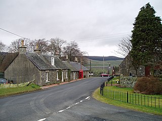
Tweedsmuir is a village and civil parish in Tweeddale, the Scottish Borders Council district, southeastern Scotland.
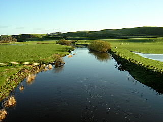
The North Calder Water is a river in North Lanarkshire, Scotland. It flows for 12 miles (19 km) from the Black Loch via the Hillend Reservoir, Caldercruix, Airdrie and Calderbank to the River Clyde at Daldowie, south-east of Glasgow. For the last 2 miles (3.2 km) of its course, it forms part of the boundary between North Lanarkshire and Glasgow.
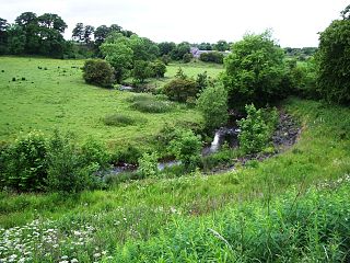
The Douglas Water is a river in South Lanarkshire of south-central Scotland. It is a tributary of the River Clyde.

The A72 road is a major route in Scotland connecting Hamilton in South Lanarkshire, with Galashiels in the Scottish Borders. It travels for over 97 kilometres (60 mi) in a south-easterly direction, along the Clyde and Tweed valleys, passing the towns of Larkhall, Lanark, Biggar and Peebles.
Symington is a small village in South Lanarkshire, Scotland, 3 miles (5 km) southwest of Biggar, 10 miles (16 km) east of Douglas and 13 miles (21 km) southeast of Carluke. Geographical features near Symington include Tinto Hill, the Coulter Hills and the River Clyde. A map by Pont in 1596 showed two St John's Kirks in a small settlement, and another map by Roy in 1754 showed a mill to the east.

Lyne is a small village and civil parish in the Scottish Borders area of Scotland, 4 miles (6.4 km) west of the market town of Peebles; it lies off the A72, in the old county of Peeblesshire and has an area of about 4 square miles (10 km2).

Manor Water is a river in the parish of Manor, Peeblesshire in the Scottish Borders. It rises in the Ettrick Forest and flows down through the Maynor valley passing the various farms and hamlets of Maynor as well as Kirkton Manynor where the Maynor kirk and village hall are flowing into the River Tweed one mile south of Peebles at Olde Maynor Brig which is closed to traffic for the foreseeable future.
Manor is a parish in Peeblesshire in the Scottish Borders, whose church lies on the west bank of Manor Water 3 miles south-west of Peebles.
Kirkurd is a parish in Peeblesshire in the Scottish Borders situated 3 miles south-east of Dolphinton and 6 miles north-east of Broughton. Tarth Water, a tributary of Lyne Water forms the northern boundary, with the parishes of Linton and Newlands on the north bank. The parish of Stobo lies to the east and south, the parish of Broughton, Glenholm and Kilbucho to the south, Skirling and Dolphinton (Lanarkshire) to the east.
Broughton, Glenholm and Kilbucho is a parish in Peeblesshire in the Scottish Borders, 11 miles south-west of Peebles, lying in the upper part of the valley of the River Tweed in the Southern Uplands. It is a union of three former parishes of bearing these names and the united parish is bound by Kirkurd on the north, Stobo on the east, Drumelzier on the south-east, Culter and Biggar, South Lanarkshire on the west and by Skirling in the north-west. For 4½ miles the eastern border of the parish follows the northward flowing Tweed. It is 9½ miles long north-to-south and 3½ miles wide. The only village is Broughton.
Skirling is a parish, community council area and village in Peeblesshire in the Scottish Borders situated 2½ miles east of Biggar in Lanarkshire. Biggar Water, a tributary the River Tweed forms the southern boundary of the parish with the parish of Broughton, Glenholm and Kilbucho. It is also bounded by that parish on the east, namely the Broughton part of it. On the north it is bounded by the parish Kirkurd in Peeblesshire. Spittal Burn forms most of its western boundary with Lanarkshire.