
Holmer and Shelwick is a civil parish in Herefordshire, England. It is immediately to the north of the Hereford and includes Holmer, Munstone, Shelwick and Shelwick Green. It is surrounded by rural fields, however the amenities of Hereford are very close by.

Slawston is a village and civil parish in the Harborough district of Leicestershire, England, north-east of Market Harborough. According to the 2001 census the parish had a population of 143, including Welham and increasing to 191 at the 2011 census. The parish includes the deserted village of Othorpe at grid reference SP770956. Slawston is located roughly 1 km away from Medbourne.

Ashleyhay is a village and civil parish in the Amber Valley district of Derbyshire, England, about five miles north-west of Belper. It is also situated one and three-quarters of a mile south of Wirksworth and eleven miles north of Derby city centre. According to the 2001 census it had a population of 105, increasing to 118 at the 2011 Census.

Ripple, also known as 'Ripple Vale', is a village and civil parish in the Dover District of Kent, England.

Belstead is a village and civil parish in the Babergh district of the English county of Suffolk. Located on the southern edge of Ipswich, around 3 miles (5 km) south-west of Ipswich town centre. It had a population of 202 according to the 2011 census. Belstead has amenities such as a village hall, St Mary's the Virgin Church, The bridge school for children with learning difficulties and Belstead Brook Hotel and Spa. It is in the Belstead Brook electoral division of Suffolk County Council.
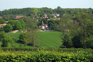
Sundridge and Ide Hill is a civil parish in the Sevenoaks District of Kent, England. It is located in the Darenth valley and lies between Sevenoaks and Westerham. The parish contains the villages of Sundridge and Ide Hill and the hamlet of Goathurst Common. It lies within the Kent Downs Area of Outstanding Natural Beauty and within London’s Metropolitan Green Belt. It is approximately 21 miles south of London.

Smeeton Westerby is a village and civil parish in the Harborough district, located approximately nine miles south east from Leicester. Smeeton Westerby is situated in the Leicestershire countryside. It is close to Saddington, Kibworth and Fleckney and is situated 500m North of the Grand union canal. Smeeton Westerby is approximately 6.8 miles from the nearest railway station which is located in Market Harborough. The closest area for shops is Kibworth, which is approximately 1.4 miles North of Smeeton Westerby. Kibworth has numerous shops and in 2002 many new shops appeared, including a new branch of the Co-op UK. Smeeton Westerby doesn't have any shops of its own but it does have a traditional village pub, a village hall, a parish church plus several stables and farms.

Bransford is a village and civil parish in the Malvern Hills district of the county of Worcestershire, England. It is situated close to the River Teme and the village of Leigh. It is on the primary route between Worcester and Hereford, the A4103 that runs through the centre of the village. According to the 2011 census, Bransford has a population of 389. The parish shares its parish council with Leigh.
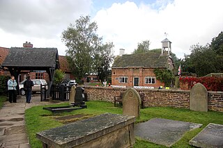
Peover Inferior is a civil parish in the Borough of Cheshire East and the ceremonial county of Cheshire, England. The village is known for its picturesque surrounding countryside and surprisingly convenient location. The name Peover is pronounced 'Peever' and derives from the Anglo-Saxon 'Peeffer' meaning 'a bright river', this 'bright river' being the River Peover which runs through the parish. The village and its neighbour Peover Superior lie on the river Peover, 'Inferior' here meaning downstream. The parish is situated on the B5081 roughly 25 km south south west of Manchester between Knutsford and Holmes Chapel and within five miles of junction 19 on the M6. Together with Nether Peover, it forms part of the village of Lower Peover, Lower Peover being the parish council. Peover Inferior is in Cheshire East, however Nether Peover is in Cheshire West, this often causes complications for the Lower Peover parish council. According to the 2011 census, it had a population of 220.
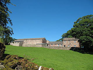
Hartley is a village and civil parish in the Eden district of Cumbria, England. It is about 0.5 miles (0.8 km) east of Kirkby Stephen. The area has many old lead and copper mines that are now abandoned as well as having a large quantity of iron haematite, ironstone and ore. At the highest peak in Hartley stand nine obelisks referred to as "Nine Standards". Nobody knows the true purpose of the "Nine Standards" although some believe that they were used to create a sense of a forthcoming army to scare the enemy forces. However, it is believed more heavily that they were placed as geographical aid to help outline the borders between the two neighbouring counties, Westmorland and Yorkshire. Hartley also is home to Hartley Castle. It was originally built as a "tower house circa 1353 and extended circa 1600" and then re- developed in the 18th century. The Castle was built at the southern point of Hartley.
Hulland is a village and civil parish in the Derbyshire Dales district of Derbyshire, England, adjoining the A517 road. It had a population of 215 according to the 2011 census.
Hulland Ward is a village and civil parish in the Derbyshire Dales district of Derbyshire roughly 6 miles west of Belper, Derbyshire England on the A517 road. The parish includes the hamlets of Biggin, Nether Biggin and Millington Green. Hulland Ward itself contains about 400 houses and has a population of just under 1000 inhabitants, being measured at 927 in the 2011 Census.

Pennington is a small village and civil parish in Furness, a region of Cumbria, England. Pennington lies between Ulverston, Rosside and Lindal. Pennington is located just off the nearby A590, with the nearest railway link in Ulverston.
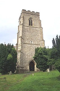
Clopton is a village and civil parish in Suffolk. It is located between Ipswich and Debenham two kilometres north of Grundisburgh on the River Lark. The village is no larger than a series of houses either side of the B1078, surrounded by farm land. The village itself has no clear centre; houses and other buildings are concentrated around the four manors of Kingshall, Brendhall, Rousehall and Wascolies, all of which are mentioned in the Domesday Book.

Fakenham Magna is a village and civil parish in the West Suffolk district of Suffolk in eastern England. The meaning of the word 'Fakenham' can be split into two: 'Faken' and 'ham', both of which derive from Old English. The former refers to somebody by the name of 'Facca', with the latter meaning 'a village / a homestead', making the direct translation 'Facca's homestead'. 'Magna' translates from Latin as 'great', hence the alternative name of the village of 'Great Fakenham'. During World War Two, however, the village was referred to as 'Little Fakenham', which was used to avoid confusion with the larger civil parish of Fakenham in Norfolk.

Dunstall is a small village and civil parish in the borough of East Staffordshire, Staffordshire, England. It lies between Burton upon Trent and Barton-under-Needwood. The population of the parish at the 2001 census was 215, decreasing to 209 at the 2011 Census.

Great Moulton is a civil parish in the English county of Norfolk. Until the 16th Century it also included the Little Moulton parish.
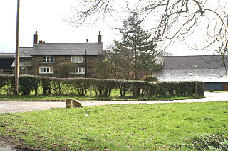
Millington is a civil parish in the Borough of Cheshire East in England. The parish is 8 miles (13 km) from Warrington and 3 miles (5 km) from Altrincham. Its name is a "relic of Saxon clanship – the ton or town of the Millings". The parish is primarily agricultural, with a number of farms including Moss House Farm, Newhall Farm, Mereside Farm, Boothbank Farm and Stonedelph Farm. Millington has been recently described on Britain Streets as a "hamlet or isolated settlement in inhabited countryside". Millington is situated within the market town Macclesfield within the Unitary Authority of Cheshire East. The M56 motorway is close to the parish, which allows travel into areas of Warrington and Manchester, 13 miles (21 km) and 14 miles (23 km) away respectively.

Skelsmergh is a small village and former civil parish, now in the parish of Skelsmergh and Scalthwaiterigg, in South Lakeland in rural Cumbria, England, about 4 miles (6.4 km) north of Kendal, on the A6 road.
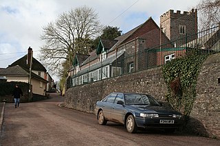
Poughill is a village and civil parish in Devon, England. It lies 5 miles (8 km) north of Crediton. In 2011, the parish had a population of 216.


