
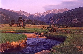
The Platte River is a major river in the state of Nebraska and is about 310 mi (500 km) long. Measured to its farthest source via its tributary the North Platte River, it flows for over 1,050 miles (1,690 km). The Platte River is a tributary of the Missouri River, which itself is a tributary of the Mississippi River which flows to the Gulf of Mexico. The Platte over most of its length is a muddy, broad, shallow, meandering stream with a swampy bottom and many islands—a braided stream. These characteristics made it too difficult for canoe travel, and it was never used as a major navigation route by European-American trappers or explorers.

The North Platte River is a major tributary of the Platte River and is approximately 716 miles (1,152 km) long, counting its many curves. In a straight line, it travels about 550 miles (890 km), along its course through the U.S. states of Colorado, Wyoming, and Nebraska.
The Big Thompson River is a tributary of the South Platte River, approximately 78 miles (123 km) long, in the U.S. state of Colorado.

The Laramie River is a tributary of the North Platte River, approximately 280 miles (450 km) long, in the U.S. states of Colorado and Wyoming. The river was named for Jacques La Ramie, a fur trapper who visited the area in the early 19th century. Laramie County, Wyoming, the city of Laramie, and other geographical entities in the region have "Laramie" in their names.

Cherry Creek is a tributary of the South Platte River, 48.0 miles (77.2 km) long, in Colorado in the United States.

Clear Creek is a tributary of the South Platte River, approximately 66 miles (106 km) long, in north central Colorado in the United States. The creek flows through Clear Creek Canyon in the Rocky Mountains directly west of Denver, descending through a long gorge to emerge on the Colorado Eastern Plains where it joins the South Platte. Clear Creek is unusual in that it is a stream named "creek" fed by a stream named "river". Fall River empties into Clear Creek along I-70 west of Idaho Springs, Colorado.

St. Vrain Creek is a tributary of the South Platte River, approximately 32.2 miles (51.8 km) long, in north central Colorado in the United States. It drains part of the foothills north of Boulder and the Colorado Piedmont area in the vicinity of Longmont.

Trout Creek Pass, elevation 9,487 ft (2,892 m), is a mountain pass located in the Rocky Mountains of south-central Colorado in the United States. The pass sits atop the southern end of the Mosquito Range on the Park-Chaffee county line, between South Park and the headwaters of the Arkansas River to the west. It is traversed jointly by U.S. Highway 24 (US 24) and US 285. It is passable by most motorized vehicles and is closed only during severe winter storms. The approach from the north is mild, while the south side has a moderate 5% grade.
The Middle Fork South Platte River is a tributary of the South Platte River, approximately 50 miles (80 km) long, located in central Colorado in the United States. The river provides part of the drainage of South Park, the intermontane grassland basin located between the Front Range and the Mosquito Range in the Rocky Mountains southwest of Denver.

The Platte River Wilderness is primarily located in south central Wyoming, with a small section extending into Colorado in the United States. Located entirely within Medicine Bow - Routt National Forest, the wilderness was created in 1984 to protect the forestlands adjacent to the North Platte River. The Wyoming section lies within the original Medicine Bow National Forest, whereas the Colorado section is in the original Routt National Forest; since 1995 these have been administratively combined.

Lodgepole Creek is a tributary of the South Platte River, approximately 278 miles (447 km) long, in the U.S. states of Wyoming, Nebraska and Colorado. Lodgepole Creek drains a basin in the interior of a low plateau which lies between the South Platte Basin and the North Platte Basin in the southeastern corner of Wyoming, the southern edge of the Nebraska Panhandle and several small portions of northeastern Colorado. As its name implies, Lodgepole Creek is a very small stream; for nearly all of its length it flows through the semiarid High Plains. The Lodgepole Creek Valley has been a major transportation route for over 100 years; the line of the original transcontinental railroad, the Lincoln Highway/U.S. Highway 30 and Interstate 80 all run along the stream for much of its length.

The U.S State of Colorado includes the headwaters of several important rivers. The state is divided into two major hydrographic regions by the Continental Divide of the Americas. East of the Continental Divide, surface waters flow via the South Platte River, the North Platte River, the Republican River, the Arkansas River, the Cimarron River, the Canadian River, or the Rio Grande to the Gulf of Mexico. West of the Continental Divide, surface waters flow via the Green River, the upper Colorado River, or the San Juan River into the Colorado River and on to the Gulf of California. Colorado also has three significant endorheic basins: the San Luis Closed Basin in the San Luis Valley, and the Bear Creek Basin and the White Woman Basin spanning the Colorado-Kansas border north and south of the Arkansas River.

Sand Creek is a 14.6-mile-long (23.5 km) tributary that flows into the South Platte River near Commerce City, Colorado. From its source in unincorporated Arapahoe County, it flows through Aurora and Denver before joining the South Platte in Adams County.
Beaver Creek is a 165-mile-long (266 km) tributary of the South Platte River in Colorado. The creek flows from a source in Elbert County to a confluence with the South Platte in Morgan County near Hillrose.
Kiowa Creek is a 123-mile-long (198 km) tributary that flows northeast into the South Platte River in Morgan County, Colorado near Orchard. The creek's source is in the Black Forest of El Paso County, northeast of Colorado Springs, Colorado. Kiowa Creek rises in the highlands of the Colorado Piedmont and is subject to occasional flash floods.

The Bayou Gulch is one of the tributaries of the Cherry Creek and is located in the U.S. states of Colorado. It is part of the Colorado Eastern Plains.
The Sulphur Gulch is one of the tributaries of the Cherry Creek and is located in the U.S. states of Colorado. It is part of the Eastern Plains.
Monument Creek is an El Paso County, Colorado stream on the Arkansas River water basin. It flows south from Mount Deception through Pikeview, Monument and into Colorado Springs, Colorado, where it meets up with Fountain Creek. It is 27.2 miles (43.8 km) from its northernmost boundary with National Forest Lands to its confluence with Fountain Creek near the intersection of Interstate 25 and U.S. Route 24.
Floods in Colorado include the flood of 1844 which filled the South Platte valley from "bluff to bluff" to the recent Denver floods of 1965 and the 2013 Colorado floods.


