Bingley Hall

Last updated

Bingley House 1830, demolished to build Bingley Hall in 1850 Bingley House 1830, Birmingham.jpg
Bingley House 1830, demolished to build Bingley Hall in 1850

Bingley Hall in Birmingham was the first purpose-built exhibition hall in Great Britain. It was built in 1850 and burned down in 1984. The International Convention Centre now stands on the site.

Contents

Precursor

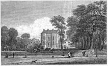
The precursor of Bingley Hall was an "Exhibition of the Manufactures of Birmingham and the Midland Counties" in a temporary wooden hall built in the grounds of, and attached to, Bingley House on Broad Street in central Birmingham (once the home of banker Charles Lloyd, and visited by Samuel Taylor Coleridge) and opened on 3 September 1849 for visitors to the Birmingham Triennial Music Festival. This exhibition was visited by Charles Darwin, and also on 12 November by Prince Albert and may have contributed to his ideas for the Great Exhibition of 1851 at the Crystal Palace.

History

Bingley House was built about 1760 as Byngas Hall, but was shown on local maps as Bynges Hall as early as 1553, and was the home of James Farmer, whose daughter Mary married Charles Lloyd. [1] The house and its land were bought by a railway company in order to build the railway tunnel (New Street North Tunnel) for the Birmingham, Wolverhampton and Stour Valley Railway. The house was demolished.

In December 1849, the first Birmingham annual cattle show and poultry show were held in a temporary hall on the corner of Lower Essex Street and Kent Street, but the following year the 2nd shows were held in the new Bingley Hall.

Bingley Hall was built by Messrs Branson and Gwyther (architect J. A. Chatwin), [2] [3] for £6,000 in six weeks in 1850, using steel columns surplus to the construction of Euston railway station. It was built in the Roman Doric style using red and blue bricks (the Staffordshire blue bricks being diverted from building the Oxford Street viaduct [3] ). Covering one and a quarter acres internally, it measured 224 feet (68 m) by 221 feet (67 m), used 11,700 feet (3,600 m) of 21-inch (530 mm) glass, and had ten entrance doors.

During its life, it was used as a venue for the Birmingham Dog Show, cattle shows, chrysanthemum shows, circus, boxing, cinema, and in its later days for popular music concerts. It had a cycle track used for competitions. It was used as a huge meeting space. Gladstone held a political meeting in November 1888, following Joseph Chamberlain's split from the Liberal Party over Irish Home Rule, and spoke for two hours. The speech was recorded by the journal Political World on an Edison phonograph shipped from New York – the first political speech recorded. Chamberlain himself spoke there before an audience of some 10,000 people in November 1903, during his campaign for fiscal reform. On 17 September 1909, Charlotte Marsh and Mary Leigh climbed onto the roof of Bingley Hall. They were protesting at women being excluded from a political meeting where the British Prime Minister Asquith was giving a speech. Marsh and Leigh threw roof tiles at the police. [4] They went to trial and were sent onto Winson Green Prison. [5]

In the early months after it was raised in 1859, the Birmingham Rifles (later the 1st Volunteer Battalion of the Royal Warwickshire Regiment) paraded at Beardsworth's Horse Repository, but as numbers grew it moved at the invitation of the Cattle Show committee to Bingley Hall. This arrangement was never satisfactory, because the battalion could not use the hall for the duration of the cattle show in November and December each year. When the show committee also let the hall to a circus for three months in the spring of 1879, the battalion was temporarily housed in Mr Wiley's factory in Graham Street. The battalion then acquired a site of its own and built a drill hall at Thorp Street. [6]

The hall was used repeatedly for meetings and conversions by various non-conformist religions, including the Elim Pentecostal Church in 1930, led by George Jeffreys.

Fire

The hall was damaged by fire at the Midland Caravan, Camping and Leisure Exhibition in January 1984 and subsequently demolished, [1] its functionality having been replaced by the National Exhibition Centre (NEC) just outside the city in Solihull. The International Convention Centre stands in its place.

Related Research Articles

<span class="mw-page-title-main">Rugby, Warwickshire</span> Town in England

Rugby is a market town in eastern Warwickshire, England, close to the River Avon. At the 2021 census its population was 78,117, making it the second-largest town in Warwickshire. It is the main settlement within the larger Borough of Rugby, which had a population of 114,400 in 2021.

<span class="mw-page-title-main">Midland Counties Railway</span>

The Midland Counties' Railway (MCR) was a railway company in the United Kingdom which existed between 1839 and 1844, connecting Nottingham, Leicester and Derby with Rugby and thence, via the London and Birmingham Railway, to London. The MCR system connected with the North Midland Railway and the Birmingham and Derby Junction Railway in Derby at what become known as the Tri Junct Station. The three later merged to become the Midland Railway.

<span class="mw-page-title-main">Transport in Birmingham</span> Overview of the transport infrastructure in Birmingham

Birmingham is a major transport hub, due in part to its location in central England. The city is well connected by rail, road, and water. Public transport and key highways in the city are overseen by Transport for West Midlands (TfWM).

<span class="mw-page-title-main">Selly Oak</span> Human settlement in England

Selly Oak is an industrial and residential area in south-west Birmingham, England. The area gives its name to Selly Oak ward and includes the neighbourhoods of: Bournbrook, Selly Park, and Ten Acres. The adjoining wards of Edgbaston and Harborne are to the north of the Bourn Brook, which was the former county boundary, and to the south are Weoley, and Bournville. A district committee serves the four wards of Selly Oak, Billesley, Bournville and Brandwood. The same wards form the Birmingham Selly Oak constituency, represented since 2010 by Steve McCabe (Labour). Selly Oak is connected to Birmingham by the Pershore Road (A441) and the Bristol Road (A38). The Worcester and Birmingham Canal and the Birmingham Cross-City Railway Line run across the Local District Centre.

<span class="mw-page-title-main">Stirchley, Birmingham</span> Human settlement in England

Stirchley is a suburb in south-west Birmingham, England.

<span class="mw-page-title-main">New Street, Birmingham</span>

New Street is a street in central Birmingham, England. It is one of the city's principal thoroughfares and shopping streets linking Victoria Square to the Bullring Shopping Centre. It gives its name to New Street railway station, although the station has never had direct access to New Street except via Stephenson Place and latterly Grand Central shopping centre.

<span class="mw-page-title-main">Birmingham Curzon Street railway station (1838–1966)</span> Former railway station in Birmingham, United Kingdom

Birmingham Curzon Street railway station was a railway station in central Birmingham, England. Initially used as a major early passenger terminus before being eclipsed by newer facilities and converted into a goods depot, it was a continuously active railway facility up until 1966.

<span class="mw-page-title-main">Architecture of Birmingham</span> Overview of the architecture of Birmingham

Although Birmingham in England has existed as a settlement for over a thousand years, today's city is overwhelmingly a product of the 18th, 19th, and 20th centuries, with little surviving from its early history. As it has expanded, it has acquired a variety of architectural styles. Buildings of most modern architectural styles in the United Kingdom are located in Birmingham. In recent years, Birmingham was one of the first cities to exhibit the blobitecture style with the construction of the Selfridges store at the Bullring Shopping Centre.

The Birmingham and Gloucester Railway (B&GR) was the first name of the railway linking the cities in its name and of the company which pioneered and developed it; the line opened in stages in 1840, using a terminus at Camp Hill in Birmingham. It linked with the Bristol and Gloucester Railway in Gloucester, but at first that company's line was broad gauge, and Gloucester was a point of the necessary but inconvenient transhipment of goods and passengers onto 4 ft 8+12 in gauge that became the national standard. Nearly all of the original main line remains active as a "trunk" route, also known as an arterial route or line.

<span class="mw-page-title-main">Henley-in-Arden</span> Town in Warwickshire, England

Henley-in-Arden is a town and civil parish in the Stratford-on-Avon District in Warwickshire, England. The town takes its last name from the former Forest of Arden. Henley is known for its variety of historic buildings, some of which date back to medieval times, and its wide variety of preserved architectural styles. The one-mile-long (1.6 km) High Street is a conservation area.

<span class="mw-page-title-main">Bournbrook</span> Human settlement in England

Bournbrook is an industrial and residential district in southwest Birmingham, England, in the ward of Bournbrook and Selly Park and the parliamentary constituency of Birmingham Selly Oak. Before 2018 it was in Selly Oak Council Ward. Prior to what is commonly termed the Greater Birmingham Act, which came into effect on 9 November 1911, the Bourn Brook watercourse was the North Eastern boundary of Worcestershire, and the area was locally governed by the King's Norton and Northfield Urban District Council.

<span class="mw-page-title-main">Manchester Central railway station</span> Former railway station in England

Manchester Central railway station is a former railway station in Manchester city centre, England. One of Manchester's main railway terminals between 1880 and 1969, it has been converted into an exhibition and conference centre, originally known as G-MEX, but now named Manchester Central. The structure is a Grade II* listed building.

<span class="mw-page-title-main">J. A. Chatwin</span> British architect

Julius Alfred Chatwin FRIBA, ARBS, FSAScot was a British architect. He was involved with the building and modification of many churches in Birmingham, and practised both Neo-Gothic and Neo-Classical styles. His designs always included all of the carvings and internal fittings.

<span class="mw-page-title-main">Portland Expo Center</span> Convention center in Portland, Oregon, U.S.

The Portland Expo Center, officially the Portland Metropolitan Exposition Center, is a convention center located in the Kenton neighborhood of Portland, Oregon, United States. Opened in the early 1920s as a livestock exhibition and auction facility, the center now hosts over 100 events a year, including green consumer shows, trade shows, conventions, meetings and other special events. Located on the north side of Portland near Vancouver, Washington, it includes the northern terminus for the Yellow Line of Portland's light-rail transit system and has connections to TriMet Bus Line 11-Rivergate/Marine Dr.

This article is intended to show a timeline of events in the History of Birmingham, England, with a particular focus on the events, people or places that are covered in Wikipedia articles.

<span class="mw-page-title-main">Banbury Merton Street railway station</span> Disused railway station in Banbury, Cherwell

Banbury Merton Street was the first railway station to serve the Oxfordshire market town of Banbury in England. It opened in 1850 as the northern terminus of the Buckinghamshire Railway providing connections to Bletchley and Oxford and closing for passengers in 1961 and goods in 1966.

<span class="mw-page-title-main">Birmingham city centre</span> City in the West Midlands, England

Birmingham city centre, also known as Central Birmingham is the central business district of Birmingham, England. The area was historically in Warwickshire. Following the removal of the Inner Ring Road, the city centre is now defined as being the area within the Middle Ring Road. The city centre is undergoing massive redevelopment with the Big City Plan, which means there are now nine emerging districts and the city centre is approximately five times bigger.

The Alcester–Bearley branch line was a 6+34-mile single-track branch railway line in Warwickshire, England. It was built by the Alcester Railway Company. It connected the manufacturing town of Alcester into the Great Western Railway network, opening in 1876.

The Birmingham Rifles was a volunteer unit of the British Army founded in Birmingham in 1859. As the 5th Battalion, Royal Warwickshire Regiment, it served as infantry on the Western Front and in Italy during World War I. Its successor units served in air defence during the early part of World War II, and later as anti-tank gunners in the Burma Campaign.

<span class="mw-page-title-main">The Exchange, Birmingham</span> Commercial building in England, UK

The Exchange was a large and prominent Victorian commercial building in central Birmingham, England, on the corner of New Street and Stephenson Place. It was among the many Victorian buildings lost during the 1960s redevelopment of Birmingham.

References

  1. 1 2 Norman Bartlam (2002). Broad Street Birmingham. Sutton Publishing. ISBN   0-7509-2874-3.
  2. Birmingham Buildings, The Architectural Story of a Midland City, Bryan Little, 1971, ISBN   0-7153-5295-4
  3. 1 2 The Life Story of J. A. Chatwin FRIBA, FSA.Scot 1830-1907, P. B. Chatwin, Oxford University Press, 1952
  4. Myall, M. (2004-09-23). Leigh [née Brown], Mary [Marie] (b. 1885, d. in or after 1965), militant suffragette. Oxford Dictionary of National Biography. Retrieved 1 December 2017
  5. Elizabeth Crawford (2 September 2003). The Women's Suffrage Movement: A Reference Guide 1866-1928. Routledge. p. 5. ISBN   1-135-43402-6.
  6. John Jeff, The 5th Battalion, The Royal Warwickshire Regiment, T.A.: its Predecessors, Successors and Historians, Kingswinford, 1986, ISBN   0-9504999-3-5.

52°28′44.40″N1°54′38.84″W / 52.4790000°N 1.9107889°W / 52.4790000; -1.9107889