Related Research Articles

Platinum is a city in Bethel Census Area, Alaska, United States. The population was 61 at the 2010 census, up from 41 in 2000.

The Reed Gold Mine is located in Midland, Cabarrus County, North Carolina, and is the site of the first documented commercial gold find in the United States. It has been designated a National Historic Landmark because of its importance and listed on the National Register of Historic Places
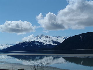
Turnagain Arm is a waterway into the northwestern part of the Gulf of Alaska. It is one of two narrow branches at the north end of Cook Inlet, the other being Knik Arm. Turnagain is subject to climate extremes and large tide ranges.

The Liard River of the North American boreal forest flows through Yukon, British Columbia and the Northwest Territories, Canada. Rising in the Saint Cyr Range of the Pelly Mountains in southeastern Yukon, it flows 1,115 kilometres (693 mi) southeast through British Columbia, marking the northern end of the Rocky Mountains and then curving northeast back into Yukon and Northwest Territories, draining into the Mackenzie River at Fort Simpson, Northwest Territories. The river drains approximately 277,100 square kilometres (107,000 sq mi) of boreal forest and muskeg.

Birch Creek is a 150-mile (240 km) tributary of the Yukon River in the U.S. state of Alaska. Beginning at the confluence of Ptarmigan and Eagle creeks near Porcupine Dome, it flows southwest, then south under the Steese Highway and into the Steese National Conservation Area. It then turns east, then north, again passing under the Steese Highway and entering the Yukon Flats National Wildlife Refuge. Turning northwest, it ends where it splits into two distributaries, Lower Mouth Birch Creek and Upper Mouth Birch Creek, near Birch Creek, Alaska. The distributaries flow into the Yukon River at separate locations downstream of Fort Yukon.
Gold mining in Alaska, a state of the United States, has been a major industry and impetus for exploration and settlement since a few years after the United States acquired the territory in 1867 from the Russian Empire. Russian explorers discovered placer gold in the Kenai River in 1848, but no gold was produced. Gold mining started in 1870 from placers southeast of Juneau, Alaska.

Big Bug is a ghost town in Yavapai County, Arizona, United States. The former settlement is located twelve miles southeast of Prescott and was established in 1862.

Gold Rush is a reality television series that airs on Discovery and its affiliates worldwide. The series follows the placer gold mining efforts of various family-run mining companies, mostly in the Klondike region of Dawson City, Yukon, Canada. In its 11th season as of early 2020, prior seasons also included mining efforts in South America and western North America.
Granite Creek is a creek and townsite in British Columbia located in the Similkameen region. Granite Creek flows north into the Tulameen River and joins that river approximately one and a half miles to the east of Coalmont, British Columbia. It is assumed Granite Creek yielded more than $500,000 in placer gold since its discovery. Gold nuggets worth $50 in value were not unusual in the early years. The creek was mined by Europeans and Chinese. Granite Creek was hydraulicked near its mouth in the 1890s.
McDame Creek is a creek in Cassiar Land District of British Columbia, Canada. The creek flows southeast into Dease River and is south of Good Hope Lake. The creek was discovered in 1874 by a prospector named Harry McDame. McDame Creek was mined for gold in the 19th century. A camp called Centreville contained cabins and stores and served as a trading centre for miners working on McDame Creek in the 19th century. In 1877 a 72 ounce solid gold nugget valued at $1,300 was found in McDame Creek. The solid gold nugget was found by a prospector named Al Freeman, it was the largest found in the province. This nugget was found roughly where 1st N. Fork Creek flows into McDame Creek.
Boulder Creek is a creek located in the Atlin Country region of British Columbia.
McKee Creek is a creek located in the Atlin Country region of British Columbia. The creek flows into Atlin Lake from the east side. It is located 8 miles south of Atlin Town and is 7 miles in length. McKee Creek was first discovered in 1898, and since then has been hand-mined and hydraulicked. Outfits such as Atlin Mining Company have worked the creek, with the largest gold nugget recovered from the creek weighing just over 28 ounces. McKee Creek was a consistent mining producer well into the 1930s.
Otter Creek is a creek located in the Atlin Country region of British Columbia. This creek flows into the south side of Lake Surprise about 2 miles west of Wright Creek. Otter Creek was discovered in 1898. The creek has been mined and for some years Compagnie Francaise des Mines d'Or du Canada hydraulicked a number of leases along Otter Creek.
Pine Creek is a creek located in the Atlin Country region of British Columbia. Pine Creek flows out of Lake Surprise and empties into Atlin Lake just south of the town of Atlin. The creek is 12 miles in length. The gold bearing section is 2 miles long. This creek was staked in 1898 by Fritz Miller and Kenneth McLaren. By 1899, 3,000 prospectors stood on the banks of this creek. The largest nugget found weighed just over 48 ounces and was discovered in 1925. The creek has been worked with rockers, waterwheels, sluices and hydraulicked.
Ruby Creek is a creek located in the Atlin Country region of British Columbia. This creek flows into the north side of Lake Surprise about 3 miles to the east of Boulder Creek. The creek has been mined and was discovered in 1898. The largest nugget recovered from the creek weighed just over 47 ounces on July 3, 1931.
Spruce Creek is located in the Atlin Country region of British Columbia. The creek flows into Pine Creek. Fred Marius discovered gold in this creek in 1898. In 1899 two American prospectors named West and Hoffenen found a gold nugget which weighed just over 83 ounces. The nugget was nicknamed "the west". "The west" nugget contained some quartz and thus was not the largest solid gold nugget found in British Columbia. The creek produced over 300,000 fine ounces of gold, valued at $7,000,000.
Dollis Creek is a creek that spans the border between British Columbia and the Yukon. The creek is 8 miles in length and flows from the Atlin Country region of British Columbia north across the BC-Yukon boundary into the Tatshenshini River approximately 10 miles from Old Dalton Post.
Wright Creek is a creek located in the Atlin Country region of British Columbia. The creek flows into the south side of Lake Surprise. It is located 2 miles to east of Otter Creek. The creek was mined for gold.
Dease Creek is a creek located in the Stikine Region of British Columbia. This creek flows into the west side of Dease Lake. Dease Creek was first staked for gold in 1873 by the Moores. The creek was staked for 16 miles and in 1874 supported 700 miners. Mining companies such as Three to One, Preseverence, Canadian, Caledonia, and Baronovitch worked the creek. The total yield for the first five years was $1,054,400.00. The largest gold nugget recovered was in 1875 and weighed 50 ounces. By 1876 Chinese miners controlled most of the creek. The creek was considered to be mined out by 1880.
Solomon River is a waterway in the U.S. state of Alaska, near Nome.
References
- ↑ N.L. Barlee (1980), The Guide to Gold Panning, Revised Second Edition, Second Printing. Canada West Publications., ISBN 0-920164-04-8