Related Research Articles

In modern mapping, a topographic map or topographic sheet is a type of map characterized by large-scale detail and quantitative representation of relief features, usually using contour lines, but historically using a variety of methods. Traditional definitions require a topographic map to show both natural and artificial features. A topographic survey is typically based upon a systematic observation and published as a map series, made up of two or more map sheets that combine to form the whole map. A topographic map series uses a common specification that includes the range of cartographic symbols employed, as well as a standard geodetic framework that defines the map projection, coordinate system, ellipsoid and geodetic datum. Official topographic maps also adopt a national grid referencing system.
The Pacific Crest Trail (PCT), officially designated as the Pacific Crest National Scenic Trail, is a long-distance hiking and equestrian trail closely aligned with the highest portion of the Cascade and Sierra Nevada mountain ranges, which lie 100 to 150 miles east of the U.S. Pacific coast. The trail's southern terminus is next to the Mexico–United States border, just south of Campo, California, and its northern terminus is on the Canada–US border, upon which it continues unofficially to the Windy Joe Trail within Manning Park in British Columbia; it passes through the states of California, Oregon, and Washington.

Mount Monadnock, or Grand Monadnock, is a mountain in the towns of Jaffrey and Dublin, New Hampshire. It is the most prominent mountain peak in southern New Hampshire and is the highest point in Cheshire County. It lies 38 miles (61 km) southwest of Concord and 62 miles (100 km) northwest of Boston. At 3,165 feet (965 m), Mount Monadnock is nearly 1,000 feet (305 m) higher than any other mountain peak within 30 miles (48 km) and rises 2,000 feet (610 m) above the surrounding landscape. Monadnock's bare, isolated, and rocky summit provides expansive views. It is known for being featured in the writings of Ralph Waldo Emerson and Henry David Thoreau.

The Continental Divide National Scenic Trail is a United States National Scenic Trail with a length measured by the Continental Divide Trail Coalition of 3,028 miles (4,873 km) between the U.S. border with Chihuahua, Mexico and the border with Alberta, Canada. Frequent route changes and a large number of alternate routes result in an actual hiking distance of 2,700 miles (4,300 km) to 3,150 miles (5,070 km). The CDT follows the Continental Divide of the Americas along the Rocky Mountains and traverses five U.S. states — Montana, Idaho, Wyoming, Colorado, and New Mexico. In Montana near the Canadian border the trail crosses Triple Divide Pass.

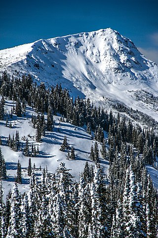
Garibaldi Provincial Park, also called Garibaldi Park, is a wilderness park located on the coastal mainland of British Columbia, Canada, 70 kilometres (43.5 mi) north of Vancouver. It was established in 1920 and named a Class A Provincial Park of British Columbia in 1927. The park is a popular destination for outdoor recreation, with over 30,000 overnight campers and over 106,000 day users in the 2017/2018 season.

Mount Burke, 1,270 m (4,167 ft), is a mountain located in northeast Coquitlam, British Columbia, north of Port Coquitlam on the ridge system leading to Coquitlam Mountain. Most of the mountain is part of Pinecone Burke Provincial Park. Mount Burke is found in Coquitlam near Minnekhada Regional Park.

Golden Ears is the name of the double summit that lies north of Maple Ridge, British Columbia and is visible from most of the western Lower Mainland. The mountain is in Golden Ears Provincial Park, and was originally referred to as Golden Eyries, possibly for golden eagles that were observed near the summit. There is confusion about the name, because of the twin summits the peak exhibits. Many people believe that the mountain is named because it looks like ears which become golden in the sunset light.

A national mapping agency (NMA) is an organisation, usually publicly owned, that produces topographic maps and geographic information of a country. Some national mapping agencies also deal with cadastral matters.

The Britannia Range is a small mountain range of the Coast Mountains that runs along the eastern shore of Howe Sound just north of Vancouver, British Columbia, Canada. It is a subrange of the Pacific Ranges and often considered part of the North Shore Mountains. The range is bounded by the Howe Sound to the west, the Stawamus River to the north, Loch Lomond on the upper Seymour River to the east, and Deeks Lake to the south. However, some official maps extend the range further south of these boundaries and many local sources such as hiking guidebooks will often include all of the peaks along the Howe Sound between Deeks Lake and Cypress Mountain as part of the range.
Classy Creek is a tributary of the Tuya River in northwest part of the province of British Columbia, Canada. It flows generally southeast and south roughly 20 km (12 mi) to join the Tuya River about 10 km (6.2 mi) north of the Tuya River's confluence with the Stikine River in the Grand Canyon of the Stikine, near Telegraph Creek Road, unofficially called Highway 51, a spur of the Stewart–Cassiar Highway.
Kaha Creek is a tributary of the Koshin River in northwest part of the province of British Columbia, Canada. It flows generally northwest for roughly 30 km (19 mi) to join the Koshin River about 3.8 km (2.4 mi) north of Hatin Lake, and about 6 km (3.7 mi) north of Callison Ranch. Kaha Creek's watershed covers 95.1 km2 (36.7 sq mi), and its mean annual discharge is estimated at 1.19 m3/s (42 cu ft/s). The mouth of Kaha Creek is located about 93 km (58 mi) north of Telegraph Creek, British Columbia, about 165 km (103 mi) east of Juneau, Alaska, and about 103 km (64 mi) west of Dease Lake, British Columbia. Kaha Creek's watershed's land cover is classified as 41.1% conifer forest, 40.2% shrubland, 12.3% barren, and small amounts of other cover.
Lost Creek is a tributary of the Koshin River in northwest part of the province of British Columbia, Canada. It flows generally northwest for roughly 26 km (16 mi) to join the Koshin River just north of Hatin Lake, and about 4 km (2.5 mi) north of Callison Ranch. Lost Creek's watershed covers 70.0 km2 (27.0 sq mi), and its mean annual discharge is estimated at 1.07 m3/s (38 cu ft/s). The mouth of Lost Creek is located about 90 km (56 mi) north of Telegraph Creek, British Columbia, about 102 km (63 mi) west of Dease Lake, British Columbia, and about 163 km (101 mi) east of Juneau, Alaska. Lost Creek's watershed's land cover is classified as 46.3% shrubland, 31.5% conifer forest, 12.2% barren, and small amounts of other cover.
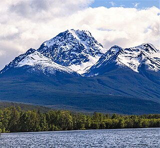
Whitesaddle Mountain is a summit located in British Columbia, Canada.
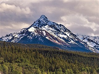
Blackhorn Mountain is a summit located in British Columbia, Canada.
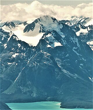
Mount Farrow is a mountain summit in British Columbia, Canada.

Spire Peaks is a 2,279-metre (7,477-foot) mountain located in British Columbia, Canada.

Purity Mountain is a 3,149-metre (10,331-foot) summit in British Columbia, Canada.
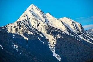
Mount Loki is a 2,779-metre (9,117-foot) mountain summit located in British Columbia, Canada.

Corrie Peak is a 2,263-metre (7,425-foot) summit in British Columbia, Canada.
Old Glory Mountain is a 2,376-metre (7,795-foot) summit in British Columbia, Canada.
References
- ↑ "BC Basemap". Archived from the original on 2012-12-03. Retrieved 2014-04-29.
- Exploring the Coast Mountains on Skis" by John Baldwin ISBN 978-0-9691550-3-4, page 17
- Official website
| | This article about an organization in Canada is a stub. You can help Wikipedia by expanding it. |