
The Orange River is a river in Southern Africa. It is the longest river in South Africa. With a total length of 2,432 km (1,511 mi), the Orange River Basin extends from Lesotho into South Africa and Namibia to the north. It rises in the Drakensberg mountains in Lesotho, flowing westwards through South Africa to the Atlantic Ocean. The river forms part of the international borders between South Africa and Lesotho and between South Africa and Namibia, as well as several provincial borders within South Africa. Except for Upington, it does not pass through any major cities. The Orange River plays an important role in the South African economy by providing water for irrigation and hydroelectric power. The river was named the Orange River in honour of the Dutch ruling family, the House of Orange, by the Dutch explorer Robert Jacob Gordon. Other names include simply the word for river, in Khoekhoegowab orthography written as !Garib, which is rendered in Afrikaans as Gariep River with the intrusion of a velar fricative in place of the alveolar click, Groote River or Senqu River, derived from ǂNū "Black". It is known in isiZulu as isAngqu

The Maputo River, also called Great Usutu River, Lusutfu River, or Suthu River, is a river in South Africa, Eswatini, and Mozambique. The name Suthu refers to Basotho people who lived near the source of the river, but were attacked and displaced by Swazis. It is also said to mean 'dark brown', a description of the river's muddy water.

The Great Kei River is a river in the Eastern Cape province of South Africa. It is formed by the confluence of the Black Kei River and White Kei River, northeast of Cathcart. It flows for 320 km (199 mi) and ends in the Great Kei Estuary at the Indian Ocean with the small town Kei Mouth on the west bank. Historically the Great Kei River formed the southwestern border of the Transkei region as was formerly known as the Nciba River.

British Kaffraria was a British colony/subordinate administrative entity in present-day South Africa, consisting of the districts now known as Qonce and East London. It was also called Queen Adelaide's Province.

The Manjara, also spelled Manjara or Manjeera, is a tributary of the river Godavari. It passes through the states of Maharashtra, Karnataka and Telangana. It originates in the Balaghat range of hills near Ahmednagar district at an altitude of 823 metres (2,700 ft) and empties into the Godavari River. It has a total catchment area of 30,844 square kilometres (3,084,400 ha).
Tsolwana Nature Reserve is an 8,500 hectare nature reserve situated on the edge of the Winterberg Mountain range. It is located 60 km west of Queenstown, and 30 km south- east of Tarkastad in Eastern Cape Province, South Africa and is managed by Eastern Cape Parks Board. Its western boundary is formed by the upper Black Kei River. The reserve's name originates from the Xhosa word for "spike", due to the presence of the cone-shaped hill, Spitskop.
Mzimvubu to Keiskamma WMA, or Mzimvubu to Keiskamma Water Management Area , includes the following major rivers: the Swane River, Mntafufu River, Mzimvubu River, Mngazi River, Mthatha River, Xora River, Mbashe River, Nqabara River, Gqunube River, Buffalo River, Nahoon River, Groot Kei River and Keiskamma River, and covers the following Dams:
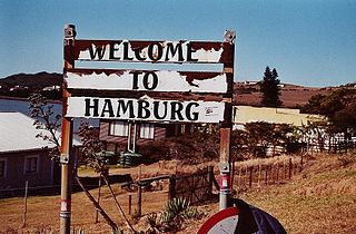
Hamburg is a small town with about 1000 inhabitants in the Eastern Cape province, in South Africa. It is located on the coast between the city of East London and the town of Port Alfred.
The Komani River, is a river part of the Great Kei River system in the Eastern Cape, South Africa. It is a short river originating north of Queenstown and joining up with the Klaas Smits River, just south of the same town.
The Klaas Smits River is a river part of the Great Kei River system in the Eastern Cape, South Africa. It originates south of Molteno and flows through Sterkstroom, first southwards and then southeastwards before joining up with the Black Kei River. Presently the Klaas Smits River is part of the Mzimvubu to Keiskama Water Management Area.
The White Kei River or Wit-Kei River is a river in the Eastern Cape, South Africa. It originates north of Queenstown, beginning its course as the Grootvleispruit river and eventually joining the Black Kei River, to form the Great Kei River.

Mthatha River or Umtata River is a river in the Eastern Cape Province in South Africa. The river flows into the Indian Ocean in an estuary located near Coffee Bay. The Mthatha river flows in a southeastern direction and is approximately 250 km long with a catchment area of 2,600 km2. Mthatha Town (Umtata) is named after it.

Mzimvubu River or Umzimvubu River is one of the most important rivers in South Africa. It is located in the Eastern Cape Province.

The Keiskamma River is a river in the Eastern Cape Province in South Africa. The river flows into the Indian Ocean in the Keiskamma Estuary, located by Hamburg Nature Reserve, near Hamburg, midway between East London and Port Alfred. The Keiskamma flows first in a southwestern and then in a southeastern direction after meeting its main tributary, the Tyhume River.
Mbhashe River is one of the major rivers in the Eastern Cape Province, South Africa. It flows in a southeastern direction and has a catchment area of 6,030 km2. The river drains into the Indian Ocean through an estuary located near the lighthouse at Bashee, south of Mhlanganisweni.
The Tsitsa River is a river in the Eastern Cape Province, South Africa. It is a tributary of the Mzimvubu River and belongs to the Mzimvubu to Keiskamma Water Management Area.
The Klipplaat River is a river in the Eastern Cape Province of South Africa.
The Dwesa-Cwebe Marine Protected Area is an inshore and offshore conservation region, off the coast of the Dwesa-Cwebe Nature Reserve in the Eastern Cape province, in the territorial waters of South Africa.
The Amathole Offshore Marine Protected Area is an offshore conservation region, alongside the Amathole Marine Protected Area in the territorial waters of South Africa.
The Amathole Marine Protected Area is an inshore conservation region in the territorial waters of South Africa, near East London on the coast of the Eastern Cape.
