


Blackbury Camp, also known as Blackbury Castle, [1] is an Iron Age hill fort in Devon, England. It is managed by English Heritage. [2]
Blackbury Camp, also known as Blackbury Castle, [1] is an Iron Age hill fort in Devon, England. It is managed by English Heritage. [2]
Blackbury Camp is situated to the south west of Southleigh, Devon. It is to the west of Colyton and Seaton, and north of Branscombe. To its north is Wiscombe Park, a Gothic country house and hill climb course. The site is within the East Devon Area of Outstanding Natural Beauty.
Blackbury Camp sits on an east to west ridge overlooking valleys formed by tributaries of the River Coly, [1] some 185 metres (607 ft) above sea level. [3] The camp consists of an oval enclosure, around 200 metres (660 ft) long and 100 metres (330 ft) wide, which is surrounded by a rampart 3 metres (9.8 ft) high and up to 10 metres (33 ft) wide. [4] The rampart was built from clay and flint quarried from a surrounding outer ditch which is up to 12 metres (39 ft) wide. [4] Today the ditch contains up to 2 metres (6.6 ft) of silt, so the earthworks would have looked more imposing with a deeper ditch when they were built. [5]
The camp has a single 5 metres (16 ft) wide entrance on the south side. [4] Originally, the entrance had a gateway with wooden gates, possibly within a wooden gate-tower. [4] The entrance was gravelled using pebbles from a nearby stream suggesting heavy usage was expected in the wetter seasons. [4] The three other entrances are believed to have been built more recently than the Iron Age. [6] In front of the entrance is a triangular earthwork, or barbican, flanked by a bank and ditch. [4] It is not known whether this earthwork was a defensive structure or had a practical use such as holding cattle. [4]
From flint tools found at the site, it is known that the area was in use during the Late Neolithic or Bronze Age. [6] Pottery found within the ramparts indicates that Blackbury Camp was built in the Middle Iron Age between 300 and 100 BC. [5] The camp was likely in use for several hundred years. [4] Some of the pottery finds suggest that activity may have continued as late as the first century BC, but there is no evidence that it was still in use by the time the Romans arrived in Britain. [7] It is unknown whether the barbican was built at the same time as the main enclosure or added later. [8]
Due to their size, it is believed that hill forts like Blackbury were centres for the local community, being large enough to shelter them and their livestock. [6] However, it has also been argued that these camps were the defended homesteads of wealthier members of Iron Age society. [4] It is not known whether the camp was lived in year round or only maintained for major community events. [7] Two spindle whorls, made of local chert, found at the site suggest wool was being worked there, and the presence of iron slag shows that this metal was being smelted or smithed at the camp. [7]
It is unknown what the landscape around the camp looked like during the Iron Age, but it is thought to have been a mix of woods, open grazing land and small fields. [9]
Excavation of Blackbury Camp has been very limited and has not included any use of modern techniques such as geophysical surveying or radiocarbon dating. [10] An excavation of the site was carried out in 1954-5 by Alison Young and Kitty Richardson, focused on the entrance and the area immediately within the enclosure. [5] On the east side of the entrance, evidence was found for a wooden palisade, in the form of a series of post holes 90 centimetres (35 in) apart. [11] Two larger post holes lined with flint on either side of the entrance were large enough to support gates and a walkway above them. [11]
Within the enclosure, the remains of a hut were discovered, as well as a cooking pot, an oven, and Iron Age pottery made from local Greensand clays. [4] A total of 1,271 slingstones, individually weighing between 57g and 78g, were also found, the majority of them near to the entrance. [12] This find suggests that defence was at least one reason for building the camp. [6]

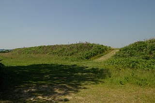
Small Down Knoll, or Small Down Camp, is a Bronze Age hill fort near Evercreech in Somerset, England. The hill is on the southern edge of the Mendip Hills, and rises to 222 m (728 ft).
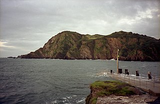
Hillsborough is a local nature reserve in Ilfracombe, North Devon. It is known locally as the sleeping elephant. It was bought by the local council in the late nineteenth century to prevent development on the site. As well as a pleasant coastal area where visitors may roam, it includes the remains of an Iron Age hill fort.

Yarnbury Castle is the site of a multiphase, multivallate Iron Age hillfort near the village of Steeple Langford, Wiltshire, England. The site covers an area of 28.5 acres (11.5 ha), and was extensively surveyed and investigated by the Royal Commission on the Historical Monuments of England in 1991, with finds of Iron Age and Romano-British pottery, Iron Age and Roman coins, and burials of human remains. There is much evidence of prolonged and extensive settlement of the site, including evidence of around 130 structures of various sizes, most probably representing a mix of round houses, pits, and other features. It was designated as a scheduled monument in 1925.
Boringdon Camp is an English Iron Age and Roman earthwork in Cann Woods, near Plympton, Plymouth, Devon. It is a scheduled ancient monument and owned by South Hams District Council.

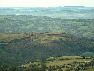
Berry Camp or Berry Cliff, is an Iron Age Hill fort on a partially eroded cliff top close to Branscombe in Devon. The cliff is situated some 140 metres (460 ft) above sea level.
Embury Beacon is the site of an Iron Age promontory fort on the west of the Hartland Peninsula, north of Bude and west of Clovelly, in north Devon. The fort has almost entirely been lost to coastal erosion, but a fraction of the eastern ramparts still exist at approximately 150 metres (490 ft) above Sea Level. It is part of the National Trust property of Bideford Bay and Hartland, which also includes two other hill forts at Windbury Head and Bucks Mills earthworks. The site's name suggests it was the location of a beacon, possibly during the Elizabethan period, but there is no archaeological evidence of this.
Nordy Bank is an Iron Age hill fort on Brown Clee Hill in the Shropshire Hills Area of Outstanding Natural Beauty in South Shropshire, England.

Scratchbury Camp is the site of an Iron Age univallate hillfort on Scratchbury Hill, overlooking the Wylye valley about 1 km northeast of the village of Norton Bavant in Wiltshire, England. The fort covers an area of 37 acres (15 ha) and occupies the summit of the hill on the edge of Salisbury Plain, with its four-sided shape largely following the natural contours of the hill.

Chiselbury is the site of an Iron Age univallate hillfort in Wiltshire, England. The hillfort is sub-circular in plan, and encloses an area of approximately 10.5 acres (460,000 sq ft). It is defined by an earthen rampart up to 3.6 metres (12 ft) in height and an external ditch, up to a maximum of 1.6 metres (5.2 ft) in depth. A gap in the south-eastern side of the rampart, and a corresponding causeway across the ditch, is thought to be the original entrance and is associated with a small D-shaped embanked enclosure, which is apparently visible on aerial photographs. Although the enclosure has subsequently been degraded by ploughing, it is still apparent as a series of low earthworks.

Southleigh is a village and civil parish in the East Devon district of Devon, England. Its nearest town is Colyton, which lies approximately 3 miles (4.8 km) east from the village. Southleigh parish encompasses Wiscombe Park with its hill climb course.

Cholesbury Camp is a large and well-preserved Iron Age hill fort on the northern edge of the village of Cholesbury in Buckinghamshire, England. It is roughly oval-shaped and covers an area, including ramparts, of 15 acres (6.1 ha), and measures approximately 310 m (1,020 ft) north-east to south-west by 230 m (750 ft) north-west to south-east. The interior is a fairly level plateau which has been in agricultural use since the medieval period. The hill fort is now a scheduled ancient monument.

Cornish promontory forts, commonly known in Cornwall as cliff castles, are coastal equivalents of the hill forts and Cornish "rounds" found on Cornish hilltops and slopes. Similar coastal forts are found on the north–west European seaboard, in Normandy, Brittany and around the coastlines of the British Isles, especially in Wales, Scotland and Ireland. Many are known in southwest England, particularly in Cornwall and its neighbouring county, Devon. Two have been identified immediately west of Cornwall, in the Isles of Scilly.

Caesar's Camp is an Iron Age hill fort straddling the border of the counties of Surrey and Hampshire in southern England. The fort straddles the borough of Waverley in Surrey and the borough of Rushmoor and the district of Hart, both in Hampshire. Caesar's Camp is a Scheduled Ancient Monument with a list entry identification number of 1007895. It lies approximately 3 kilometres (1.9 mi) north of the town of Farnham, and a similar distance west of Aldershot. The hillfort lies entirely within the Bourley and Long Valley Site of Special Scientific Interest. Caesar's Camp is a multivallate hillfort, a fort with multiple defensive rings, occupying an irregular promontory, with an entrance on the south side. The site has been much disturbed by military activity, especially at the southeast corner. The remains of the hillfort are considered to be of national importance.
Beacon Hill, also known as Harting Beacon, is a hillfort on the South Downs, in the county of West Sussex in southern England. The hillfort is located in the parish of Elsted and Treyford, in Chichester District. It is a Scheduled Ancient Monument with a list entry identification number of 1015915. The hilltop enclosure is dated to the Late Bronze Age, from the 8th to 6th centuries BC. The hillfort defences were renewed during the Late Iron Age.

Warbstow Bury is an Iron Age hillfort about 0.5 miles (0.80 km) west of the village of Warbstow, in Cornwall, England. It is a scheduled monument.

Castle Goff is an enclosure about 1.5 miles (2.4 km) south-west of Camelford, in Cornwall, England. It is a scheduled monument.

The Martin Down Enclosure is an archaeological site on Martin Down, near the village of Martin, in Hampshire, England. It is near the boundaries with Dorset and Wiltshire.

Thundersbarrow Hill is an archaeological site in West Sussex, England. It is on a chalk ridge, aligned north-west to south-east, on the South Downs north of Shoreham-by-Sea.
South Weald Camp was a hillfort based in South Weald, Brentwood, Essex, England. Roughly circular in plan, the fort covered 2.8 hectares, with a suggested construction date in the late Iron Age, from the 1st century BC to the 1st century AD. The location is associated in this period with the Catuvellauni and the Trinovantes.
Brandon Camp is an archaeological site, about 1 mile south of Leintwardine, in Herefordshire. England. It is a hillfort of the Iron Age, which later became a Roman fort. The site is a scheduled monument.
Young A, Richardson K (1954-5). “Report on the excavation of Blackberry Castle”. Proceedings of the Devon Archaeological Exploration Society. 5: 43–67.
50°43′31″N3°09′10″W / 50.7252°N 3.1527°W
| | This article about a Devon building or structure is a stub. You can help Wikipedia by expanding it. |