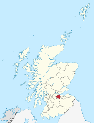
West Lothian is one of the 32 council areas of Scotland, and was one of its historic counties. The county was called Linlithgowshire until 1925. The historic county was bounded geographically by the Avon to the west and the Almond to the east. The modern council area occupies a larger area than the historic county. It was reshaped following local government reforms in 1975: some areas in the west were transferred to Falkirk; some areas in the east were transferred to Edinburgh; and some areas that had formerly been part of Midlothian were added to West Lothian.

Nitshill is a district on the south side of Glasgow. It is bordered by South Nitshill to the south, Darnley to the east, Crookston and Roughmussel to the north-west, Hurlet to the west and Househillwood and Priesthill to the north, with the Pollok district and the Silverburn Centre beyond. An area of open ground to the south-west of Nitshill forms the boundary between Glasgow and the town of Barrhead in East Renfrewshire.

Uphall is a village in West Lothian, Scotland. It is a swiftly growing village in a conurbation with Broxburn to the east, Dechmont to the west and the major town of Livingston to the south west. Uphall is 30 miles from Glasgow and 14 miles from Edinburgh in the Scottish Lowlands. Uphall Station and Pumpherston are separate villages that lie to the south of Uphall.

Bathgate is a town in West Lothian, Scotland, 5 miles (8 km) west of Livingston and adjacent to the M8 motorway. Nearby towns are Armadale, Blackburn, Linlithgow, Livingston, West Calder and Whitburn. Situated 2 miles (3 km) south of the ancient Neolithic burial site at Cairnpapple Hill, Bathgate and the surrounding area show signs of habitation since about 3500 BC and the world's oldest known reptile fossil has been found in the town. By the 12th century, Bathgate was a small settlement, with a church at Kirkton and a castle south of the present day town centre. Local mines were established in the 17th century but the town remained small in size until the coming of the industrial revolution. By the Victorian era, Bathgate grew in prominence as an industrial and mining centre, principally associated with the coal and shale oil industries. By the early 20th century, much of the mining and heavy industry around the town had ceased and the town developed manufacturing industries, principally in vehicle production and later electronics before these factories closed in the late 20th century. Today Bathgate is the second largest town in West Lothian, after Livingston and serves as a regional commuter town within the Scottish Central Belt.

Uddingston is a small town in South Lanarkshire, Scotland. It is on the north side of the River Clyde, south-east of Glasgow city centre, and acts as a dormitory suburb for the city.

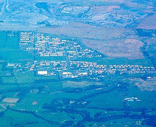
Fauldhouse is a village in West Lothian, Scotland. It is about halfway between Glasgow and Edinburgh. The nearest towns to Fauldhouse are Whitburn and Livingston. Other neighbouring villages include Longridge, Shotts and Stoneyburn. At approximately 750 feet above sea level, Fauldhouse is one of the highest villages in West Lothian.
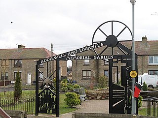
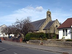
Addiewell is a former mining village in the Scottish council area of West Lothian. Historically it lies within the County of Midlothian. A new prison, HMP Addiewell, opened in 2008.
Carntyne is a suburban district in the Scottish city of Glasgow. It is situated north of the River Clyde, and in the east end of the city. it has formed the core of the East Centre ward under Glasgow City Council, which also includes the neighbouring Riddrie and Cranhill areas.

Carnwath is a moorland village on the southern edge of the Pentland Hills of South Lanarkshire, Scotland. The village lies about 30 mi (50 km) south of both Edinburgh and Glasgow. It is bounded by the North Medwyn and South Medwyn watercourses.

Harthill is a rural village split between North Lanarkshire and West Lothian in Scotland, with most of the village in North Lanarkshire. It is located about halfway between Glasgow, 21 miles to the west, and Edinburgh, 25 miles (40 km) to the east. It lies on the River Almond about 2+1⁄2 miles (4 km) west of the small town of Whitburn. The closest major towns are Bathgate, 6 miles (9.7 km) away, and Livingston, 10 miles (16 km) away. Major towns within North Lanarkshire, such as Wishaw, Airdrie, Motherwell, Coatbridge and Bellshill are all around 10 to 15 miles to the west. The M8 motorway bypasses the village and Harthill has a service station named after it.
Plains is a village outside the town of Airdrie, in North Lanarkshire, Scotland, about 14 miles (23 km) east of Glasgow city centre and 32 miles (51 km) west of Edinburgh. The nearest major towns are Airdrie and Coatbridge. The village is west of Caldercruix and the North Calder Water. The population is about 2,740.

Armadale is a town within the county of West Lothian in the Central Belt of Scotland. It lies to the west of Bathgate and to the east of Blackridge. Armadale, formerly known as Barbauchlaw, is an ex-mining town which was also known for its brick manufacturing. It is named after Armadale in Sutherland, this estate being owned by Sir William Honeyman who later acquired the land of Barbauchlaw. Primarily a residential community, the town has a number of different public places, a central Mains Street and a series of parks, green spaces and nature reserves, many of which lie atop former mines and industrial areas.

The Airdrie–Bathgate rail link is a completed railway project in central Scotland.

Mid Calder is a village in West Lothian, Scotland. It is located on a steep hill overlooking the River Almond and Calder Wood, around 15 miles (24 km) west of Edinburgh. The settlement has been on a major crossroads since its origin some time in the 11th century.

Newbridge is a village within the parish of Kirkliston, to the west of Edinburgh, Scotland. It originally lay on the western edge of the county of Midlothian; however, local government reforms in the late 20th century placed it within the City of Edinburgh council area.

Torphichen is a historic small village located north of Bathgate in West Lothian, Scotland. The village is approximately 18 miles (29 km) west of Edinburgh, 7 miles (11 km) south-east of Falkirk and 4 miles (6.4 km) south-west of Linlithgow. The village had a population of 570 in the and a population of 710 in 2016. Torphichen's placename may be Gaelic in origin, e.g., "Tóir Féichín", Tor Fithichean, or partly from Brythonic "tre fychan" or small hill.
The Monkland Railways was a railway company formed in 1848 by the merger of three "coal railways" that had been built to serve coal and iron pits around Airdrie in Central Scotland, and connect them to canals for onward transport of the minerals. The newly formed company had a network stretching from Kirkintilloch to Causewayend, near Linlithgow. These coal railways had had mixed fortunes; the discovery of blackband ironstone and the development of the iron smelting industry around Coatbridge had led to phenomenal success, but hoped-for mineral discoveries in the moorland around Slamannan had been disappointing. The pioneering nature of the railways left them with a legacy of obsolete track and locomotives, and new, more modern, railways were being built around them.

Blackridge railway station is a railway station on the North Clyde Line. It serves the village of Blackridge in West Lothian, Scotland.

Glenboig is a village in North Lanarkshire, Scotland lying north of Coatbridge and to the south east of Kirkintilloch and is approximately ten miles from Glasgow City Centre. According to a 2020 estimate, the population of Glenboig was 2,990.

Westcraigs railway station served the area of West Craigs (Blackridge) in West Lothian, Scotland, from 1862 to 1956 on the Bathgate and Coatbridge Railway.