
North Smithfield is a town in Providence County, Rhode Island, United States, settled as a farming community in 1666 and incorporated into its present form in 1871. North Smithfield includes the historic villages of Forestdale, Primrose, Waterford, Branch Village, Union Village, Park Square, and Slatersville. The population was 12,588 at the 2020 census.

The Blackstone Valley or Blackstone River Valley is a region of Massachusetts and Rhode Island. It was a major factor in the American Industrial Revolution. It makes up part of the Blackstone River Valley National Heritage Corridor and National Historical Park.
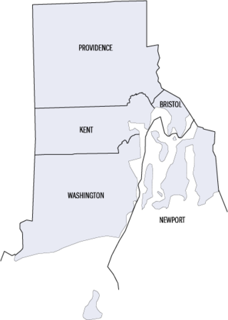
This is a list of properties and districts listed on the National Register of Historic Places in Rhode Island. As of May 29, 2015, there are more than 750 listed sites in Rhode Island. All 5 of the counties in Rhode Island have listings on the National Register.

The Blackstone Canal was a waterway linking Worcester, Massachusetts, to Providence, Rhode Island through the Blackstone Valley via a series of locks and canals during the early 19th century. Construction was started in 1825, and the canal opened three years later. Following the opening of the Boston and Providence Railroad in 1835, the canal struggled for business. It was ultimately replaced by the Providence and Worcester Railroad, which completed a parallel line in 1847. The canal shut down in 1848. Several segments of the canal are preserved, with the canal alignment and remains listed on the National Register of Historic Places.

Blackstone is a predominantly residential neighborhood in Providence, Rhode Island. It is in the northeast corner of the city and is bounded to the south and west by Lloyd Avenue and Hope Street respectively. It is one of six neighborhoods comprising the East Side of Providence.
The East Side is a collection of neighborhoods in the eastern part of the city of Providence, Rhode Island. It officially comprises the neighborhoods of Blackstone, Hope, Mount Hope, College Hill, Wayland, and Fox Point.

Slatersville is a village on the Branch River in the town of North Smithfield, Rhode Island, United States. It includes the Slatersville Historic District, a historic district listed on the National Register of Historic Places. The historic district has been included as part of the Blackstone River Valley National Historical Park. The North Smithfield Public Library is located in Slatersville.

This is a list of the National Register of Historic Places listings in Providence County, Rhode Island.
Albion is a village and historic district in Lincoln, Rhode Island, in the United States.
Lonsdale is a village and historic district in Lincoln and Cumberland, Providence County, Rhode Island, United States, near Rhode Island Route 146 and Route 95. The village was originally part of the town of Smithfield until Lincoln was created in the 1870s, and was originally centered on the Lincoln side of the Blackstone River. William Blaxton settled in the area in 1635. In the nineteenth and early twentieth centuries, Lonsdale was home to several manufacturers including the Lonsdale Company's Bleachery, and the Ann & Hope mill was also located in the village in Cumberland.

This is a list of the National Register of Historic Places listings in Providence, Rhode Island.
The Blackstone Boulevard Realty Plat Historic District is a historic district roughly bounded by Blackstone Blvd., Rochambeau Ave., Holly St. and Elmgrove Ave. in Providence, Rhode Island.

Butler Hospital is a private, non-profit, psychiatric and substance abuse hospital for adolescents, adults, and seniors, located at 345 Blackstone Boulevard in Providence, Rhode Island. The hospital is affiliated with the Warren Alpert Medical School of Brown University, and is the flagship for Brown University's renowned department of psychiatry. Butler Hospital was a founding member, along with Women & Infants Hospital and Kent Hospital, of the Care New England health system in 1996.

Constance Witherby Park is an historic park at 210 Pitman Street, Wayland, Providence, Rhode Island. It was added to the National Register of Historic Places in 1975.

The Wayland Historic District is a predominantly residential historic district on the east side of Providence, Rhode Island. It is a large area, covering about 122 acres (49 ha), bounded roughly on the north by Everett and Laurel Avenues, on the east by Blackstone Boulevard and Butler Avenue, on the west by Arlington Avenue, and on the south by Angell and South Angell Streets. This area, which was in the 19th century part of the Moses Brown farm, was platted for development in 1891, with most of the construction taking place in the early decades of the 20th century. Most of the residential properties in the district are single-family houses, typically built in revival styles popular at the time. They are set on similarly sized lots with fairly uniform setbacks, and were typically built without garages. There are a number of two-family houses, and a small number of apartment buildings, most of which are found on the arterial roads of the area. There are several religious buildings, including several churches; the most architecturally distinctive religious building is the Jewish Temple Beth El, built 1951–54.

The Blackstone Boulevard–Cole Avenue–Grotto Avenue Historic District is a predominantly residential historic district roughly bounded by Blackstone Boulevard, Cole Avenue, Grotto Avenue, President and Rochambeau Avenues on the east side of Providence, Rhode Island. It encompasses one of the last areas of the city be developed residentially. Covering about 100 acres (40 ha), most of its building stock was built between about 1889 and the 1940s, with a notable building spurt taking place in the 1920s. The architecture in the area is heterogeneous, with Colonial and Georgian Revival styles predominating. The area was developed after the city built Blackstone Boulevard with the intention of developing the area into a streetcar suburb.

Blackstone River Valley National Historical Park is a National Park Service unit in the states of Rhode Island and Massachusetts. The park was created for the purpose of preserving, protecting, and interpreting the industrial heritage of the Blackstone River Valley and the urban, rural, and agricultural landscape of that region. The Blackstone River Valley was the site of some of the earliest successful textile mills in the United States, and these mills contributed significantly to the earliest American Industrial Revolution. The subsequent construction of the Blackstone Canal, a few years after the successful completion of the Erie Canal, helped to sustain the region's industrial strength.

This is a list of National Register of Historic Places listings in Woonsocket, Rhode Island.

The Blackstone Park Conservation District is a public, 45-acre woodland conservation area on the East Side of Providence, Rhode Island. It is run by the non-profit Blackstone Parks Conservancy in partnership with the Providence Parks Department. The park is situated on the west bank of the tidal Seekonk River, the northernmost part of Narragansett Bay tidewater. The park lies within the watershed and wildlife corridor of the Blackstone River Valley. Unlike many city parks, it is actively managed as a preserve for the purpose of providing habitats for wildlife and supporting a healthy ecosystem for native flora and fauna.

Blackstone Boulevard Park is a public park and footpath that runs down the center of Blackstone Boulevard on the East Side of Providence, Rhode Island. It is located in the Blackstone neighborhood, an affluent and primarily residential part of Providence. The park is well-used by joggers and dog walkers from the East Side of Providence and surrounding areas. Along with the Blackstone Park Conservation District, it is run in partnership between the non-profit Blackstone Parks Conservancy and the Providence Parks Department. The Conservancy actively maintains the condition of the park and path, as well as planting and caring for the trees and other flora along the path. Blackstone Boulevard is also a part of the National Register of Historic Places, at the boundary of the Blackstone Park Historic District and Blackstone Boulevard Realty Plat Historic District.

