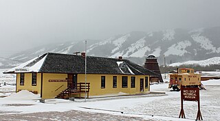
Centennial is a census-designated place (CDP) in Albany County, Wyoming, United States. The population was 270 at the 2010 census.

Cassidy, British Columbia is located south of Nanaimo on Vancouver Island and is home to the Ray Collishaw Air Terminal, Nanaimo's only airfield. It is home to farms and is generally rural. Its proximity to Nanaimo means it provides a short commute for those looking to live away from town. Its 2008 population was 1,002 people.

Princeton is a town in the Similkameen region of southern British Columbia, Canada. It lies just east of the Cascade Mountains, which continue south into Washington, Oregon and California. The Tulameen and Similkameen Rivers converge here. At the 2016 census, the population was 2,828.
Anyox was a small company-owned mining town in British Columbia, Canada. Today it is a ghost town, abandoned and largely destroyed. It is located on the shores of Granby Bay in coastal Observatory Inlet, about 60 kilometres southeast of Stewart, British Columbia, and about 20 kilometres, across wilderness, east of the tip of the Alaska Panhandle.

Keremeos is a village in the Southern Interior of British Columbia, Canada. The name originated from the Similkameen dialect of the Okanagan language word "Keremeyeus" meaning "creek which cuts its way through the flats" referring to Keremeos Creek which flows down from the Upper Benchlands to the Similkameen River that runs by the village. Local legend claims the name means "the meeting of the winds" and joke that the only time it's calm is when the wind blows equally from all four directions. Residents often abbreviate Keremeos as 'K Town', though this nickname is also commonly used to refer to nearby Kelowna and sometimes Kamloops as well.

Coleman is an urban community in the Rocky Mountains within the Municipality of Crowsnest Pass in southwest Alberta, Canada. It was formerly incorporated as a town prior to 1979 when it amalgamated with four other municipalities to form Crowsnest Pass.

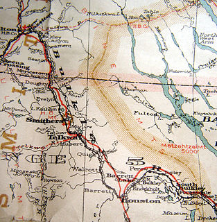
The Bulkley Valley is in the northwest Central Interior of British Columbia, Canada.

Nordegg is a hamlet in west-central Alberta, Canada within Clearwater County. It is located in the North Saskatchewan River valley in the foothills of the Canadian Rockies, just east of the intersection of the David Thompson Highway and the Highway 734 spur of the Bighorn Highway. A former coal-mining town, it was named after Martin Nordegg and the name probably means "North Corner" in a German dialect. The railway station name at the locality was called Brazeau rather than Nordegg at certain points in its history, but the local post office has always been named Nordegg. The name Brazeau is now obsolete.

Coalmont is a tiny mining town, 11 miles (18 km) northwest of Princeton, British Columbia, Canada, on the north bank of the Tulameen River. The population of Coalmont is roughly 100 full-time residents. It is near the community of Tulameen and Otter Lake and the Coldwater Junction of the Coquihalla Highway. The town was established in 1912 to serve as a supply point to the neighbouring coal mine at Blakeburn.

Tulameen, originally known as Otter Flat, is a small community in British Columbia, Canada, about 26 kilometres northwest of the town of Princeton on the Crowsnest Highway, and about 185 kilometres northeast from the city of Vancouver, British Columbia. Located at the south end of Otter Lake and just north of the Tulameen River, it is on the lee side of the Canadian Cascades mountain range and enjoys a slightly semi-arid climate, sheltered from the heavy rains west of that range.
The Similkameen Country, also referred to as the Similkameen Valley or Similkameen District, but generally referred to simply as The Similkameen or more archaically, Similkameen, is a region roughly coinciding with the basin of the river of the same name in the Southern Interior of British Columbia. The term "Similkameen District" also refers to the Similkameen Mining District, a defunct government administrative district, which geographically encompasses the same area, and in more casual terms may also refer to the Similkameen electoral district, which was combined with the Grand Forks-Greenwood riding by the time of the 1966 election. The Similkameen Country has deep historical connections to the Boundary Country and the two are sometimes considered one region, partly as a result of the name of the electoral district. It is also sometimes classed as being part of the Okanagan region, which results from shared regional district and other administrative boundaries and names. The term "Similkameen District" may also historically refer to the Similkameen Division Yale Land District, which also includes Osoyoos and the Boundary Country to Osoyoos' east.

Blue Heron, also known as Mine 18, is a former coal mining community or coal town on the banks of the Big South Fork of the Cumberland River in McCreary County, Kentucky, United States, that has been recreated and is maintained as an interpretive history area in the Big South Fork National River and Recreation Area.

Allenby was an important copper-mining company town in the Similkameen Country of the Southern Interior of British Columbia, Canada, just south of the town of Princeton. It was for a short time the location of the Copper Mountain post office but that name was reinstated to its original site when the neighbouring Copper Mountain mining town, affiliated with the same mine, was revived.

Kitsault is an unincorporated settlement on the North Coast of British Columbia, Canada, at the head of Alice Arm, Observatory Inlet and at the mouth of the Kitsault River. The locality of Alice Arm and the Nisga'a community of Gits'oohl are in the immediate vicinity. "Kitsault" is an adaptation of Gits'oohl, which means "a ways in behind".
The Laramie, North Park and Western Railroad was a railroad in the U.S. states of Wyoming and Colorado between Laramie, Wyoming and Coalmont, Colorado. It operated under several different names between 1901 and 1951 prior to absorption by the Union Pacific Railroad.
The Consolidation Coal Company (CCC) was founded in 1875 in Iowa and purchased by the Chicago and North Western Railroad in 1880 in order to secure a local source of coal. The company operated in south central Iowa in Mahaska and Monroe counties until after World War I. Exhaustion of some resources, competition from overseas markets, and other changes led to the company's closing down its mines and leaving its major planned towns by the late 1920s. The CCC worked at Muchakinock in Mahaska County until the coal resources of that area were largely exhausted. In 1900, the company purchased 10,000 acres (40 km2) in southern Mahaska County and northern Monroe County, Iowa.

Packard is a ghost town in Whitley County, Kentucky, United States. Packard was located 7 miles (11 km) southeast of Williamsburg. It was founded as a mining camp by the Thomas B. Mahan family around 1900. Packard's population is thought to have reached at one point nearly 400 residents. The community was a coal town which served the Packard Coal Company; the community and the company were named after Whitley County school teacher Amelia Packard. Packard once had a railway station on the Louisville and Nashville Railroad as well as a post office, which opened on November 27, 1908.
Corbin is a ghost town in British Columbia, Canada. It was a coal mining community located at the foot of Coal Mountain, south of the Crowsnest Pass in the southern Canadian Rockies.

Nuttallburg was an unincorporated community located in Fayette County, West Virginia, named by English pioneer John Nuttall who discovered coal in the area. Nuttallburg had a post office until 1955. It is no longer inhabited and is just outside Winona.

The Vancouver, Victoria and Eastern Railway was a railway line in British Columbia that was proposed in 1896 and built in stages from 1906 to 1916. It was owned by the Vancouver, Victoria, and Eastern Railway and Navigation Company, a subsidiary of the Great Northern Railway, and was managed by James J. Hill.


