Blo' Norton

Last updated

Blo' Norton
St Andrew Blo Norton - geograph.org.uk - 1229400.jpg
St Andrew's parish church
Norfolk UK location map.svg
Red pog.svg
Blo' Norton
Location within Norfolk
Area4.62 km2 (1.78 sq mi)
Population270 (2001 Census)
  Density 58/km2 (150/sq mi)
OS grid reference TM0179
Civil parish
  • Blo' Norton
District
Shire county
Region
Country England
Sovereign state United Kingdom
Post town Diss
Postcode district IP22
Police Norfolk
Fire Norfolk
Ambulance East of England
UK Parliament
Website Blo' Norton Parish Council
List of places
UK
England
Norfolk
52°22′30″N0°57′28″E / 52.375018°N 0.957870°E / 52.375018; 0.957870

Blo' Norton is a village and civil parish in the Breckland district of Norfolk, England, on the River Little Ouse, about 6+12 miles (10 km) west of Diss. The 2001 Census recorded the parish population as 270 people, living in about 100 households. [1]

Contents

Early history

Blo' Norton's unusual placename is reputedly derived from ‘Blae’, itself derived from Old English and Old Norse words meaning both ‘cold’ and ‘blue’. The ‘blue’ could refer to the woad plant that grows in wetter areas and is a source of traditional blue dye. ‘Norton’ is a settlement on the north side of the river. The first record of 'Blo' added to the name is in 1291, which in Middle English may have meant 'bleak and cold or exposed' or it may have derived from ‘blae’ meaning blue, perhaps from the growth of the woad plants from which a blue dye can be obtained. [2]

Bill Bryson mentioned the placename in his book Notes From A Small Island . The name was also briefly featured in an episode of the Channel 4 television show So Graham Norton .

There is evidence of people living in the area from Anglo-Saxon times, and perhaps from the Romano-British period. Aerial photographs show outlines of buildings and tracks that may be from the Romano-British period, near to Blo' Norton Hall.

Parish church

The Church of England parish church of St Andrew was built in the 13th century, remodelled in the 14th century and restored in 1879. It is a Grade II* listed building. [3]

The west tower has a ring of six bells. Thomas Osborn, who had bell-foundries at Downham Market in Norfolk and St Neots in Cambridgeshire, cast five of the bells including the tenor in 1794. John Warner & Sons of Cripplegate, London cast the treble bell in 1892. [4]

Blo' Norton Hall

Blo' Norton Hall Blo Norton Hall 2 by ICW.jpg
Blo' Norton Hall

Blo' Norton Hall is a timber-framed, moated Tudor manor house at the end of an avenue of lime trees west of St Andrew's church. It was enlarged in Elizabethan style in 1585. It is a Grade II* listed building. [5]

In the summer of 1906 Virginia Woolf (1882–1941) stayed at Blo' Norton Hall. The visit inspired her short story, "The Journal of Miss Joan Martyn". [6] [7]

Blo' Norton and Thelnetham Fen

South of the village and along the river is the Blo' Norton and Thelnetham Fen Site of Special Scientific Interest, an important calcareous fen wetland site supporting rare plant species including black bog rush Schoenus nigricans and saw sedge Cladium mariscus . [8] The Little Ouse Headwaters Project manages part of this area as well as surrounding wetland areas such as Hinderclay Fen and Suffolk Wildlife Trust also has a reserve on part of the site. [9] [10]

Prince Frederick Duleep Singh

Prince "Freddy" Frederick Duleep Singh (1868–1926) lived at Blo' Norton Hall for the last 20 years of his life and is buried in St Andrew's parish churchyard. For this reason Blo' Norton is part of the Anglo-Sikh Heritage trail.

Frogstock festival

The village used to host the Frogstock festival, which was established in 1995 as a local music festival in answer to the perceived over-commercialisation of festivals such as Glastonbury. Frogstock was last held in 2011. [11]

War memorial

Blo' Norton's War Memorial is located at the junction between Church Lane and The Street, and the takes the form of a stone cross with an octagonal base. It was unveiled on 7 November 1920 and was funded by donations from local charities and the people of Blo' Norton. [12] It holds the following names for the First World War:

And, the following for the Second World War:

See also

Related Research Articles

<span class="mw-page-title-main">River Little Ouse</span> River in east England

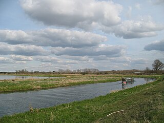
The River Little Ouse, also known as the Brandon River, is a river in the east of England, a tributary of the River Great Ouse. For much of its length it defines the boundary between Norfolk and Suffolk.

<span class="mw-page-title-main">Welney</span> Human settlement in England

Welney is a village and civil parish in the Fens of England and the county of Norfolk. The village is about 10 miles (16 km) south-west of the town of Downham Market, 20 miles (30 km) south of the town of King's Lynn and 45 miles (70 km) west of the city of Norwich. The county boundary with Cambridgeshire is adjacent, with the city of Cambridge 25 miles (40 km) to the south.

<span class="mw-page-title-main">Soham</span> Human settlement in England

Soham is a town and civil parish in the district of East Cambridgeshire, in Cambridgeshire, England, just off the A142 between Ely and Newmarket. Its population was 12,336 at the 2021 census.

<span class="mw-page-title-main">Denver, Norfolk</span> Human settlement in England

Denver is a village and civil parish in the English county of Norfolk. The village is situated on the River Great Ouse, approximately 1 mile (1.6 km) south of the small town of Downham Market, 14 miles (23 km) south of the larger town of King's Lynn, and 37 miles (60 km) west of the city of Norwich.

<span class="mw-page-title-main">Downham Market</span> Market town in Norfolk, England

Downham Market, sometimes simply referred to as Downham, is a market town and civil parish in Norfolk, England. It lies on the edge of the Fens, on the River Great Ouse, approximately 11 miles south of King's Lynn, 39 miles west of Norwich and 30 miles north of Cambridge.

<span class="mw-page-title-main">Barton Bendish</span> Village and a civil parish in the English county of Norfolk

Barton Bendish is a civil parish and small ancient village in the English county of Norfolk located 10 miles (16 km) south of King's Lynn and 90 miles (140 km) North East of London. It has two medieval parish churches, and once had three. The parish includes the old hamlet of Eastmoor, and covers 3,936 acres (1,593 ha). The village has been settled since Neolithic times and was expanded during the Saxon period. Today the village has a population of 210 as recorded at the 2010 census and contains eight listed buildings, with the two medieval parishes churches being Grade I.

<span class="mw-page-title-main">Wissett</span> Human settlement in England

Wissett is a village and civil parish in the English county of Suffolk. It is 2 miles (3.2 km) north-east of the market town of Halesworth in the East Suffolk district. Historically, it was in the Blything Hundred.

<span class="mw-page-title-main">Angles Way</span> Long-distance footpath in England

The Angles Way is a long-distance footpath in England, close to the River Waveney and River Little Ouse and thus close to the Norfolk/Suffolk border between Great Yarmouth and Thetford.

<span class="mw-page-title-main">Hilgay</span> Human settlement in England

Hilgay is a village and civil parish in Norfolk, England, 4 miles (6 km) south of Downham Market. The parish covers an area of 33.38 km2 (12.89 sq mi) and had a population of 1,341 at the 2011 Census. For local government purposes, it falls within the district of King's Lynn and West Norfolk.

<span class="mw-page-title-main">Fordham, Norfolk</span> Human settlement in England

Fordham is a small village and civil parish in the English county of Norfolk. The village is located 2.2 miles (3.5 km) north of Downham Market and 39 miles (63 km) west of Norwich, located along the A10 between London and King's Lynn and close to the confluence of the River Wissey and River Great Ouse.

The Little Ouse Headwaters Project (LOHP) was set up in 2002 by local residents to promote conservation and enjoyment of the fenland habitats bordering the upper reaches of the River Little Ouse, which lies on the Norfolk-Suffolk border. The site lies between Blo' Norton in Norfolk and Thelnetham in Suffolk. It includes a number of areas including Hinderclay Fen, Blo' Norton Fen, Betty's Fen, The Frith, Blo' Norton Lowes, Blo' Norton Little Fen and Parker's Piece. The area also include parts of the Blo' Norton and Thelnetham Fen Site of Special Scientific Interest (SSSI).

<span class="mw-page-title-main">Witchford</span> Human settlement in England

Witchford is a village and civil parish about 2.5 miles (4 km) west of Ely, Cambridgeshire, England. The 2011 Census recorded the parish's population as 2,385.

<span class="mw-page-title-main">Elveden</span> Village in Suffolk, England

Elveden is a village and civil parish in the West Suffolk district of Suffolk in eastern England. In 2005 it had a population of 270. The village is bypassed by the A11 between Cambridge and Norwich, which ran through the centre of the village prior to 2014.

<span class="mw-page-title-main">Hinderclay</span> Human settlement in England

Hinderclay is a village and civil parish in the Mid Suffolk district of Suffolk in eastern England. The village is located around 14 miles (23 km) - from Bury St Edmunds in an area of rolling arable land to the south of the Little Ouse river valley. Neighbouring villages include Thelnetham and Rickinghall. In 2005 its population was 340. The parish also contains the hamlet of Thorpe Street.

<span class="mw-page-title-main">Thelnetham</span> Human settlement in England

Thelnetham is a village and civil parish in the West Suffolk district of Suffolk in eastern England. Located on the southern bank of the River Little Ouse, six miles west of Diss, in 2005 its population was 230. The village of Blo' Norton lies on the Norfolk side of the river. The name of the village derives from the Old English words "thel" which means a plank bridge, "elfitu" meaning swans and "hamm" meaning a meadow or enclosure. Hence the village is the "meadow with the plank bridge and the swans".

<span class="mw-page-title-main">Outwell</span> Human settlement in England

Outwell is a village and civil parish in the borough of King's Lynn and West Norfolk, in the English county of Norfolk.

<span class="mw-page-title-main">West Walton</span> Human settlement in England

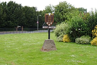
West Walton is a village and civil parish in the King's Lynn and West Norfolk District of Norfolk, England.

<span class="mw-page-title-main">Blo' Norton and Thelnetham Fens</span>

Blo' Norton and Thelnetham Fens are a 21.3-hectare (53-acre) biological Site of Special Scientific Interest (SSSI) on the Norfolk/Suffolk border. Blo' Norton Fen is in the parish of Blo' Norton in Norfolk and Thelnetham Fen is in Thelnetham parish in Suffolk. It is a Nature Conservation Review site, Grade 2, and part of the Waveney and Little Ouse Valley Fens Special Area of Conservation, Thelnetham Fen is managed by the Suffolk Wildlife Trust and Blo' Norton Fen by the Little Ouse Headwaters Project (LOHP).

Laurence Arthur Turner FSA was an English artisan and master craftsman.

<span class="mw-page-title-main">Albert Powys</span> British architect (1881–1936)

Albert Reginald Powys CBE (1881–1936) was an architect and Secretary of the Society for the Protection of Ancient Buildings for some 25 years in the early 20th century.

References

  1. "Census population and household counts for unparished urban areas and all parishes". Norfolk County Council. Archived from the original on 11 February 2017. Retrieved 20 June 2009.
  2. "Blo Norton" (PDF). www.access.arch.cam.ac.uk. Retrieved 15 March 2021.
  3. Historic England. "Church of St Andrew (Grade II*) (1077440)". National Heritage List for England . Retrieved 1 December 2017.
  4. Dawson, George (8 April 2011). "Blo' Norton S Andrew". Dove's Guide for Church Bell Ringers . Central Council of Church Bell Ringers . Retrieved 1 December 2017.
  5. Historic England. "Blo' Norton Hall (Grade II*) (1077439)". National Heritage List for England . Retrieved 1 December 2017.
  6. Squier, Susan M; DeSalvo, Louise A (Autumn–Winter 1979). "Virginia Woolf's The Journal of Mistress Joan Martyn". Twentieth Century Literature. 25 (3/4, Virginia Woolf Issue): 237–269. doi:10.2307/441323. JSTOR   441323.
  7. "Blo' Norton". Literary Norfolk. Retrieved 1 December 2017.
  8. "Site Name: Blo' Norton and Thelnetham Fen" (PDF). Natural England. Archived from the original (PDF) on 8 May 2014. Retrieved 31 January 2013.
  9. "Our sites". Little Ouse Headwaters Project. Retrieved 31 January 2013.
  10. "Thelnetham Fen". Suffolk Wildlife Trust. Archived from the original on 18 February 2013. Retrieved 31 January 2013.
  11. "Frogstock Festival" . Retrieved 1 December 2017.
  12. Imperial War Memorial. (2022). Retrieved November 6, 2022. https://www.iwm.org.uk/memorials/item/memorial/19713

Further reading