Bloomsbury is a district in the West End of London, part of the London Borough of Camden in England. It is considered a fashionable residential area, and is the location of numerous cultural, intellectual, and educational institutions. Bloomsbury is home of the British Museum, the largest museum in the United Kingdom, and several educational institutions, including University College London and a number of other colleges and institutes of the University of London as well as its central headquarters, the New College of the Humanities, the University of Law, the Royal Academy of Dramatic Art, the British Medical Association and many others. Bloomsbury is an intellectual and literary hub for London, as home of world-known Bloomsbury Publishing, publishers of the Harry Potter series, and namesake of the Bloomsbury Group, a group of British intellectuals which included author Virginia Woolf, biographer Lytton Strachey, and economist John Maynard Keynes.

Covent Garden is a district in London, on the eastern fringes of the West End, between St Martin's Lane and Drury Lane. It is associated with the former fruit-and-vegetable market in the central square, now a popular shopping and tourist site, and with the Royal Opera House, itself known as "Covent Garden". The district is divided by the main thoroughfare of Long Acre, north of which is given over to independent shops centred on Neal's Yard and Seven Dials, while the south contains the central square with its street performers and most of the historical buildings, theatres and entertainment facilities, including the London Transport Museum and the Theatre Royal, Drury Lane.
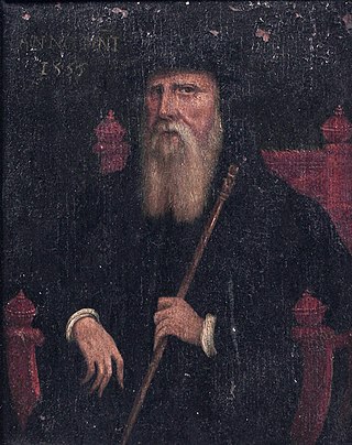
John Russell, 1st Earl of Bedford was an English royal minister in the Tudor era. He served variously as Lord High Admiral and Lord Privy Seal. Among the lands and property he was given by Henry VIII after the Dissolution of the Monasteries, were the Abbey and town of Tavistock, and the area that is now Covent Garden. Russell is the ancestor of all subsequent Earls and Dukes of Bedford and Earls Russell, including John Russell, Prime Minister of the United Kingdom, and philosopher Bertrand Russell.

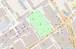
Russell Square is a large garden square in Bloomsbury, in the London Borough of Camden, built predominantly by the firm of James Burton. It is near the University of London's main buildings and the British Museum. Almost exactly square, to the north is Woburn Place and to the south-east is Southampton Row. Russell Square tube station sits to the north-east.

Tavistock Square is a public square in Bloomsbury, in the London Borough of Camden near Euston Station.

Gordon Square is a public park square in Bloomsbury, London, England. It is part of the Bedford Estate and was designed as one of a pair with the nearby Tavistock Square. It is owned by the University of London.

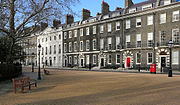
Bedford Square is a garden square in the Bloomsbury district of the Borough of Camden in London, England.

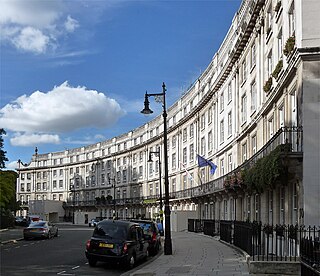
Belgrave Square is a large 19th-century garden square in London. It is the centrepiece of Belgravia, and its architecture resembles the original scheme of property contractor Thomas Cubitt who engaged George Basevi for all of the terraces for the 2nd Earl Grosvenor, later the 1st Marquess of Westminster, in the 1820s. Most of the houses were occupied by 1840. The square takes its name from one of the Duke of Westminster's subsidiary titles, Viscount Belgrave. The village and former manor house of Belgrave, Cheshire, were among the rural landholdings associated with the main home and gardens of the senior branch of the family, Eaton Hall. Today, many embassies occupy buildings on all four sides.
Euston Square is a large square in the London Borough of Camden in Central London. It lies on Euston Road, and Euston railway station and Euston bus station are on its northernmost side. Although “Euston Square” strictly refers to the square, in day to day use the name is often used to refer to Euston Square tube station, whose entrance is at the junction of Euston Road and North Gower Street. The southern half of the square was built over in the 1920s, leaving Euston Square Gardens on the north side in front of Euston station.

The A4200 is a major thoroughfare in central London. It runs between the A4 at Aldwych, to the A400 Hampstead Road/Camden High Street, at Mornington Crescent tube station, via Holborn, Bloomsbury, Euston and Somers Town.

Chenies Manor House in the parish of Chenies in Buckinghamshire, England, is a Tudor Grade I listed building once known as Chenies Palace, although it was never a royal seat nor the seat of a bishop. It was held by the Cheney family since 1180 and passed by marriage successively to the Semark and Sapcote families and thence in 1526 to the Russell family, Earls of Bedford, later Dukes of Bedford, by whom it was held for several centuries. Although the Russells soon abandoned Chenies as its main seat in favour of Woburn Abbey in Bedfordshire, Chenies parish church remains the site of the private "Bedford Chapel", the mausoleum still in use by that family.

Lieutenant-Colonel James Burton was an English property developer. The Oxford Dictionary of National Biography identifies him as the most successful property-developer of Regency and of Georgian London, in which he built over 3000 properties in 250 acres.
Wilton Crescent is a street in Belgravia, Central London, comprising a sweeping elegant terrace of Georgian houses and the private communal gardens that the semi-circle looks out upon. The houses were built in the early 19th century and are now Grade II listed buildings. The street is the northern projection of Belgravia and is often taken to fall into the category of London's garden squares.

The Bedford Estate is an estate in central London owned by the Russell family, which holds the peerage title of Duke of Bedford. The estate was originally based in Covent Garden, then stretched to include Bloomsbury in 1669. The Covent Garden property was sold for £2 million in 1913 by Herbrand Russell, 11th Duke of Bedford, to the MP and land speculator Harry Mallaby-Deeley, who sold his option to the Beecham family for £250,000; the sale was finalised in 1918.
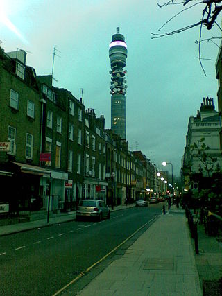
Cleveland Street in central London runs north to south from Euston Road (A501) to the junction of Mortimer Street and Goodge Street. It lies within Fitzrovia, in the W1 post code area. Cleveland Street also runs along part of the border between Bloomsbury (ward) which is located in London Borough of Camden, and West End (ward) in the City of Westminster. In the 17th century, the way was known as the Green Lane, when the area was still rural, or Wrastling Lane, after a nearby amphitheatre for boxing and wrestling.

The coat of arms of the London Borough of Camden were granted on 10 September 1965. The borough was formed by the merger of three former boroughs, namely the Metropolitan Borough of Hampstead, the Metropolitan Borough of Holborn and the Metropolitan Borough of St. Pancras, from whose arms elements were utilised in the arms of the new borough.

In British usage, the term townhouse originally referred to the opulent town or city residence of a member of the nobility or gentry, as opposed to their country seat, generally known as a country house or, colloquially, for the larger ones, stately home. The grandest of the London townhouses were stand-alone buildings, but many were terraced buildings.
This is a list of the etymology of street names in the London district of Bloomsbury. The following utilises the generally accepted boundaries of Bloomsbury viz. Euston Road to the north, Gray's Inn Road to the east, New Oxford Street, High Holborn, Southampton Row and Theobald's Road to the south and Tottenham Court Road to the west.
Bedford House also called Russell House was the Elizabethan and Jacobean London home of the Russell family, Earls of Bedford, situated on the site of the present Southampton Street on the north side of the Strand. It was demolished in 1704 after the family had relocated to Bloomsbury.

Oakley Square is a crescent-shaped garden square in Somers Town in Central London, close to Mornington Crescent and Camden Town. It is located in the London Borough of Camden and runs roughly northeastwards from Eversholt Street meeting with the southern end of Camden Street on its eastern side.