
The Ridgeway is a ridgeway or ancient trackway described as Britain's oldest road. The section clearly identified as an ancient trackway extends from Wiltshire along the chalk ridge of the Berkshire Downs to the River Thames at the Goring Gap, part of the Icknield Way which ran, not always on the ridge, from Salisbury Plain to East Anglia. The route was adapted and extended as a National Trail, created in 1972. The Ridgeway National Trail follows the ancient Ridgeway from Overton Hill, near Avebury, to Streatley, then follows footpaths and parts of the ancient Icknield Way through the Chiltern Hills to Ivinghoe Beacon in Buckinghamshire. The National Trail is 87 miles (140 km) long.

Oxfordshire is a ceremonial county in South East England. The county is bordered by Northamptonshire and Warwickshire to the north, Buckinghamshire to the east, Berkshire to the south, and Wiltshire and Gloucestershire to the west. The city of Oxford is the largest settlement and county town.

The Uffington White Horse is a prehistoric hill figure, 110 m (360 ft) long, formed from deep trenches filled with crushed white chalk. The figure is situated on the upper slopes of Whitehorse Hill in the English civil parish of Uffington, some 10 mi (16 km) east of Swindon, 5 mi (8.0 km) south of the town of Faringdon and a similar distance west of the town of Wantage; or 1.5 mi (2.4 km) south of Uffington. The hill forms a part of the scarp of the Berkshire Downs and overlooks the Vale of White Horse to the north. The best views of the figure are obtained from the air, or from directly across the Vale, particularly around the villages of Great Coxwell, Longcot, and Fernham.
The Vale of White Horse is a local government district of Oxfordshire in England. It was historically part of Berkshire. The area is commonly referred to as the 'Vale of the White Horse'. It is crossed by the Ridgeway National Trail in its far south, across the North Wessex Downs AONB at the junction of four counties. The northern boundary is defined by the River Thames. The name refers to Uffington White Horse, a prehistoric hill figure.

Westbury White Horse or Bratton White Horse is a hill figure on the escarpment of Salisbury Plain, approximately 1.5 mi (2.4 km) east of Westbury in Wiltshire, England. Located on the edge of Bratton Downs and lying just below an Iron Age hill fort, it is the oldest of several white horses carved in Wiltshire. It was restored in 1778, an action which may have obliterated another horse that had occupied the same slope. A contemporary engraving from around 1772 appears to show a horse facing in the opposite direction that was rather smaller than the present figure. There is, however, no documentation or other evidence for the existence of a chalk horse at Westbury before 1772.

The Big Hill on the Canadian Pacific Railway main line in British Columbia, Canada, was the most difficult piece of railway track on the CPR's route. It was in the rugged Canadian Rockies west of the Continental Divide of the Americas and Kicking Horse Pass. Even though the Big Hill was replaced by the Spiral Tunnels in 1909, the area has long been a challenge to the operation of trains and remains so to this day.
Uffington is a village and civil parish in Oxfordshire, about 4 miles (6.4 km) south of Faringdon and 6 miles (10 km) west of Wantage. The 2011 Census recorded the parish's population as 783. Lying within the historic county boundaries of Berkshire, in 1974 it was transferred for local government purposes to Oxfordshire under the Local Government Act 1972. Uffington is most commonly known for the Uffington White Horse hill figure on the Berkshire Downs in the south of the parish.

Kingston Lisle is a village and civil parish in the Vale of White Horse, England, about 4+1⁄2 miles (7 km) west of Wantage and 5 miles (8 km) south-southeast of Faringdon. The parish includes the hamlet of Fawler, about 1⁄2 mile (800 m) west of Kingston Lisle village. The 2011 Census recorded the parish population as 225. Kingston Lisle was part of Berkshire until the 1974 local government boundary changes transferred the Vale of White Horse to Oxfordshire.

Charney Bassett is a village and civil parish about 4+1⁄2 miles (7 km) north of Wantage and 6 miles (10 km) east of Faringdon in the Vale of White Horse. It was part of Berkshire until the 1974 boundary changes transferred it to Oxfordshire. The 2011 Census recorded the parish population as 314. The River Ock flows through it, and divides here for a mile or so. The alternative name of the river, Charn or Cearn, may have originally applied to the northern arm only.

The A338 is a major primary route in southern England, that runs from the junction with the A35 at Poole in Dorset to the junction with the A420 at Besselsleigh in Oxfordshire, a distance of 84 miles (135 km).

Childrey is a village and civil parish about 2+1⁄2 miles (4 km) west of Wantage in the Vale of White Horse. The parish was part of the Wantage Rural District in Berkshire until the 1974 boundary changes transferred the Vale of White Horse to Oxfordshire. The 2021 Census recorded the parish population as 527.

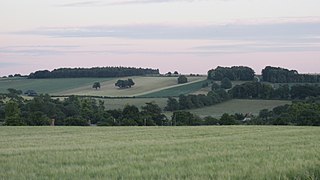
Chain Hill is one of the hills of the Berkshire Downs, located in the civil parish of Wantage in the English county of Oxfordshire. In 1974 it was transferred from Berkshire. It is designated part of the North Wessex Downs Area of Outstanding Natural Beauty by the Countryside Agency and forms part of the Vale of White Horse.
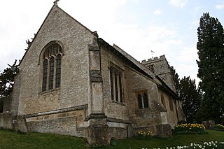
Letcombe Regis is a village and civil parish in the Vale of White Horse. It was part of Berkshire until the 1974 boundary changes transferred the Vale of White Horse to Oxfordshire. The village is on Letcombe Brook at the foot of the Berkshire Downs escarpment about 1 mile (1.6 km) southwest of the market town of Wantage. The 2011 Census recorded the parish population as 578.

Cherhill White Horse is a hill figure on Cherhill Down, 3.5 miles east of Calne in Wiltshire, England. Dating from the late 18th century, it is the third oldest of several such white horses in Great Britain, with only the Uffington White Horse and the Westbury White Horse being older. The figure is also sometimes called the Oldbury White Horse.
Faringdon was a rural district in the administrative county of Berkshire from 1894 to 1974.

Woolstone is a village and civil parish about 4+1⁄2 miles (7 km) south of Faringdon in the Vale of White Horse. Woolstone was part of Berkshire until the 1974 boundary changes transferred it to Oxfordshire. The 2011 Census recorded the parish population as 210.
Sparsholt is a village and civil parish about 3 miles (5 km) west of Wantage in the Vale of White Horse district of Oxfordshire. The parish includes the hamlet of Westcot about 1⁄2 mile (800 m) west of the village. Sparsholt was part of Berkshire until the 1974 boundary changes transferred the Vale of White Horse to Oxfordshire.

Letcombe Bassett is a village and civil parish about 2 miles (3 km) southwest of the market town of Wantage in the Vale of White Horse. It was part of Berkshire until the 1974 boundary changes transferred the Vale of White Horse to Oxfordshire. The 2011 Census recorded the parish population as 148. The village is a spring line settlement, being the source of Letcombe Brook at the foot of the Berkshire Downs escarpment. Hackpen, Warren & Gramp's Hill Downs Site of Special Scientific Interest is in the parish.

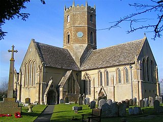
Ardington and Lockinge are two civil parishes in the Vale of White Horse district, centred about 2 miles (3 km) east of Wantage, Oxfordshire, that share a single parish council. The two parishes were part of Berkshire until 1974 when they were transferred to Oxfordshire.

