
Augusta is a consolidated city-county on the central eastern border of the U.S. state of Georgia. The city lies directly across the Savannah River from North Augusta, South Carolina at the head of its navigable portion. Georgia's third most populous city, Augusta is located in the Fall Line section of the state.

Robert Tyre Jones Jr. was an American amateur golfer who was one of the most influential figures in the history of the sport; he was also a lawyer by profession. Jones founded and helped design the Augusta National Golf Club, and co-founded the Masters Tournament. The innovations that he introduced at the Masters have been copied by virtually every professional golf tournament in the world.

Interstate 520 (I-520) is a 23.34-mile (37.56 km) auxiliary Interstate Highway that encircles most of Augusta, Georgia, and North Augusta, South Carolina, as a three-quarter beltway around the western, southern, and eastern parts of the main part of the Augusta metropolitan area. It begins at I-20 and State Route 232 (SR 232) in the northern part of Augusta, Georgia, and ends at I-20 in the northern part of North Augusta, South Carolina. I-520 is also known as Bobby Jones Expressway and the Deputy James D. Paugh Memorial Highway in Georgia and Palmetto Parkway in South Carolina. On the Georgia side, the road also carries the internal designation State Route 415 (SR 415).

State Route 10 (SR 10) is a 172.3-mile-long (277.3 km) state highway in the U.S. state of Georgia. It travels from Downtown Atlanta to the South Carolina state line in Augusta. This highway, along with U.S. Route 78 (US 78), connect three of the biggest metro areas of the state together: Atlanta, Athens, and Augusta. It travels concurrently with US 78 in three sections: from Atlanta to Druid Hills; from near Stone Mountain to near Athens; and from Athens to its eastern terminus, for a total of 149.2 miles (240.1 km), or approximately 86.6 percent of its route.
Central Avenue may refer to:
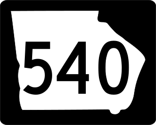
The Fall Line Freeway is a 215-mile-long (346 km) highway designed to span the width of the U.S. state of Georgia from Columbus at the Alabama state line to Augusta, travelling through several cities including Macon, Fort Valley, Sandersville, and Wrens. Though it is called a freeway, it is composed of both limited-access and high-speed divided highway portions. There are also two segments of the highway that are two lanes, separated by a center turn lane: a brief portion in west-central Washington County and another brief portion in northern Jefferson County. As of August 2018, the Fall Line Freeway is 100% open to traffic. Between August 2017 and July 2018, the highway was completed. The Georgia Department of Transportation (GDOT) announced that the highway was officially signed as SR 540 on September 24, 2018, as the newest state route in the state.

U.S. Highway 1 (US 1) in the U.S. state of Georgia, which is concurrent for almost its entire length with State Route 4 (SR 4), is a highway traversing south–north through portions of Charlton, Ware, Bacon, Appling, Toombs, Emanuel, Jefferson, and Richmond counties in the southeastern and east-central parts of the state. In Georgia, the highway originates at US 1/US 23/US 301/State Road 15 (SR 15) at the St. Marys River and the Florida state line, where SR 4 reach their southern terminus. It travels to the Savannah River at South Carolina state line in Augusta where the route continues to North Augusta, South Carolina. Here, SR 10 reaches its eastern terminus.

State Route 4 (SR 4) is a state highway in the eastern part of the U.S. state of Georgia. Except for its northernmost portion, it is completely concurrent for its entire length with U.S. Route 1 (US 1). It traverses south-to-north through portions of Charlton, Ware, Bacon, Appling, Toombs, Emanuel, Jefferson, and Richmond counties in the southeastern and east-central parts of the state. The highway begins at the Florida state line, on US 1/US 23/US 301/SR 15 at the St. Marys River. It travels to its northern terminus at the South Carolina state line, on the Augusta–North Augusta, South Carolina city line, on US 25 Business at the Savannah River.

State Route 28 (SR 28) is a 25.7-mile-long (41.4 km) state highway in the U.S. state of Georgia. It exists in two distinct segments separated by the northern segment of South Carolina Highway 28 (SC 28), which connects the two segments. The southern segment is entirely within the Augusta metropolitan area. The northern segment is located in the northeastern corner of the Chattooga River District of the Chattahoochee–Oconee National Forest. SR 28 consists of Georgia's segments of a multi-state Route 28 that includes two segments of SC 28 and one segment of North Carolina Highway 28 (NC 28). The northern segment is a south-to-north highway and the roadway it uses is unnamed. However, the southern segment is a west-to-east highway, and the roads it uses are known as Furys Ferry Road from the Furys Ferry Bridge at the South Carolina state line to the intersection with SR 104 Conn. in Augusta, Washington Road in the northern part of Augusta, John C. Calhoun Expressway, Greene Street, 5th Street, and Broad Street in downtown Augusta, and Sand Bar Ferry Road in the northeastern part of Augusta.

State Route 56 (SR 56) is an inverted question mark-shaped state highway that travels south-to-north, with a western loop around Vidalia. It is 140.3-mile-long (225.8 km) and travels through portions of Tattnall, Toombs, Montgomery, Treutlen, Emanuel, Burke, and Richmond counties in the southeastern and east-central parts of the U.S. state of Georgia. The route connects the Reidsville and Augusta areas, via Swainsboro and Waynesboro.

State Route 104 (SR 104) is a 22.3-mile-long (35.9 km) state highway in the east-central part of the U.S. state of Georgia. Most of its eastern portion is an urban corridor in the Augusta metropolitan area. It travels within portions of Columbia and Richmond counties. It is known as Washington Road from its western terminus to the Columbia–Richmond county line. On both sides of the county line, it is known as Pleasant Home Road. It is known as Riverwatch Parkway from just west of the county line to the northern part of downtown Augusta. In downtown, it is known as part of Jones Street and Reynolds Street.

In the US state of Georgia, Interstate 20 (I-20) travels from the Alabama state line to the Savannah River, which is the South Carolina state line. The highway enters the state near Tallapoosa. It travels through the Atlanta metropolitan area and exits the state in Augusta. The highway also travels through the cities of Bremen, Douglasville, Conyers, Covington, and Madison. I-20 has the unsigned state highway designation of State Route 402 (SR 402).
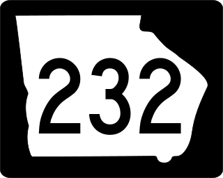
State Route 232 (SR 232) is a 14.3-mile-long (23.0 km) east–west state highway located in the east-central part of the U.S. state of Georgia. It travels through west-central Columbia County and northeastern Richmond County. At its western end, it is a fairly rural highway, but its eastern end is an urban corridor of the Augusta metropolitan area. It connects Appling with Evans, Martinez, and Augusta.

U.S. Route 278 (US 278) in the U.S. state of Georgia is an east–west United States Highway traversing the north-central portion of the state. The highway travels from the Alabama state line near Esom Hill to the South Carolina state line where it crosses the Savannah River in the Augusta metropolitan area.

U.S. Route 25 (US 25) is a U.S. Highway that travels from Brunswick, Georgia to the Kentucky-Ohio state line, where Covington, Kentucky meets Cincinnati, Ohio at the Ohio River. In the U.S. state of Georgia, US 25 is as a 190.0-mile-long (305.8 km) highway that travels south to north in the eastern part of the state, near the Atlantic Ocean, serving Brunswick, Statesboro, and Augusta on its path from Brunswick to South Carolina at the Savannah River. Its routing travels through portions of Glynn, Wayne, Long, Tattnall, Evans, Bulloch, Jenkins, Burke, and Richmond counties.

Georgia State Route 121 (SR 121) is a 238-mile-long (383 km) state highway between Charlton County and Augusta. It is part of a three-state multistate route beginning in Florida and ending in South Carolina.
Several special routes of U.S. Route 25 exist. In order from south to north they are as follows.

Wrightsboro Road is a 45.0-mile-long (72.4 km) major road in the east-central part of the U.S. state of Georgia, traveling through the northwestern part of McDuffie County, the extreme northern part of Warren County, the southeastern part of Wilkes County, the southern part of Columbia County, and the northeastern part of Richmond County.
Wheeler Road is a 7.1-mile-long (11.4 km) major highway in the east-central part of the U.S. state of Georgia, traveling through the southeastern part of Columbia County and the northeastern part of Richmond County. For its entire length, it is an urban corridor of the Augusta metropolitan area. It connects Evans and Martinez with Augusta. Even though Georgia does not sign its county highways, except for on green street signs, Wheeler Road is Columbia County Route 573 (CR 573).
The City of Augusta, Georgia has an expansive transport network. It consists of two airports, various road bridges, national and local bus service, a highway and street network, freight train service, and boat tours and marinas.