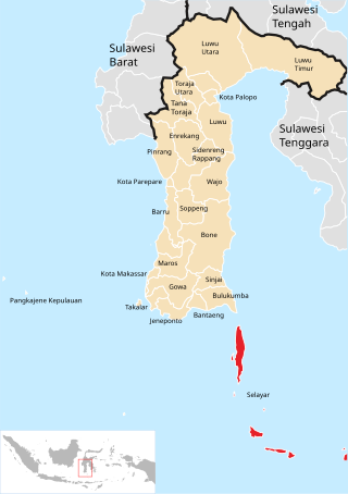
The Selayar Islands Regency is a regency of Indonesia in South Sulawesi province that covers the Selayar Islands, which lie southeast of the southern peninsula of Sulawesi. The archipelago consists of the group's main island, which is surrounded by 41 smaller islands around its coast; further to the southeast lies a widespread group of islands, including the huge atoll of Takabonerate. The regency covers an area of 1,357.03 km2, and had a population of 103,596 at the 2000 Census, 122,055 at the Census of 2010 and 137,071 at that of 2020. The official estimate for mid 2022 was 139,145. The administrative centre is the town of Benteng on Selayar Island. The Selayar Straits separate the regency from Sulawesi island.

Buol Regency is a regency of Central Sulawesi Province of Indonesia. It was created on 4 October 1999, having previously been the eastern half of a larger Buol Tolitoli Regency. It covers an area of 4,043.57 km2, and had a population of 132,330 at the 2010 Census; and 145,254 at the 2020 Census; the official estimate as at mid 2022 was 148,246. The administrative centre is the town of Buol, in Biau District.

Pinrang Regency is one of the twenty-one regencies in South Sulawesi Province of Indonesia. Pinrang town is the administrative capital of Pinrang Regency. The regency covers 1,961.77 km2 and had a population of 351,161 at the 2010 Census and 403,994 at the 2020 Census; the official estimate as at mid 2022 was 411,795.
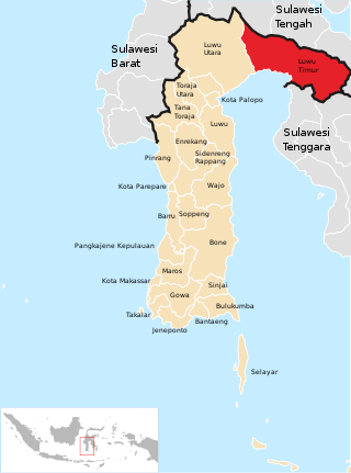
East Luwu Regency is the most easterly of the twenty-one regencies in South Sulawesi Province of Indonesia. The regency was created on 25 February 2003 by separation of the eastern districts from North Luwu Regency. It covers an area of 6,944.88 km2. The administrative capital of the regency is the coastal town of Malili on the Bay of Usu, itself an inlet in the northeast corner of the Gulf of Bone; the town, with its port of Balantang, is the shipping port for one of the world's major nickel-producing plants. The population of the Regency was 243,069 at the 2010 Census and 296,741 at the 2020 Census; the official estimate as at mid 2022 was 305,521.

Sitaro Islands Regency is a regency located off the northern extremity of Sulawesi Island in the southern Sangihe Islands, North Sulawesi Province, Indonesia. The regency was formed under Law Number 15 Year 2007 from 2 January 2007, by separation from the Sangihe Islands Regency of which it had previously formed the southern part. The short form of the name is formed from the those of the three principal islands — Siau, Tagulandang and Biaro.

Paser Regency is a Regency (kabupaten) within East Kalimantan province in Indonesia, it is the southernmost regency of the East Kalimantan province. Its administrative centre is Tana Paser. It covers an area of 7,730 km2, and it had a population of 230,316 at the 2010 Census and 275,452 at the 2020 Census; the official estimate as at mid 2022 was 280,065 . Before 2007, this regency was formerly named Pasir Regency.
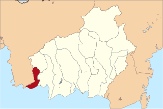
Sukamara Regency is one of the thirteen regencies which comprise the Central Kalimantan Province on the island of Kalimantan (Borneo), Indonesia. It was created on 10 April 2002 from the former southwest part of West Kotawaringin Regency. The town of Sukamara is the capital of Sukamara Regency, which covers an area of 3,827 km2. The population of the Regency was 44,952 at the 2010 Census and 63,464 at the 2020 Census; the official estimate as at mid 2022 was 66,845.

The Pangkajene and Islands Regency, is a regency of South Sulawesi Province of Indonesia. The regency lies primarily on the mainland of Sulawesi's southern peninsula, but also includes the Spermonde Islands off the west coast of that peninsula, as well as other small islands further west and southwest. The principal town lies at Pangkajene on Sulawesi, but there are a series of further small towns like Lejang, Labakkang, Bonto-Bonto and Segeri proceeding northwards from Pangkajene along the Trans-Sulawesi Highway. The total land area is 1,112.29 km2, and the population was 305,737 at the 2010 Census and 345,775 at the 2020 Census; the official estimate as at mid 2022 was 351,426.

Sinjai Regency is a regency of South Sulawesi Province of Indonesia. The regency, whichis separated from the Bone Regency to its north by the River Tangka, covers an area of 819.96 km2. It had a population of 228,936 at the 2010 Census and 259,478 at the 2020 Census; the official estimate as at mid 2022 was 263,827. It includes the Nine Islands in the Gulf of Bone off the east coast of the southern peninsula of Sulawesi; this archipelago forms a district within the regency. The regency's principal town lies at Sinjai, a port situated on the east coast of that peninsula.

Kolaka Regency is a regency of Southeast Sulawesi Province, Indonesia. It covers an area of 2,958.69 km2 and had a population of 208,817 at the 2010 Census, rising to 237,587 at the 2020 Census; the official estimate as at mid 2022 was 246,137. The principal town lies at Kolaka.
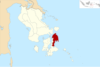
North Buton Regency is a regency of Indonesia's Southeast Sulawesi Province, which was separated from Buton Regency in accordance with Indonesia's Law Number 14 of 2007. The area of the regency, which covers the north part of Buton Island, is 1,923.03 km2. Its population was 54,736 at the 2010 Census and 66,653 at the 2020 Census; the official estimate as at mid 2022 was 69,051. The administrative capital of the regency is at the town of Buranga.

South Konawe Regency is a regency of Southeast Sulawesi Province, Indonesia. It covers an area of 4,237.74 km2 and had a population of 264,587 at the 2010 Census and of 308,524 at the 2020 Census; the official estimate as at mid 2022 was 317,826 - comprising 162,949 males and 154,877 females. The administrative centre is in the town of Andoolo.

The Banggai Archipelago is a group of islands, which are located at the far eastern end of Central Sulawesi, Indonesia. It makes up a regency (kabupaten) of Central Sulawesi Province of Indonesia, created on 4 October 1999 by splitting the existing Banggai Regency into a new Banggai Regency situated on the mainland of Sulawesi and a Banggai Islands Regency then comprising the entire archipelago. On 14 December 2012 a further splitting of the Regency was the removal of the more southerly seven districts to form a new Banggai Laut Regency.
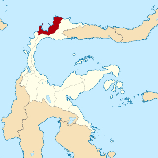
Tolitoli Regency is a regency of Central Sulawesi Province of Indonesia. It was previously part of a larger Buol Tolitoli Regency, but this was split into two on 4 October 1999 after rapid decentralization of the Indonesian government. The present Tolitoli Regency covers an area of 3,701.54 km2 and had a population of 211,296 at the 2010 Census and 225,154 at the 2020 Census; the official estimate as at mid 2022 was 228,641, comprising 116,514 male and 112,127 female inhabitants. Its regency seat is located at the town of Tolitoli, which is a port town and where its population is concentrated.
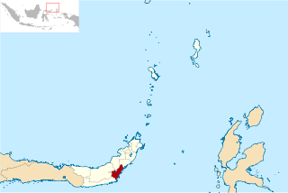
East Bolaang Mongondow Regency is a regency of North Sulawesi Province of Indonesia. It was created on 24 June 2008 by splitting off districts which were previously part of Bolaang Mongondow Regency. It covers an area of 910.18 sq km and had a population of 63,654 at the 2010 Census, rising to 87,241 at the 2020 Census; the official estimate as at mid 2022 was 92,299. The principal town lies at Tutuyan.
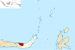
North Bolaang Mongondow Regency is a regency of North Sulawesi Province of Indonesia. It was created on 2 January 2007 by splitting off districts which were previously part of Bolaang Mongondow Regency. The regency covers an area of 1,672.61 km2 and had a population of 70,693 at the 2010 Census and 83,112 at the 2020 Census; the official estimate as at mid 2022 was 84,543. Boroko is the principal town of the regency.

North Minahasa Regency is a regency in North Sulawesi, Indonesia. Its capital is Airmadidi. It was originally part of the Minahasa Regency until it was split off and established as a separate regency on 20 November 2003. It covers an area of 1,059.24 km2, and had a population of 188,904 at the 2010 Census; this had risen to 224,993 at the 2020 Census, and the official estimate as at mid 2022 was 229,368. The Regency includes the offshore islands of Bangka and Talisei to the north of Sulawesi, and Mantenang and Naeng Besar to the northwest.

South Bolaang Mongondow Regency is a regency of North Sulawesi Province of Indonesia. The Regency stretches along the south coast of the province as part of the Minahasa Peninsula, facing the Gulf of Tomini. It was created on 24 June 2008 by splitting off districts which were previously part of Bolaang Mongondow Regency. It covers a land area of 1,932.30 km2, and had a population of 57,001 at the 2010 Census, which rose to 69,791 at the 2020 Census; the official estimate as at mid 2022 was 72,550. The principal town lies at Molibagu.

Southeast Minahasa Regency is a regency in North Sulawesi, Indonesia. Its capital is Ratahan. It covers an area of 710.83 km2, and had a population of 100,443 at the 2010 Census; this had risen to 116,323 at the 2020 Census, and the official estimate as at mid 2022 was 118,023. It was established as a separate regency from part of the South Minahasa Regency on 2 January 2007. Its administrative centre is at Ratahan.
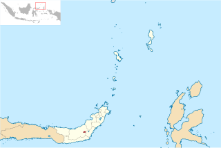
Kotamobagu is a city in North Sulawesi, Indonesia. Having previously been a town within the Bolaang Mongondow Regency, Kotamobagu was separated from that regency on 2 January 2007 to become an autonomous city. It is the principal centre of the southern part of the province, the Bolaang Mongondow region, which is projected by the Indonesian government to be separated from the rest of North Sulawesi and formed into a separate province. The city covers an area of 108.89 km2, and had a population of 107,459 at the 2010 Census, rising to 123,722 at the 2020 Census; the official estimate as at mid 2022 was 123,146.


