Bombooflat

Last updated

Bambooflat
Bamboo Flat
Town
India Andaman and Nicobar Islands location map.svg
Red pog.svg
Bambooflat
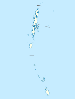
Location in the Andaman and Nicobar Islands
Coordinates: 11°42′18.5″N92°42′54.8″E / 11.705139°N 92.715222°E / 11.705139; 92.715222
CountryFlag of India.svg  India
Union Territory Andaman and Nicobar Islands
District South Andaman
Population
 (2011)
  Total7,962
Time zone UTC+5.30 (IST)
Climate Am

Bambooflat, also known as Bamboo Flat is a village in Ferrargunj Tehsil in South Andaman district of the Andaman and Nicobar Islands, a union territory of India. It is located 17 KM towards North from District headquarters. 1 KM from Ferrargunj. 13 KM from state capital Port Blair. Bambooflat Pin code is 744107 and postal head office is Bambooflat.
Contents

Demographics

[ needs update ] As of the 2011 Census of India, [1] Bambooflat had a population of 7,962. Males constitute 51.4% of the population and females 48.6%. Bambooflat has an average literacy rate of 88.8%. 17.5% of the population is under 6 years of age.

Related Research Articles

<span class="mw-page-title-main">Andaman and Nicobar Islands</span> Union territory of India

The Andaman and Nicobar Islands is a union territory of India consisting of 572 islands, of which 37 are inhabited, at the junction of the Bay of Bengal and the Andaman Sea. The territory is about 150 km (93 mi) north of Aceh in Indonesia and separated from Thailand and Myanmar by the Andaman Sea. It comprises two island groups, the Andaman Islands (partly) and the Nicobar Islands, separated by the 150 km wide Ten Degree Channel, with the Andaman islands to the north of this latitude, and the Nicobar islands to the south. The Andaman Sea lies to the east and the Bay of Bengal to the west. The island chains are thought to be a submerged extension of the Arakan Mountains.

<span class="mw-page-title-main">South Andaman Island</span>

South Andaman Island is the southernmost island of the Great Andaman and is home to the majority of the population of the Andaman Islands. It belongs to the South Andaman administrative district, part of the Indian union territory of Andaman and Nicobar Islands. It is the location of Port Blair, capital of the Andaman and Nicobar Islands.

<span class="mw-page-title-main">Middle Andaman Island</span>

Middle Andaman Island is an island of the Andaman Islands. It belongs to the North and Middle Andaman administrative district, part of the Indian union territory of Andaman and Nicobar Islands.

Nicobar district is one of three districts in the Indian union territory of Andaman and Nicobar Islands. The district's administrative territory encompasses all of the Nicobar Islands, which are located in the Indian Ocean, between the Bay of Bengal and the Andaman Sea. The headquarters of the district is the village of Malacca, located on the island of Car Nicobar.

Ferrargunj is one of five local administrative divisions of the Indian district of Andaman, part of the Indian union territory of Andaman and Nicobar Islands. The name is after Michael Lloyd Ferrar, a commissioner and butterfly collector.

Interview Island is an island of the Andaman Islands. It belongs to the North and Middle Andaman administrative district, part of the Indian union territory of Andaman and Nicobar Islands. It lies 125 km (78 mi) north of Port Blair.

South Andaman district is one of the 3 districts of the Indian Union Territory of Andaman and Nicobar Islands located in the Bay of Bengal. Port Blair, the capital of the Union Territory is the district headquarters. The area covered by this district is 2,640 km².

North and Middle Andaman district is one of the 3 districts of the Indian Union Territory of Andaman and Nicobar Islands located in the Bay of Bengal. Mayabunder town is the district headquarters. The area covered by this district is 3251.85 km2.

Tushnabad is a rural village in Ferrargunj, South Andaman, Andaman and Nicobar Islands. It is adjacent to the Jarawa Reserve

Tapong is a village in the Nicobar district of Andaman and Nicobar Islands, India. It is located on the Nancowry Island, around 10 km from the Champin village, and comes under the administration of the Nancowry tehsil.

7 km Farm is a village in the Nicobar district of Andaman and Nicobar Islands, India. It is located in the Great Nicobar tehsil.

Sastri Nagar is a village in the Nicobar district of Andaman and Nicobar Islands, India. It is located in the Great Nicobar tehsil, around 35 km from Campbell Bay.

East Island is an island of the Andaman Islands. It belongs to the North and Middle Andaman administrative district, part of the Indian union territory of Andaman and Nicobar Islands. The island is located 220 km (137 mi) north from Port Blair.

Curlew Island is an island of the Andaman Islands. It belongs to the North and Middle Andaman administrative district, part of the Indian union territory of Andaman and Nicobar Islands. The island lies 150 km (93 mi) north of Port Blair.

Stewart Island is an island of the Andaman Islands. It belongs to the North and Middle Andaman administrative district, part of the Indian union territory of Andaman and Nicobar Islands. The island lies 150 km (93 mi) north of Port Blair. Its population only consists of two people.

Aves Island is an island of the Andaman Islands. It belongs to the North and Middle Andaman administrative district, part of the Indian union territory of Andaman and Nicobar Islands. The island lies 140 km (87 mi) north from Port Blair.

Kyd Island is an island of the Andaman Islands. It belongs to the South Andaman administrative district, part of the Indian union territory of Andaman and Nicobar Islands. The island lies 30 km (19 mi) north from Port Blair.

James Island is an island of the Andaman Islands. It belongs to the South Andaman administrative district, part of the Indian union territory of Andaman and Nicobar Islands. The island is 30 km (19 mi) north of Port Blair.

Defence Island is an island of the Andaman Islands. It belongs to the South Andaman administrative district, part of the Indian union territory of Andaman and Nicobar Islands. The island is 33.5 km (21 mi) north of Port Blair.

Defence Islands are an island group of the Andaman Islands. It belongs to the South Andaman administrative district, part of the Indian union territory of Andaman and Nicobar Islands. The islands are situated 33.5 km (21 mi) north from Port Blair.

References

  1. "Census of India: Search Details - Bambooflat" . Retrieved 14 November 2021.

Sources