
Greenland is located between the Arctic Ocean and the North Atlantic Ocean, northeast of Canada and northwest of Iceland. The territory comprises the island of Greenland—the largest island in the world—and more than a hundred other smaller islands. Greenland has a 1.2 kilometre long border with Canada on Hans Island. A sparse population is confined to small settlements along certain sectors of the coast. Greenland possesses the world's second largest ice sheet.

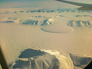
Glacier morphology, or the form a glacier takes, is influenced by temperature, precipitation, topography, and other factors. The goal of glacial morphology is to gain a better understanding of glaciated landscapes and the way they are shaped. Types of glaciers can range from massive ice sheets, such as the Greenland ice sheet, to small cirque glaciers found perched on mountain tops. Glaciers can be grouped into two main categories:
The Aramis Range is the third range south in the Prince Charles Mountains, situated 11 miles southeast of the Porthos Range and extending for about 30 miles in a southwest–northeast direction. First visited in January 1957 by Australian National Antarctic Research Expeditions (ANARE) southern party led by W.G. Bewsher, who named it for a character in Alexandre Dumas' novel The Three Musketeers, the most popular book read on the southern journey.

The Watkins Range is Greenland's highest mountain range. It is located in King Christian IX Land, Sermersooq municipality.
Paatusoq, mentioned as 'Patursok' by Wilhelm August Graah, is a fjord in the King Frederick VI Coast, Kujalleq municipality, southeastern Greenland. Its name means "The one with the big mouth" in the Greenlandic language.
Sikuijivitteq, also known as Kangerdlugsuatsiak, is a fjord of the King Frederick VI Coast in the Kujalleq municipality, southeastern Greenland. The name 'Mogens Heinesen' is based on Magnus Heinason, a 16th-century Faroese naval hero.

Mount Paatusoq, also known as 'Mount Patuersoq', is the highest mountain in the Kujalleq municipality, SE Greenland.

The Stauning Alps are a large system of mountain ranges in Scoresby Land, King Christian X Land, northeastern Greenland. Administratively the Stauning Alps are part of the Northeast Greenland National Park zone.

Schweizerland, also known as Schweizerland Alps, is a mountain range in King Christian IX Land, eastern Greenland. Administratively this range is part of the Sermersooq Municipality. Its highest point is one of the highest peaks in Greenland.

The Princess Caroline-Mathilde Alps are a mountain range system in the Holm Land Peninsula, King Frederick VIII Land, northeastern Greenland. Administratively this range is part of the Northeast Greenland National Park zone.

Queen Louise Land is a vast mountainous region located west of Dove Bay, King Frederick VIII Land, northeastern Greenland. Administratively it is part of the Northeast Greenland National Park zone.

Odinland, also Odinsland in the Defense Mapping Agency Greenland Navigation charts, is a peninsula in the King Frederick VI Coast, southeastern Greenland. It is a part of the Sermersooq municipality.

The Lemon Range or Lemon Mountains is a mountain range in King Christian IX Land, eastern Greenland. Administratively this range is part of the Sermersooq Municipality.
The Crown Prince Frederick Range is a large mountain range in King Christian IX Land, eastern Greenland. Administratively this range is part of the Sermersooq Municipality.

The Gronau Nunataks is a mountain range in King Christian IX Land, eastern Greenland. Administratively this range is part of the Sermersooq Municipality.
Ejnar Mikkelsen Range is a mountain range in King Christian IX Land, eastern Greenland. Administratively it is part of the Sermersooq Municipality.
The Princess Elizabeth Alps is a mountain range in King Frederick VIII Land, northeastern Greenland. Administratively this range is part of the Northeast Greenland National Park zone.
The Lindbergh Range or Lindbergh Nunataks is a mountain range in King Christian IX Land, eastern Greenland. Administratively the range is part of the Sermersooq Municipality.

The Lilloise Range or Lilloise Mountains is a mountain range in King Christian IX Land, eastern Greenland. Administratively this range is part of the Sermersooq Municipality.
The Kangerluluk Range is a mountain range in the King Frederick VI Coast, southeastern Greenland. Administratively this range is part of the Kujalleq municipality.

