
Botswana, officially the Republic of Botswana, is a landlocked country in Southern Africa. Botswana is topographically flat, with approximately 70 per cent of its territory part of the Kalahari Desert. It is bordered by South Africa to the south and southeast, Namibia to the west and north, Zambia to the north and Zimbabwe to the northeast. With a population of slightly over 2.4 million people and a land area similar to France, Botswana is one of the most sparsely populated countries in the world. It is essentially the nation-state of the Tswana people, who constitute nearly 80 per cent of the population.

Demographic features of the population of Botswana include population density, ethnicity, education level, health of the populace, economic status, religious affiliations and other aspects.

The economy of Botswana is currently one of the world's fastest growing economies, averaging about 5% per annum over the past decade. Growth in private sector employment averaged about 10% per annum during the first 30 years of the country's independence. After a period of stagnation at the turn of the 21st century, Botswana's economy registered strong levels of growth, with GDP growth exceeding 6–7% targets. Botswana has been praised by the African Development Bank for sustaining one of the world's longest economic booms. Economic growth since the late 1960s has been on par with some of Asia's largest economies. The government has consistently maintained budget surpluses and has extensive foreign-exchange reserves.

Gaborone is the capital and largest city of Botswana with a population of 246,325 based on the 2022 census, about 10% of the total population of Botswana. Its agglomeration is home to 421,907 inhabitants at the 2011 census. Gaborone has per capita income of US$32,000 (PPP), the highest in Africa.

Kgalagadi is a district in southwest Botswana, lying along the country's border with Namibia and South Africa. The administrative center is Tsabong. The district of Kgalagadi covers a large part of the Kalahari Desert. It has a total area of 105,200 km2 and has a population of 42,000 (2001). More than one-third of the district is covered by the Kgalagadi Transfrontier Park, which extends into South Africa, and which is a major tourist attraction.

Kang is a village in Kgalagadi District of Botswana. It is situated in the Kalahari Desert and lies on the Trans-Kalahari Highway between Ghanzi in the north and Sekoma in the south. Kang also provides access to the Kgalagadi Transfrontier Park in the south-west and the Central Kalahari Game Reserve in the north-east. The route via Ghanzi takes one to the Namibian border, whilst that to Sekoma leads to Gaborone, the capital of Botswana. The population was 5,985 according to the 2011 census. Kang also falls under the Kgalagadi North constituency whose Member of Parliament is Hon. Talita Monnakgotla. The village is divided into seven wards which are; Gasekgalo, Gamonyemana, Gamotshoto, Gapanyana, Gamoriti, Kaatshwene and Tshwaragano ward. The village is led by a female chief, Kgosi Basadi Seipone who is the daughter to the late former chief Churchill Pego Seipone who died in 2010. The village's key development areas include the Central Roads Depot, Central Transport Organisation, Airstrip/Landing ground, mini Rural Administration Centre/ Service Centre, Botswana Open University Regional Campus, Brigade Centre, Police Station, Health Clinic, Magistrate Court, Department Road Transport Service offices, Wildlife offices, Botswana Power Corporation Offices, Water Utilities Corporation offices, Facility Management offices, Senior Secondary, Junior Secondary School and two primary schools.

Francistown is the second-largest city in Botswana, with a population of about 103,417 and 147,122 inhabitants for its agglomeration at the 2022 census. It is located in eastern Botswana, about 400 kilometres (250 mi) north-northeast from the capital, Gaborone. Francistown is located at the confluence of the Tati and Ntshe rivers, and near the Shashe River and 90 kilometres (56 mi) from the international border with Zimbabwe.
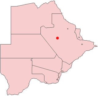
Orapa is a town located in the Central District of Botswana. It is the site of the Orapa diamond mine, the largest diamond-producing mine in the world, and is considered to be the diamond capital of the country. Nearby is another kimberlite mine owned by Lucara Diamond, thought to have very large reserves of diamonds.

Southern is one of the districts of Botswana. The capital of Southern district is Kanye, home to the Bangwaketse and Barolong in Botswana. The Southern district is home to Botswana's second largest beef farmers where there are large privately owned ranges, and several government run beef ranges which provide agricultural support to the local farmers. Maize and sorghum, Botswana's staple crop, are also raised in the area. Southern district is where the third diamond mine of Botswana was found, which buoys Botswana's economic state of prosperity. It was the first district to house the capital city before being moved to Gaborone after independence.

The North-East District is one of the administrative districts of Botswana. Its capital is Francistown. In 2011, North-East had a population of 60,264 people. The district is predominantly occupied by Kalanga-speaking people, the BaKalanga. The district is administered by a district administration and district council, which are responsible for local administration.

The North-West District or Ngamiland is one of the first-level administrative subdivisions of Botswana. For census and administrative purposes Ngamiland is subdivided into Ngamiland East, Ngamiland West and Ngamiland Delta (Okavango). It is governed by a District Commissioner, appointed by the national government, and the elected North-West District Council. The administrative centre is Maun.
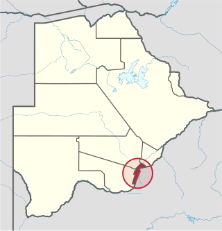
South-East is one of the districts of Botswana. The capital city of Botswana, Gaborone, is surrounded by this district. The administrative capital for the South-East district is the village of Ramotswa. In the southeast, South-East borders the North West Province of South Africa. Domestically, it borders Kgatleng in northeast, Kweneng in northwest, Southern in southwest.

Kasane is a town in Botswana, close to Africa's 'Four Corners', where the borders of Botswana, Namibia, Zambia and Zimbabwe almost meet. The town is at the far northeastern corner of Botswana where it serves as the administrative center of the Chobe District. The population of Kasane was 9,244 at the 2011 census.
Shoshong is a town in Botswana, formerly the chief settlement of the eastern Bamangwato.

Shakawe is a village located in the northwest corner of Botswana at the beginning of the Okavango Delta, close to Namibia and Angola. Shakawe is awakening from its former status as a sleepy little outpost on the Okavango. For travellers, Shakawe means a Botswana entry or exit stamp or a staging post for a visit to the Tsodilo Hills, 40 km away. For Southern African holiday-makers, it is most often the start of a fishing trip in the Okavango Panhandle. It also provides access to the Caprivi Strip. The record high temperature ever registered in Shakawe was 39.6 °C (103.3 °F). The lowest temperature registered in Shakawe was −6.1 °C (21.0 °F).
Botswana is experiencing one of the most severe HIV/AIDS epidemics in the world. The national HIV prevalence rate among adults ages 15 to 49 is 24.8 percent, which is the third highest in the world, behind Lesotho and Eswatini. HIV/AIDS threatens the many developmental gains Botswana has achieved since its independence in 1966, including economic growth, political stability, a rise in life expectancy, and the establishment of functioning public educational and health care systems.
Otse is a village in the South-East District of Botswana. It is located 60 km south of Gaborone, along the Gaborone–Lobatse road and close to the border with South Africa. This village is home to the Balete people who are related to those in Ramotswa, Gabane and Mogobane. The population was 7,636 in 2011 census.
The history of Gaborone began with archaeological evidence in the area around Gaborone dating back to 400 BCE, and the first written accounts of Gaborone are from the earliest European settlers in the 19th century. Since the 1960s, when Botswana gained its independence from Britain and Gaborone became the capital, the city has grown from a small village in the Botswana scrubland to a major center in southern Africa.
Goodhope is a village in the Goodhope District of Botswana. It serves as the administrative center for the Goodhope District Council.
