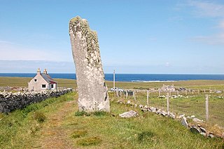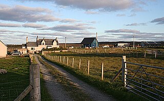
Callanish is a village (township) on the west side of the Isle of Lewis, in the Outer Hebrides, Scotland. Callanish is within the parish of Uig. A linear settlement with a jetty, it is on a headland jutting into Loch Roag, a sea loch 13 miles west of Stornoway. Callanish is situated alongside the A858, between Breasclete and Garynahine.

Dun Carloway is a broch situated in the district of Carloway, on the west coast of the Isle of Lewis, Scotland. It is a remarkably well preserved broch – on the east side parts of the old wall still reach to 9 metres tall.

Shawbost is a large village in the West Side of the Isle of Lewis. The village of Shawbost has a population of around 500 and lies around 20 miles west of Lewis's capital Stornoway. Shawbost is within the parish of Barvas. A recent development in the village was the renovation of the old school into the new community centre. The scattered settlement is split into three sections: North Shawbost, South Shawbost and New Shawbost. There is a small museum of folk life and nearby is a small stone circle. The village is overlooked by a small hill named Beinn Bhragair, 261 m high.

Barvas is a settlement, community and civil parish on the Isle of Lewis in Scotland.

Achmore is a village in the Scottish Outer Hebrides, on the Isle of Lewis. The name means 'big field'. Achmore is within the parish of Lochs and lies on the A858, about 7 miles (11 km) southwest of Stornoway. The village is the only one on Lewis which does not lie on the coast.

Bragar is a village on the west side of the Isle of Lewis in the Outer Hebrides, Scotland, 14 miles from the island's only town, Stornoway. Bragar is within the parish of Barvas, and is situated on the A858 between Carloway and Barvas.

Carloway is a crofting township and a district on the west coast of the Isle of Lewis, in the Outer Hebrides, Scotland. The district has a population of around 500. Carloway township is within the parish of Uig, and is situated on the A858.

Breasclete is a village and community on the west side of the Isle of Lewis, in the Outer Hebrides, Scotland. Breasclete is within the parish of Uig, and is situated adjacent to the A858.

The Callanish IV stone circle is one of many megalithic structures around the better-known Calanais I on the west coast of the Isle of Lewis, in the Outer Hebrides, Scotland. It is a scheduled monument and its offcial name is Sron a'Chail. The site was first surveyed and recorded by RCAHMS in 1914 and again in 2009, with another survey in the 1970s by other archaeologists, but no known archaeological excavations have taken place at the stones.

Garynahine is a settlement on Lewis, in the Outer Hebrides, Scotland. Garynahine is situated at a T-junction where roads from Stornoway, Uig and the west side of Lewis all meet. The roads are the A858 and the B8011. Garynahine is within the parish of Uig.

Adabrock, is a village in the area of Ness, Lewis, in the Outer Hebrides, Scotland. Adabrock is within the parish of Barvas, and is situated on the B8015 between Lionel and Eorodale. It is at the northern tip of Lewis, south-west of Port of Ness.

Garrabost is a village in the Point peninsula isthmus on the east coast of the Isle of Lewis, in the Outer Hebrides, Scotland. The village is one of the largest in Point, comprising Upper and Lower Garrabost, and Claypark. Garrabost is within the civil parish of Stornoway. The church parish for Point is called Knock, and both Knock Church of Scotland and Knock Free Church of Scotland are located in Garrabost. Garrabost is situated on the A866, between Stornoway and Portnaguran.

Arnol is a small village typical of many settlements of the west coast of the Isle of Lewis, in the Outer Hebrides, Scotland. Arnol is within the parish of Barvas, and is situated on the A858.

Ballantrushal is a village on the Isle of Lewis in the West Side district, in the Outer Hebrides, Scotland. Ballantrushal is within the parish of Barvas, and is situated on the A857. The standing stone Clach an Trushal is beside the village. and was the site of the last battle between the Lewis Macaulays and Morrison clans.

Brenish is a small village situated on the west coast of the Isle of Lewis, which is part of the Outer Hebrides of Scotland. Brenish is within the parish of Uig. The name of the village is sometimes spelt Breanish, however maps normally refer to Brenish.

Cross is a township on the Isle of Lewis in the community of Ness, in the Outer Hebrides, Scotland. Cross is within the parish of Barvas. Cross is also situated on the A857, between Stornoway and Port of Ness.

Eorodale is a settlement in the community of Ness, on Lewis, in the Outer Hebrides, Scotland. Eorodale is within the parish of Barvas, and is situated on the B8015 between Lionel and Skigersta.

Brue is a village on the Isle of Lewis in the West Side district, in the Outer Hebrides, Scotland. It is a crofting township and it is composed of two areas: Am Baile Staigh, which is nearer the coast, and Pàirc Bhrù, which runs towards the moor. In total it covers a road distance of 2.5 km. Brue is situated on a minor road which joins to the A858, and is within the parish of Barvas.

Marybank is a settlement on the outskirts of Stornoway, Isle of Lewis in the Outer Hebrides of Scotland. It is also within the parish of Stornoway. Marybank is situated at the junction of the A858 and A859. Lews Castle and Stornoway Golf Club are to the east of Marybank.

Tolsta Chaolais is a village on the Isle of Lewis, Scotland. It consists of about forty houses, clustered around Loch a' Bhaile, about 1 mile from the A858 road between Callanish and Carloway. The name has a Norse element, Tolsta, combined with a Gaelic element, Caolas, and means "Farm by the Strait". Tolsta Chaolais is in the parish of Uig, and has a building as a place of worship for all denominations.


