Bouladuff

Last updated

Bouladuff
An Bhuaile Dhubh
Village
Bouladuff enterance.jpg
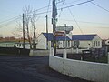
Entrance to Bouladuff R498
Ireland adm location map.svg
Red pog.svg
Bouladuff
Location in Ireland
Coordinates: 52°43′02″N7°54′40″W / 52.717112°N 7.911179°W / 52.717112; -7.911179 Coordinates: 52°43′02″N7°54′40″W / 52.717112°N 7.911179°W / 52.717112; -7.911179
Country Ireland
Province Munster
County County Tipperary
Population
 (2016) [1]
395
 (Inch Electoral Division)

Bouladuff (Irish : An Bhuaile Dhubh), [2] also known as Inch and The Ragg, [3] is a village near Thurles in County Tipperary, Ireland. According to the 2016 CSO census, the population of the Inch electoral division was 395. [1] Bouladuff is in the barony of Eliogarty.

Contents

Location and access

Bouladuff (also known as Inch) lies 5 miles from Thurles and 3 miles from Borrisoleigh. The village is set in the Suir valley and bounded by the Silvermine Mountains to the northwest and the Slieveardagh hills to the Southeast. The main road is the R498 regional road from Nenagh to Thurles. The area around Bouladuff has views of the Devils Bit and Tower mountains.

Amenities

Drom and Inch GAA Club Bouladuff DROMANDINCHGAACLUBBOULADUFF.JPG
Drom and Inch GAA Club Bouladuff

Amenities in the area include Inch National school, Inch Community Hall, and Inch Church (the latter 200 years old).[ citation needed ]

The village is served by a nightclub and bar, a petrol station and shop, and a restaurant.[ citation needed ]

The GAA grounds of Drom-Inch GAA club have dressing room facilities and a covered stand.[ citation needed ]

See also

Related Research Articles

County Tipperary County in Ireland

County Tipperary is a county in Ireland. It is located in the province of Munster. The county is named after the town of Tipperary, and was established in the early 13th century, shortly after the Norman invasion of Ireland. The population of the county was 159,553 at the 2016 census. The largest towns are Clonmel, Nenagh and Thurles.

Thurles Town in Munster, Ireland

Thurles is a town in County Tipperary, Ireland. It is located in the civil parish of same name in the barony of Eliogarty and in the ecclesiastical parish of Thurles. The cathedral church of the Roman Catholic Archdiocese of Cashel and Emly is located in the town.

Cahir Town in Munster, Ireland

Cahir is a town in County Tipperary in Ireland. It is also a civil parish in the barony of Iffa and Offa West.

Birr, County Offaly Town in Leinster, Ireland

Birr is a town in County Offaly, Ireland. Between 1620 and 1899 it was called Parsonstown, after the Parsons family who were local landowners and hereditary Earls of Rosse. Birr is a designated Irish Heritage Town with a carefully preserved Georgian heritage. Birr itself has graceful wide streets and elegant buildings. Many of the houses in John's Place and Oxmantown Mall have exquisite fanlight windows of the Georgian period. The town is known for Birr Castle and gardens, home of the Parsons family, and also site of the Leviathan of Parsonstown, the largest telescope in the world for over 70 years, and a large modern radio telescope.

Templemore Town in Munster, Ireland

Templemore is a town in County Tipperary, Ireland. It is a civil parish in the historical barony of Eliogarty. It is part of the parish of Templemore, Clonmore and Killea in the Roman Catholic Archdiocese of Cashel and Emly.

Fethard, County Tipperary Town in Munster, Ireland

Fethard is a small town in County Tipperary, Ireland. Dating to the Norman invasion of Ireland, the town's walls were first laid-out in the 13th century, with some sections of these defensive fortifications surviving today.

Ballinspittle Village in Munster, Ireland

Ballinspittle is a village in County Cork, Ireland. It is in the barony of Courceys and lies about 8 km (5 miles) southwest of Kinsale. It is near Garrylucas and Garrettstown Blue Flag beaches.

Borrisoleigh Village in Munster, Ireland

Borrisoleigh is a small town in County Tipperary, Ireland. According to the 2011 census, the town had a population of 708, an increase of 82 people on the 2006 census. In recent years the population has exceeded 1,000 while historically the population has been around 8,000. It is in the ecclesiastical parish of Borrisoleigh and Ileigh in the Roman Catholic Archdiocese of Cashel and Emly.

Clonoulty Village in Munster, Ireland

Clonoulty is a small village and a civil parish in County Tipperary, Ireland. It is one of nine civil parishes in the barony of Kilnamanagh Lower. It is also one half of the ecclesiastical parish of Clonoulty-Rossmore in the Roman Catholic Archdiocese of Cashel and Emly. Clonoulty may also refer to a slightly larger area which forms one half of the catchment area for Clonoulty-Rossmore GAA club.

Caragh Village in Leinster, Ireland

Caragh or Carragh is a village in County Kildare, Ireland. It is located on the R409 regional road between the River Liffey and the Grand Canal and is located 6.1 km north-west of Naas. The village is also 7.9 km from Clane and 10.6 km from Newbridge.

Kildangan Village in Leinster, Ireland

Kildangan is a village in County Kildare in Ireland.

Dundrum, County Tipperary Village in Munster, Ireland

Dundrum is a village in County Tipperary, Ireland. In the 2016 census, the population was 165. It is in the barony of Kilnamanagh Lower.

Holycross Village in Munster, Ireland

Holycross is a village and civil parish in County Tipperary, Ireland. It is one of 21 civil parishes in the barony of Eliogarty. The civil parish straddles two counties and the baronies of Eliogarty and of Middle Third. It is also an ecclesiastical parish in the Roman Catholic Archdiocese of Cashel and Emly.

Stamullen Town in Leinster, Ireland

Stamullen is a village in County Meath, Ireland on the border with County Dublin. It lies just off the M1 motorway some 35 km north of Dublin City and beside the Delvin River. In the late 1990s and early 21st century, it expanded significantly with the development of numerous housing estates in the area.

Moneygall Village in Leinster, Ireland

Moneygall is a small village on the border of counties Offaly and Tipperary, in Ireland. It is situated on the R445 road between Dublin and Limerick. There were 313 people living in the village as of the 2016 census. Moneygall has a Catholic church, motorway service station, a car sales and repair centre, a national school, a Garda station and two pubs. The nearest Church of Ireland church, Borrisnafarney, is 2 km from the village beside the former Loughton Demesne.

Duagh Village in Munster, Ireland

Duagh is a village in County Kerry, Ireland, located approximately 9 km southeast of Listowel and 7 km northwest of Abbeyfeale on the R555 regional road.

Cullen, County Tipperary Village in Munster, Ireland

Cullen is a rural village in County Tipperary, Ireland. The centre of the village is located at a junction of two roads in south Tipperary. These roads lead to Monard, Lattin, the "Rocky Road" and Oola respectively.

Portroe Village in Munster, Ireland

Portroe is a village in north County Tipperary, Ireland. The village is located on the R494 regional road, 3 km from the eastern shore of Lough Derg and 10 km west of the town of Nenagh. Portroe spans the townlands of Garrykennedy, Glencrue and Shesharoe.

Drom, County Tipperary Village in Munster, Ireland

Drom is a village in County Tipperary, Ireland. It is located just off the main Borrisoleigh to Templemore road. Its population was 129 at the 2006 census.

Boherlahan Village in Munster, Ireland

Boherlahan is a small village and census town in County Tipperary, Ireland. It lies on the R660 regional road between Cashel and Holycross. Boherlahan was designated as a census town by the Central Statistics Office for the first time in the 2016 census, at which time it had a population of 299 people.

References

  1. 1 2 http://census.cso.ie/sapmap2016/Results.aspx?Geog_Type=ED3409&Geog_Code=2AE196291C5713A3E055000000000001 [ bare URL ]
  2. "Placenames Database of Ireland". Dublin City University. Retrieved 6 February 2015.
  3. "Moves Afoot to Inch Out The Ragg". Tipperary Star. 21 June 2008. Archived from the original on 13 September 2012. Retrieved 17 November 2008.