Bowden Hill

Last updated

Bowden Hill
Rising Sun, Bowden Hill - geograph.org.uk - 1339799.jpg
The Rising Sun, Bowden Hill
Wiltshire UK location map.svg
Red pog.svg
Bowden Hill
Location within Wiltshire
OS grid reference ST938679
Civil parish
Unitary authority
Ceremonial county
Region
Country England
Sovereign state United Kingdom
Post town Chippenham
Postcode district SN15
Dialling code 01249
Police Wiltshire
Fire Dorset and Wiltshire
Ambulance South Western
UK Parliament
List of places
UK
England
Wiltshire
51°24′36″N2°05′28″W / 51.410°N 02.091°W / 51.410; -02.091

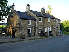
Bowden Hill is a village in Wiltshire, England, in Lacock parish about 3+12 miles (6 km) south of Chippenham and 1+12 miles (2.4 km) to the east of Lacock village. Bowden Hill has about 50 houses, a pub, and a small industrial estate.

Contents

Origins of the name

The spelling 'Bowdon Hill' was used on Andrews’ and Dury’s maps of 1773 and 1810. [1] There are a number of theories around why the village got its name. One is that the name comes from the old English words 'bow', meaning bow shaped, and 'dun' meaning hill. However, alternative theories suggest the name comes from a corruption of 'bdl' (meaning dwelling) into 'bow' meaning 'hill slope on which are dwellings'. Another theory from 'Wiltshire Collections' by Aubrey and Jackson suggests that the name means 'the winding hill'. [2]

Location

Bowden Hill sits on the side of a hill and rises up from the River Avon, at an elevation of 50m, to its peak at 172m above sea level. The village has views to the south and south-west of the river's flood plain and is surrounded by a mixture of woodlands and agricultural land. Bowden Hill borrows many of its facilities from the nearby village of Lacock and doesn't provide amenities such as a school or post office. The village encompasses the small hamlet of Bewley Common and enjoys a relatively sparse population density due to its designation as a conservation area. [3]

Landmarks

Parish church

Church of St Anne Church of St. Anne, Bowden Hill, Wiltshire, UK - Diliff.jpg
Church of St Anne

In 1856, John Gladstone, owner of Bowden Park, had the Church of England parish church of Saint Anne built to celebrate the birth of a son in the Gladstone family. The architect was S.B. Gabriel of Bristol who designed the nave and chancel in the Early English Gothic style but gave the northeast tower Norman details and a Rhenish helm, a German Romanesque roof. [4] The parish of Lacock was split and the new parish of Bowden Hill served around 300-400 people, but the two parishes were reunited in 1958. [5] Today services are held at St Anne's on the first Sunday of each month.

Conduit House

Sitting in the common land in the village is a small building which was used as a supply of water for the nearby Lacock Abbey. Built in the 16th century, this small 3.7m square building still supplies water to the abbey albeit through a modern water pipe. The original conduit house was built in around 1280 when Willian Bluet of Bewley Court granted Beatrice, Abbess of Lacock, the right to operate a watercourse on his land to serve the nunnery. This original building was replaced by the owner of the abbey, William Sharington, after its dissolution. The new building is built of limestone and has a steep roof, reaching 4.64m high, constructed of interlocking stone slabs. [6]

Bowden Park

Bowden Park, obscured by trees Bowden Park - geograph.org.uk - 446956.jpg
Bowden Park, obscured by trees

One of largest landmarks in Bowden Hill is the Bowden Park estate with its country house of 1796, designed by James Wyatt for Barnard Dickinson. The Dickinson family had owned plantations in Jamaica since 1655, and were among Wiltshire's biggest users of slave labour. [7] The property had a previous building, built for George Johnson who lived there in the 1600s. The estate was sold in 1751 to Ezekiel Dickinson who modified the house; it was later owned by the Dickinson Harmer family. [8]

The house was bought in 1849 and extended by Captain John Gladstone, older brother of Prime Minister William Gladstone. In the 20th century it was the seat of the former chairman of the General Electric Company, Arnold Weinstock. The house was remodelled in the mid 1950s, and the extensions were made smaller by owner K. Peacock who sold Bowden Park in 1967 to Lord Weinstock. A 2020 report summarizes the building as: "Built on two storeys of ashlar under a slate roof, the grand 15,900sq ft house is Classically symmetrical in style, with a central bow front, where the original front door was placed, and finely detailed wings to either side". [8]

Bowden Park was designated as Grade I listed in 1960. [9]

Spye Park

Spye Park lies on the edge of Bowden Hill to the southeast of the village. Although most of Spye Park is in Bromham parish, the gatelodge at its northwest entrance (originally a 16th-century building) stands on the edge of Bowden Hill village. [10]

Related Research Articles

<span class="mw-page-title-main">Wiltshire</span> County of England

Wiltshire is a ceremonial county in South West England. It borders Gloucestershire to the north, Oxfordshire and Berkshire to the east, Hampshire to the south-east, Dorset to the south, and Somerset to the west. The largest settlement is Swindon, and Trowbridge is the county town.

<span class="mw-page-title-main">Lacock Abbey</span> House in Lacock, England

Lacock Abbey in the village of Lacock, Wiltshire, England, was founded in the early 13th century by Ela, Countess of Salisbury, as a nunnery of the Augustinian order. The abbey remained a nunnery until the suppression of Roman Catholic institutions in England in the 16th century; it was then sold to Sir William Sharington who converted the convent into a residence where he and his family lived. It was fortified and remained loyal to the crown during the English Civil War, but surrendered to the Parliamentary forces once Devizes had fallen in 1645.

<span class="mw-page-title-main">Lacock</span> Village in Wiltshire, England

Lacock is a village and civil parish in the county of Wiltshire, England, about 3 miles (5 km) south of the town of Chippenham, and about 3.7 miles (6.0 km) outside the Cotswolds area. The village is owned almost in its entirety by the National Trust and attracts many visitors by virtue of its unspoiled appearance.

<span class="mw-page-title-main">Avebury (village)</span> Village and civil parish in Wiltshire, England

Avebury is a village and civil parish in Wiltshire, England. The village is about 5.5 miles (9 km) west of Marlborough and 8 miles (13 km) northeast of Devizes. Much of the village is encircled by the prehistoric monument complex also known as Avebury. The parish also includes the small villages of Avebury Trusloe and Beckhampton, and the hamlet of West Kennett.

<span class="mw-page-title-main">Edington, Wiltshire</span> Village in England

Edington is a village and civil parish in Wiltshire, England, about 4 miles (6 km) east-northeast of Westbury. The village lies under the north slope of Salisbury Plain and the parish extends south onto the Plain. Its Grade I listed parish church was built for Edington Priory in the 14th century.

<span class="mw-page-title-main">Calne</span> Human settlement in England

Calne is a town and civil parish in Wiltshire, southwestern England, at the northwestern extremity of the North Wessex Downs hill range, a designated Area of Outstanding Natural Beauty.

<span class="mw-page-title-main">Corsham</span> Town in Wiltshire, England

Corsham is a historic market town and civil parish in west Wiltshire, England. It is at the south-western edge of the Cotswolds, just off the A4 national route, 28 miles (45 km) southwest of Swindon, 20 miles (32 km) east of Bristol, 8 miles (13 km) northeast of Bath and 4 miles (6 km) southwest of Chippenham.

<span class="mw-page-title-main">Blunsdon</span> Human settlement in England

Blunsdon is a civil parish in the Borough of Swindon, in Wiltshire, England, about 4 miles (6 km) north of the centre of Swindon, with the A419 forming its southern boundary. Its main settlement is the village of Broad Blunsdon, with Lower Blunsdon nearby; the hamlet of Broadbush is now contiguous with Broad Blunsdon.

<span class="mw-page-title-main">History of Wiltshire</span>

Wiltshire is a historic county located in the South West England region. Wiltshire is landlocked and is in the east of the region.

<span class="mw-page-title-main">Box, Wiltshire</span> Village in Wiltshire, England

Box is a large village and civil parish within the Cotswolds Area of Outstanding Natural Beauty in Wiltshire, England, about 3 miles (5 km) west of Corsham and 5 miles (8 km) northeast of Bath. Box also falls in the easternmost part of the Avon Green Belt. Besides the village of Box, the parish includes the villages of Ashley and Box Hill; Hazelbury manor; and the hamlets of Alcombe, Blue Vein, Chapel Plaister, Ditteridge, Henley, Kingsdown, Middlehill, and Wadswick. To the east the parish includes much of Rudloe, formerly a hamlet but now a housing estate, and the defence establishments and related businesses on the site of the former RAF Rudloe Manor.

<span class="mw-page-title-main">Kington Langley</span> Human settlement in England

Kington Langley is a village and civil parish about 2 miles (3.2 km) north of Chippenham in Wiltshire, England. The parish includes the hamlet of Bowldown.

<span class="mw-page-title-main">Derry Hill</span> Human settlement in England

Derry Hill is a village in the English county of Wiltshire, in the civil parish of Calne Without. It has an elevated position at the northern edge of the Bowood House estate, about 3 miles (5 km) south-east of the centre of the town of Chippenham.

<span class="mw-page-title-main">Brinkworth, Wiltshire</span> Human settlement in England

Brinkworth is a village and civil parish in northern Wiltshire, England. The village lies between Royal Wootton Bassett and Malmesbury, about 1 mile (1.6 km) north of the M4 motorway and 9 miles (14 km) west of Swindon.

<span class="mw-page-title-main">Great Coxwell Barn</span> Medieval tithe barn in Great Coxwell, Oxfordshire, England

Great Coxwell Barn is a Medieval tithe barn at Great Coxwell, Oxfordshire, England. It is on the northern edge of the village of Great Coxwell, which is about 9 miles (14 km) northeast of Swindon in neighbouring Wiltshire.

<span class="mw-page-title-main">Spye Park</span>

<span class="mw-page-title-main">Priory Vale</span> Human settlement in England

Priory Vale is a community in the north of the town of Swindon, Wiltshire, England, which comprises the urban villages of Redhouse, Oakhurst and Haydon End. Although not strictly part of Priory Vale, the nearby village of Taw Hill completes this instalment of Swindon's northern expansion which began with Abbey Meads in the mid-1990s and continued at St Andrew's Ridge. The area was developed during the early 21st century.

<span class="mw-page-title-main">Bewley Common</span> Human settlement in England

Bewley Common is a hamlet in Wiltshire, England. It lies in the civil parish of Lacock, west of Bowden Hill and about 1 mile (1.6 km) east of Lacock village.

<span class="mw-page-title-main">Lydiard Tregoze</span> Human settlement in England

Lydiard Tregoze is a small village and civil parish on the western edge of Swindon in the county of Wiltshire, in the south-west of England. Its name has in the past been spelt as Liddiard Tregooze.

<span class="mw-page-title-main">Malmesbury</span> Town in Wiltshire, England

Malmesbury is a town and civil parish in north Wiltshire, England, which lies approximately 14 miles (23 km) west of Swindon, 25 miles (40 km) northeast of Bristol, and 9 miles (14 km) north of Chippenham. The older part of the town is on a hilltop which is almost surrounded by the upper waters of the Bristol Avon and one of its tributaries.

<span class="mw-page-title-main">History of Lacock</span>

References

  1. "Lacock: Historical maps". Wiltshire Community History. Wiltshire Council. Retrieved 16 October 2023.
  2. Notes on Wiltshire names
  3. Bowden Hill conservation area [ permanent dead link ]
  4. Pevsner, Nikolaus (1975). Cherry, Bridget (ed.). The Buildings of England: Wiltshire. Harmondsworth: Penguin Books. p. 119. ISBN   0140710264.
  5. "Church of St. Anne, Bowden Hill, Lacock". Wiltshire Community History. Wiltshire Council. Retrieved 10 December 2022.
  6. Wiltshire and Swindon Sites and Monument Record Information Archived 3 October 2011 at the Wayback Machine
  7. "Wiltshire's Slave Owners in Jamaica". Wiltshire and Swindon History Centre . 20 August 2016. Retrieved 24 April 2023.
  8. 1 2 Churchill, Penny (17 October 2020). "Bowden Park, one of England's great estates, has come to the market at £35 million". Country Life. Archived from the original on 19 October 2020. Retrieved 21 October 2020.
  9. Historic England. "Bowden Park (1022132)". National Heritage List for England . Retrieved 21 October 2020.
  10. Historic England. "Spye Arch Lodge (1033912)". National Heritage List for England. Retrieved 21 May 2017.