Brafferton and Helperby

Last updated

Brafferton and Helperby
Civil parish
Horse sheltering under a tree - geograph.org.uk - 2193520.jpg
Land at Brafferton and Helperby
North Yorkshire UK location map (2023).svg
Red pog.svg
Brafferton and Helperby
Location within North Yorkshire
Population831 (2011 census)
OS grid reference SE438699
Unitary authority
Ceremonial county
Region
Country England
Sovereign state United Kingdom
List of places
UK
England
Yorkshire
54°07′23″N1°19′44″W / 54.123°N 1.329°W / 54.123; -1.329

Brafferton and Helperby is a civil parish in the Hambleton District of North Yorkshire, England. Up until 2019, both Brafferton and Helperby were in their own civil parishes, but a vote, and then later an order was convened, to amalgamate the two into one parish covering both villages.

Contents

History

The ancient (ecclesiastical) parish of Brafferton, also included Helperby within the parish domain. [1] When civil parishes were introduced, the two villages were separated out, but are a contiguous settlement with Brafferton at the north end, and Helperby at the south end. [2] [3] On 1 April 2019, the two parishes were combined into one civil parish – Brafferton and Helperby, with seven elected council members. [4] Previous to this, each council had five members. [5]

Local authority

Historically, the ecclesiastical parish of Brafferton included Helperby and Thornton Bridge, where Helperby was described as a township. [6] Both previous civil parishes were instituted in 1894, both fulfilling the requirements of a local government act of 1889, which stipulated anywhere with 200 or more voters, could have a parish council. [5] In 1999, the two separate civil parishes of Brafferton and Helperby pooled their money and resources to build a new village hall, which is situated in Helperby next to the war memorial. [7]

At the 2011 Census, Brafferton had a population of 311 [8] and Helperby had 520. [9] In 2015, North Yorkshire County Council estimated that the two villages had a population of 820 people – 300 in Brafferton and 520 in Helperby. [10]

See also

Related Research Articles

<span class="mw-page-title-main">Upperthong</span> Village in West Yorkshire, England

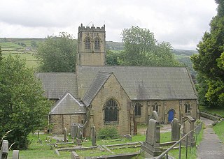
Upperthong is a village approximately 807 feet (246 m) above sea level, near the town of Holmfirth in Holme Valley, approximately 7 miles (11 km) south of Huddersfield, West Yorkshire, England.

<span class="mw-page-title-main">Roos</span> Village and civil parish in the East Riding of Yorkshire, England

Roos is a village and civil parish in the East Riding of Yorkshire, England. It is situated 12 miles (19 km) east from Kingston upon Hull city centre and 3.5 miles (6 km) north-west from Withernsea, and on the B1242 road.

<span class="mw-page-title-main">Kilham, East Riding of Yorkshire</span> Village and civil parish in the East Riding of Yorkshire, England

Kilham is a village and civil parish in the East Riding of Yorkshire, England. It is situated about 5 miles (8 km) north-east of Driffield town centre. According to the 2011 UK census, Kilham parish had a population of 1,088, an increase on the 2001 UK census figure of 1,010.

<span class="mw-page-title-main">Brafferton, North Yorkshire</span> Village and former civil parish in North Yorkshire, England

Brafferton is a village and former civil parish, now in the parish of Brafferton and Helperby, in the Hambleton District of North Yorkshire, England. According to the 2001 census it had a population of 257, increasing to 311 at the 2011 Census. On 1 April 2019 the parish was merged with Helperby to form Brafferton and Helperby.

<span class="mw-page-title-main">Calton, North Yorkshire</span> Village and civil parish in North Yorkshire, England

Calton is a village and civil parish in the Craven district of North Yorkshire, England, on the River Aire in Airedale. In both the 2001 and 2011 Censuses the population was less than 100, so details were included in the civil parish of Flasby with Winterburn. In 2015, North Yorkshire County Council estimated the population of the village to be 60.

<span class="mw-page-title-main">Helperby</span> Village and former civil parish in North Yorkshire, England

Helperby is a village and former civil parish, now in the parish of Brafferton and Helperby, in the Hambleton District of North Yorkshire, England, about five miles west of Easingwold. Over the years it has joined onto Brafferton. On 1 April 2019 the parish was merged with Brafferton to form "Brafferton and Helperby".

<span class="mw-page-title-main">Raskelf</span> Village and civil parish in North Yorkshire, England

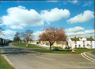
Raskelf is a village and civil parish in North Yorkshire, England. The electoral roll has a population of around 400 measured at 519 in the 2011 census.

<span class="mw-page-title-main">Thorganby, North Yorkshire</span> Village and civil parish in North Yorkshire, England

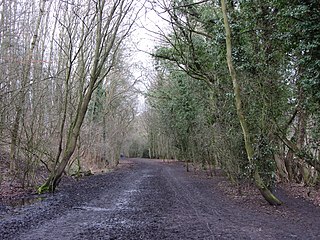
Thorganby is a small village and civil parish in North Yorkshire, England. It was historically part of the East Riding of Yorkshire until 1974, but from 1974 to 2023 was in the Selby District of the shire county of North Yorkshire. In 2023 the district was abolished and North Yorkshire became a unitary authority.

<span class="mw-page-title-main">South Milford</span> Village and civil parish in North Yorkshire, England

South Milford is a village and civil parish in the county of North Yorkshire, England. The civil parish includes the hamlet of Lumby, located south-west of the main village.

<span class="mw-page-title-main">East Witton</span> Village and civil parish in North Yorkshire, England

East Witton is a village and civil parish in Wensleydale in North Yorkshire, England. It lies south of Leyburn, in the Richmondshire district. Richard Whiteley is buried there; he and his partner, Kathryn Apanowicz, lived in the village.

<span class="mw-page-title-main">Kirkby Malham</span> Village and civil parish in North Yorkshire, England

Kirkby Malham is a small village and civil parish in the Craven district of North Yorkshire, England. Situated in the Yorkshire Dales it lies 6 miles (9.7 km) east of Settle. The population of the civil parish as taken in the 2011 Census was 202. Nearby settlements include Hanlith, Malham, Airton and Calton.

<span class="mw-page-title-main">Halton West</span> Village and civil parish in North Yorkshire, England

Halton West is a village and civil parish in the Craven district of North Yorkshire, England. North Yorkshire County Council estimated the population in 2015 at 70. It is situated on the River Ribble and is 7 miles (11 km) north of Barnoldswick, 7 miles (11 km) south of Settle and 12 miles (19 km) west of Skipton.

<span class="mw-page-title-main">Wrelton</span> Village and civil parish in North Yorkshire, England

Wrelton is a village and civil parish in North Yorkshire, England. It is on the A170 road and 2 miles west of Pickering.

<span class="mw-page-title-main">Fawdington</span> Hamlet and civil parish in North Yorkshire, England

Fawdington is a hamlet and civil parish in the Hambleton district of North Yorkshire, England. It is on the River Swale and near the A1(M) motorway, 8 miles (13 km) south of Thirsk, and 5 miles (8 km) north-east of Boroughbridge. The population of the parish was estimated at 10 in 2015. The population remained at less than 100 at the 2011 Census. Details were included in the old civil parish of Brafferton, North Yorkshire.

<span class="mw-page-title-main">Kirby Underdale</span> Village and civil parish in the East Riding of Yorkshire, England

Kirby Underdale is a village and civil parish in the East Riding of Yorkshire, England. It is situated approximately six miles north of Pocklington town centre and lies one mile north of the main A166 road from York to Driffield.

<span class="mw-page-title-main">Cundall, North Yorkshire</span> Hamlet and civil parish in North Yorkshire, England

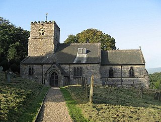
Cundall is a village in the Harrogate district of North Yorkshire, England. It is one of the Thankful Villages that suffered no fatalities during World War I.

<span class="mw-page-title-main">Hawsker-cum-Stainsacre</span> Civil parish in North Yorkshire, England

Hawsker-cum-Stainsacre is a civil parish in the former Scarborough district of North Yorkshire, England. The population of the parish was listed as being 710 at the 2021 Census.

<span class="mw-page-title-main">East Hardwick</span> Village and civil parish in West Yorkshire, England

East Hardwick is a village and civil parish in the City of Wakefield in West Yorkshire, England. It has a population of 191, reducing to 173 at the 2011 Census. Until 1974 it was part of Osgoldcross Rural District.

<span class="mw-page-title-main">St Martin's, North Yorkshire</span> Civil parish in North Yorkshire, England

St Martin's is a civil parish in North Yorkshire, England. It is located south of the town of Richmond, covering the residential areas south of the River Swale, including the former Richmond railway station and Holly Hill.

<span class="mw-page-title-main">Lillings Ambo</span> Civil parish in North Yorkshire, England

Lillings Ambo is a civil parish in North Yorkshire, England. It is between the villages of Strensall and Sheriff Hutton, and its southern edge is the border between the unitary authorities of North Yorkshire Council and the City of York Council. The River Foss flows through the parish, and in 2020, a scheme was approved to build a leaky dam to store water in the south of the parish in times of flood.

References

  1. "Genuki: Brafferton, Yorkshire (North Riding)". www.genuki.org.uk. Retrieved 28 November 2021.
  2. "Brafferton North Riding". visionofbritain.org.uk. Retrieved 28 November 2021.
  3. "Parishes: Brafferton | British History Online". www.british-history.ac.uk. Retrieved 28 November 2021.
  4. Blow, John (5 November 2020). "Representing parishoners". The Yorkshire Post. p. 3. ISSN   0963-1496.
  5. 1 2 Bottomley, F David (2000). Brafferton & Helperby : a millenium miscellany. Brafferton: Brafferton Parish Council. p. 152. ISBN   0-9539109-0-3.
  6. Whellan, T (1859). History and topography of the city of York; and the North Riding of Yorkshire. Beverley: John Green. p. 575. OCLC   6480776.
  7. "Brafferton and Helperby Parish Council". braffertonhelperbypc.org.uk. 1 March 2020. Retrieved 28 November 2021.
  8. UK Census (2011). "Local Area Report – Brafferton Parish (E04007144)". Nomis. Office for National Statistics . Retrieved 8 December 2021.
  9. UK Census (2011). "Local Area Report – Helperby Parish (E04007188)". Nomis. Office for National Statistics . Retrieved 8 December 2021.
  10. "2015 Population Estimates Parishes" (PDF). northyorks.gov.uk. December 2016. p. 11. Archived from the original (PDF) on 4 June 2022. Retrieved 28 November 2021.