Bricelyn, Minnesota

Last updated

Bricelyn
Motto: 
"A Good Place To Call Home" [1]
Faribault County Minnesota Incorporated and Unincorporated areas Bricelyn Highlighted.svg
Location of Bricelyn, Minnesota
Coordinates: 43°33′39″N93°48′47″W / 43.56083°N 93.81306°W / 43.56083; -93.81306
Country United States
State Minnesota
County Faribault
Government
  TypeMayor - Council
  MayorThomas Sens [ citation needed ]
Area
[2]
  Total0.29 sq mi (0.75 km2)
  Land0.29 sq mi (0.75 km2)
  Water0.00 sq mi (0.00 km2)
Elevation
[3]
1,181 ft (360 m)
Population
 (2020)
  Total348
  Density1,200.00/sq mi (462.59/km2)
Time zone UTC-6 (Central (CST))
  Summer (DST) UTC-5 (CDT)
ZIP code
56014
Area code 507
FIPS code 27-07678 [4]
GNIS feature ID2393414 [3]
Website http://www.co.faribault.mn.us/Bricelyn/

Bricelyn is a city in Faribault County, Minnesota, United States. The population was 365 at the 2010 census. [5]

Contents

History

Bricelyn Museum former 1st Baptist Church Bricelyn Museum former 1st Baptist Church-01.jpg
Bricelyn Museum former 1st Baptist Church

The town developed as a result of the railroad passing through the area. In 1899, town lots were auctioned. [1] The city was named for John Brice, the original owner of the town site. [6] A post office has been in operation at Bricelyn since 1899. [7]

Geography

According to the United States Census Bureau, the city has a total area of 0.29 square miles (0.75 km2), all land. [8]

Demographics

Historical population
CensusPop.Note
1900 166
1910 352112.0%
1920 56460.2%
1930 509−9.8%
1940 60118.1%
1950 6396.3%
1960 542−15.2%
1970 470−13.3%
1980 4873.6%
1990 426−12.5%
2000 379−11.0%
2010 365−3.7%
2020 348−4.7%
U.S. Decennial Census [9]

2010 census

As of the census [10] of 2010, there were 365 people, 168 households, and 97 families living in the city. The population density was 1,258.6 inhabitants per square mile (485.9/km2). There were 197 housing units at an average density of 679.3 per square mile (262.3/km2). The racial makeup of the city was 92.6% White, 2.5% African American, 1.4% Native American, 0.8% Asian, 0.5% from other races, and 2.2% from two or more races. Hispanic or Latino of any race were 9.6% of the population.

There were 168 households, of which 21.4% had children under the age of 18 living with them, 44.6% were married couples living together, 8.9% had a female householder with no husband present, 4.2% had a male householder with no wife present, and 42.3% were non-families. 38.7% of all households were made up of individuals, and 16.7% had someone living alone who was 65 years of age or older. The average household size was 2.17 and the average family size was 2.89.

The median age in the city was 47.9 years. 22.5% of residents were under the age of 18; 6.5% were between the ages of 18 and 24; 18.6% were from 25 to 44; 27.4% were from 45 to 64; and 24.9% were 65 years of age or older. The gender makeup of the city was 52.1% male and 47.9% female.

2000 census

As of the census of 2000, there were 379 people, 182 households, and 101 families living in the city. The population density was 1,283.9 inhabitants per square mile (495.7/km2). There were 208 housing units at an average density of 704.6 per square mile (272.0/km2). The racial makeup of the city was 99.47% White, 0.26% from other races, and 0.26% from two or more races. Hispanic or Latino of any race were 3.96% of the population.

There were 182 households, out of which 21.4% had children under the age of 18 living with them, 49.5% were married couples living together, 2.2% had a female householder with no husband present, and 44.0% were non-families. 39.6% of all households were made up of individuals, and 20.3% had someone living alone who was 65 years of age or older. The average household size was 2.08 and the average family size was 2.80.

In the city, the population was spread out, with 20.8% under the age of 18, 5.8% from 18 to 24, 22.4% from 25 to 44, 23.7% from 45 to 64, and 27.2% who were 65 years of age or older. The median age was 46 years. For every 100 females, there were 102.7 males. For every 100 females age 18 and over, there were 106.9 males.

The median income for a household in the city was $29,375, and the median income for a family was $39,375. Males had a median income of $31,354 versus $21,111 for females. The per capita income for the city was $15,340. About 7.5% of families and 10.2% of the population were below the poverty line, including 7.5% of those under age 18 and 10.5% of those age 65 or over.

Related Research Articles

<span class="mw-page-title-main">Faribault County, Minnesota</span> County in Minnesota, United States

Faribault County is a county in the U.S. state of Minnesota. As of the 2020 census, the population was 13,921. Its county seat is Blue Earth.

Danville Township is a township in Blue Earth County, Minnesota, United States. The population was 262 as of the 2000 census.

<span class="mw-page-title-main">Lake Shore, Minnesota</span> City in Minnesota, United States

Lake Shore is a city in Cass County, Minnesota, United States. The population was 1,056 at the 2020 census. It is part of the Brainerd Micropolitan Statistical Area.

<span class="mw-page-title-main">Mendota, Minnesota</span> City in Minnesota, United States

Mendota is a city in Dakota County, Minnesota, United States. The name is a mispronunciation of the Dakota word for the location, bdóte, which in Dakota tradition is the center of the world. The word in this use means "the confluence of the Minnesota and Mississippi Rivers," and generally "mouth or junction of one river with another." The population was 198 at the 2010 census.

Blue Earth City Township is a township in Faribault County, Minnesota, United States. The population was 454 at the 2000 census.

<span class="mw-page-title-main">Delavan, Minnesota</span> City in Minnesota, United States

Delavan is a city in Faribault County, Minnesota, United States. The population was 179 at the 2010 census.

Dunbar Township is a township in Faribault County, Minnesota, United States. The population was 312 at the 2000 census.
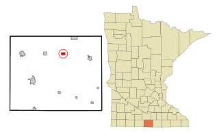
<span class="mw-page-title-main">Easton, Minnesota</span> City in Minnesota, United States

Easton is a city in Faribault County, Minnesota, United States. The population was 199 at the 2010 census.
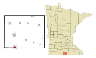
<span class="mw-page-title-main">Elmore, Minnesota</span> City in Minnesota, United States

Elmore is a city in Faribault County, Minnesota, United States. The population was 663 at the 2010 census. Elmore was the boyhood home of former U.S. Vice President and Democratic presidential candidate Walter F. Mondale.

<span class="mw-page-title-main">Frost, Minnesota</span> City in Minnesota, United States

Frost is a city in Faribault County, Minnesota, United States. The population was 215 at the 2020 census.

Rome Township is a township in Faribault County, Minnesota, United States. The population was 172 at the 2000 census.

Seely Township is a township in Faribault County, Minnesota, United States. The population was 210 at the 2000 census.

<span class="mw-page-title-main">Walters, Minnesota</span> City in Minnesota, United States

Walters is a city in Faribault County, Minnesota, United States. The population was 73 at the 2010 census.

<span class="mw-page-title-main">Wells, Minnesota</span> City in Minnesota, United States

Wells is a city in Faribault County, Minnesota, United States. The population was 2,343 at the 2010 census.

Winnebago City Township is a township in Faribault County, Minnesota, United States. The population was 221 at the 2000 census.

Holt Township is a township in Fillmore County, Minnesota, United States. The population was 307 at the 2000 census.

<span class="mw-page-title-main">Welcome, Minnesota</span> City in Minnesota, United States

Welcome is a city in Martin County, Minnesota, United States. The population was 710 at the 2020 census.

<span class="mw-page-title-main">Dellwood, Minnesota</span> City in Minnesota, United States

Dellwood is a city in Washington County, Minnesota, United States and a suburb of St. Paul. The population was 1,063 at the 2010 census.

<span class="mw-page-title-main">Minnesota Lake, Minnesota</span> City in Minnesota, United States

Minnesota Lake is a city in Blue Earth and Faribault counties in the State of Minnesota. The population was 661 at the 2020 census. The bulk of the city is in Faribault County; a small part extends into Blue Earth County.

<span class="mw-page-title-main">Eden Valley, Minnesota</span> City in Minnesota, United States

Eden Valley is a city in Meeker and Stearns counties in the U.S. state of Minnesota. The population was 1,027 at the 2020 census. Most of Eden Valley is in Meeker County; the Stearns County portion is part of the St. Cloud Metropolitan Statistical Area.

References

  1. 1 2 "The City of Bricelyn Minnesota". The City of Bricelyn Minnesota. Archived from the original on January 18, 2012. Retrieved October 14, 2012.
  2. "2020 U.S. Gazetteer Files". United States Census Bureau. Retrieved July 24, 2022.
  3. 1 2 U.S. Geological Survey Geographic Names Information System: Bricelyn, Minnesota
  4. "U.S. Census website". United States Census Bureau . Retrieved January 31, 2008.
  5. "2010 Census Redistricting Data (Public Law 94-171) Summary File". American FactFinder. United States Census Bureau . Retrieved April 27, 2011.[ dead link ]
  6. Chicago and North Western Railway Company (1908). A History of the Origin of the Place Names Connected with the Chicago & North Western and Chicago, St. Paul, Minneapolis & Omaha Railways. p. 46.
  7. "Faribault County". Jim Forte Postal History. Retrieved May 29, 2015.
  8. "US Gazetteer files 2010". United States Census Bureau. Archived from the original on January 25, 2012. Retrieved November 13, 2012.
  9. "Census of Population and Housing". Census.gov. Retrieved June 4, 2015.
  10. "U.S. Census website". United States Census Bureau . Retrieved November 13, 2012.